Likely, British Columbia
Likely is a community in British Columbia, Canada. It is located in the Cariboo region of the province, and is situated where the west arm of Quesnel Lake empties into the Quesnel River. Roads from Likely lead southwest to Williams Lake, northwest to Quesnel, south to Horsefly, and north to Barkerville. Likely is in the Quesnel Highland, a transition zone between the Cariboo Plateau and the Cariboo Mountains.
History
Likely is one of the few remaining Cariboo Gold Rush settlements. Likely was originally called Quesnel Dam. The name was changed to honour John A. Likely of the Bullion Pit Mine, who was affectionately called "Plato" for his tendency to philosophise.[1]
The Quesnel River was dammed near Likely in 1898 to enable downriver areas to be explored for gold. One such site became the Bullion Pit mine, which operated from 1892 to 1942. In 1935, this mine became the site of the largest hydraulic monitors ever installed in North America. (Hydraulic monitors are high-pressure and high-volume water nozzles used to wash down large volumes of gold bearing gravel during Placer Mining. Over 64 kilometres of canals were constructed to draw water from nearby lakes and creeks to feed the hydraulic nozzles, which used more water each day than the entire city of Vancouver did at the time. Today, the Bullion Pit stands as an astonishing man-made canyon measuring 3 kilometres long by 400 feet (120 m) deep. It displaced 12,000,000 cubic yards (9,200,000 m3) of gravel.
Bactrian camels were used as pack animals during the Cariboo Gold Rush. One was shot at Beaver Valley, near Likely, by a prospector named Morris, when he mistook it for a giant grizzly bear.
Environmental issues
On 4 August 2014, the tailings pond of the Mount Polley gold mine burst, spilling water and tailing sediment/ silt into Polley Lake and Quesnel Lake. Subsequent water quality analysis has shown no changes to water quality. A drinking water ban was lifted for all areas except a small area adjacent to the tailing pond at Polley Lake.[2]
Recreation

Quesnel Lake is the largest lake in the Cariboo, with the North Arm extending 77 kilometres and the East Arm reaching out 100 kilometres. Ten to 16 pound rainbow trout, lake trout up to 30 or 40 pounds, as well as kokanee can all be caught by fishermen and fisherwomen.
A highlight of a visit to Likely in late summer includes watching thousands of salmon migrate up the Quesnel River to their spawning grounds in the Horsefly and Mitchell Rivers. Visitors can also explore the historic ghost town of Quesnel Forks, only 11 km to the northwest.
Cedar Point Park, an impressive stand of Red cedar on the shores of Quesnel Lake, is a nice spot to visit, now a park and campground. One of the Twin Giants (huge Vulcan steam shovels purchased in 1906 to dig a canal from Spanish Lake to the Bullion Mines) lies there. The shovels weighed approximately 22,000 pounds each, and were shipped in pieces from Toledo, Ohio. Transported first by rail then by wagon to a site below the dam on Spanish Lake, they were assembled and placed on railway tracks to begin digging the ditch. It was reported that $20,000 were spent before the operations were suspended, leaving the shovels where they stopped work in the year 1907. (The other Twin Giant is now in Quesnel).
Climate
| Climate data for Likely | |||||||||||||
|---|---|---|---|---|---|---|---|---|---|---|---|---|---|
| Month | Jan | Feb | Mar | Apr | May | Jun | Jul | Aug | Sep | Oct | Nov | Dec | Year |
| Record high °C (°F) | 11.5 (52.7) |
14.5 (58.1) |
16 (61) |
29.4 (84.9) |
35 (95) |
33 (91) |
34 (93) |
34 (93) |
34.5 (94.1) |
23.5 (74.3) |
16.7 (62.1) |
11 (52) |
35 (95) |
| Average high °C (°F) | −2.9 (26.8) |
0.6 (33.1) |
5.8 (42.4) |
11.3 (52.3) |
16.3 (61.3) |
19.8 (67.6) |
22.7 (72.9) |
22.3 (72.1) |
17.3 (63.1) |
10.6 (51.1) |
2.5 (36.5) |
−2.1 (28.2) |
11.2 (52.2) |
| Average low °C (°F) | −11.1 (12) |
−9.4 (15.1) |
−6.1 (21) |
−2.1 (28.2) |
2.3 (36.1) |
6 (43) |
8.1 (46.6) |
7.8 (46) |
4 (39) |
0.1 (32.2) |
−4.8 (23.4) |
−9.2 (15.4) |
−1.2 (29.8) |
| Record low °C (°F) | −37.5 (−35.5) |
−34.5 (−30.1) |
−31.1 (−24) |
−13.9 (7) |
−6 (21) |
−3 (27) |
2.5 (36.5) |
−2.5 (27.5) |
−5.5 (22.1) |
−25 (−13) |
−35.5 (−31.9) |
−38.5 (−37.3) |
−38.5 (−37.3) |
| Average precipitation mm (inches) | 60.9 (2.398) |
41.7 (1.642) |
35.5 (1.398) |
41.8 (1.646) |
55 (2.17) |
81.8 (3.22) |
59.7 (2.35) |
67.2 (2.646) |
51.6 (2.031) |
59.4 (2.339) |
60.6 (2.386) |
77.4 (3.047) |
692.4 (27.26) |
| Source: Environment Canada[3] | |||||||||||||
References
- ↑ Akrigg, G.P. (Philip) V.; Akrigg, Helen (1 November 2011). British Columbia Place Names (3rd ed.). University of British Columbia Press. p. 153. ISBN 9780774841702. Retrieved 8 March 2015.
- ↑ Gordon Hoekstra (12 August 2014). "Most water-use bans from Mount Polley tailings dam collapse lifted (updated)". Vancouver Sun.
- ↑ Environment Canada—Canadian Climate Normals 1971–2000, accessed 24 March 2010
Further reading
- Marie Elliott (2000). Gold and Grand Dreams: Cariboo East in the Early Years. Horsdal & Schubart. ISBN 0920663710. Retrieved 26 November 2014.
External links
| Subdivisions | 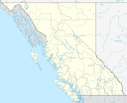 | |
|---|---|---|
| Communities | ||
| Metro areas and agglomerations | ||
| ||
Coordinates: 52°37′00″N 121°33′49″W / 52.61667°N 121.56361°W