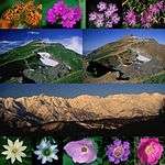
| Name |
Special Place of Scenic Beauty |
Special Historic Site |
Special Natural Monument |
Remarks |
Location |
Photo |
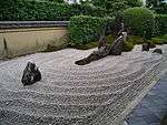
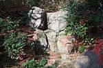
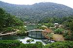
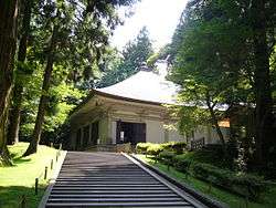
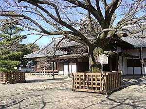
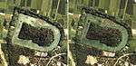
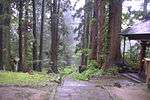
| Mōtsū-ji garden (毛越寺庭園, mōtsūji teien)[4] |
1 |
— |
— |
|
Iwate HiraizumiHiraizumi, Iwate
38°59′16.31″N 141°6′28.98″E / 38.9878639°N 141.1080500°E / 38.9878639; 141.1080500 |
 |
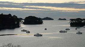
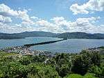
| Matsushima (松島) |
8, 11 |
— |
— |
One of the Three Views of Japan |
Miyagi variousShiogama, Shichigahama, Rifu, Matsushima, Higashimatsushima, Miyagi
38°21′59.13″N 141°4′27.87″E / 38.3664250°N 141.0744083°E / 38.3664250; 141.0744083 |
 |
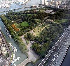
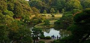
| Hamarikyu Gardens (旧浜離宮庭園, kyū hamarikyū teien)[5] |
1 |
2,8 |
— |
|
Tokyo TokyoTokyo
35°39′35.3″N 139°45′46.5″E / 35.659806°N 139.762917°E / 35.659806; 139.762917 |
 |
| Koishikawa Kōrakuen Garden (小石川後楽園, koishikawa kōrakuen)[6] |
1 |
8 |
— |
|
Tokyo TokyoTokyo
35°42′19.63″N 139°44′57.37″E / 35.7054528°N 139.7492694°E / 35.7054528; 139.7492694 |
.JPG) |
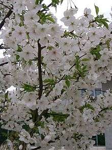
| Rikugi-en (六義園)[7] |
1 |
— |
— |
|
Tokyo TokyoTokyo
35°43′58.66″N 139°44′47.48″E / 35.7329611°N 139.7465222°E / 35.7329611; 139.7465222 |
 |
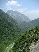
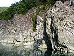
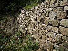
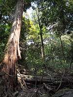
| Kurobe Gorge with Sarutobi Gorge and Mount Okukane (黒部峡谷 附 猿飛ならびに奥鐘山, kurobekyōkoku tsuketari sarutobi narabini okukaneyama) |
6 |
— |
4 |
|
Toyama variousTateyama, Kurobe, Toyama
36°37′23.18″N 137°41′11.4″E / 36.6231056°N 137.686500°E / 36.6231056; 137.686500 |
 |
| Kenroku-en (兼六園)[8] |
1 |
— |
— |
One of the Three Great Gardens of Japan |
Ishikawa KanazawaKanazawa, Ishikawa
36°33′43.5″N 136°39′44.99″E / 36.562083°N 136.6624972°E / 36.562083; 136.6624972 |
 |
| Ichijōdani Asakura Family Gardens (一乗谷朝倉氏庭園, Ichijōdani Asakura-shi teien) |
1 |
— |
— |
The ruins at the same site are a Special Historic Site. |
Fukui FukuiFukui, Fukui
35°59′57.95″N 136°17′43.52″E / 35.9994306°N 136.2954222°E / 35.9994306; 136.2954222 |
 |
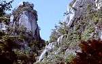
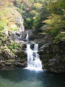
| Mitake Shōsenkyō Gorge (御嶽昇仙峡, mitake shōsenkyō)[9] |
5, 6 |
— |
— |
|
Yamanashi variousKōfu and Kai, Yamanashi
35°44′41.64″N 138°33′59.29″E / 35.7449000°N 138.5664694°E / 35.7449000; 138.5664694 |
 |
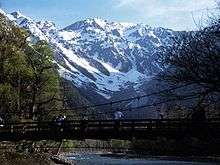
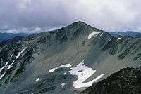
| Kamikōchi (上高地)[10] |
6 |
— |
4 |
|
Nagano MatsumotoMatsumoto, Nagano
36°14′24.93″N 137°37′27.07″E / 36.2402583°N 137.6241861°E / 36.2402583; 137.6241861 |
 |
| Konchiin Garden (金地院庭園, konchiin teien) |
1 |
— |
— |
|
Kyoto KyotoKyoto, Kyoto
35°0′38.29″N 135°47′24.02″E / 35.0106361°N 135.7900056°E / 35.0106361; 135.7900056 |
 |
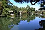
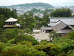
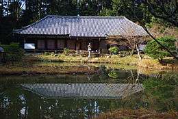
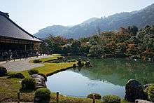
| Jishō-ji (Ginkaku-ji) Garden (慈照寺(銀閣寺)庭園, jishō-ji (ginkaku-ji) teien)[11] |
1 |
8 |
— |
|
Kyoto KyotoKyoto, Kyoto
35°1′35.78″N 135°47′54.31″E / 35.0266056°N 135.7984194°E / 35.0266056; 135.7984194 |
 |
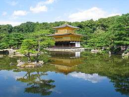
| Rokuon-ji (Kinkaku-ji) Garden (鹿苑寺(金閣寺)庭園, rokuon-ji (kinkaku-ji) teien)[12] |
1 |
8 |
— |
|
Kyoto KyotoKyoto, Kyoto
35°2′21.38″N 135°43′43.33″E / 35.0392722°N 135.7287028°E / 35.0392722; 135.7287028 |
 |
| Jōruri-ji Garden (浄瑠璃寺庭園, jōruri-ji teien) |
1 |
— |
— |
Also a historic site (hist-crit.: 8) |
Kyoto KizugawaKizugawa, Kyoto
34°42′56.16″N 135°52′22.8″E / 34.7156000°N 135.873000°E / 34.7156000; 135.873000 |
 |
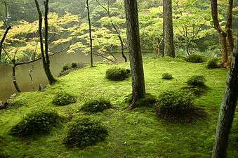
| Saihō-ji Garden (西芳寺庭園, saihō-ji teien)[13] |
1 |
— |
— |
Also a historic site (hist-crit.: 8) |
Kyoto KyotoKyoto, Kyoto
34°59′32.5″N 135°41′3.81″E / 34.992361°N 135.6843917°E / 34.992361; 135.6843917 |
 |
| Daisen-in Shoin Garden (大仙院書院庭園, daisenin shoin teien)[14] |
1 |
— |
— |
Also a historic site (hist-crit.: 8) |
Kyoto KyotoKyoto, Kyoto
35°2′40.66″N 135°44′45.01″E / 35.0446278°N 135.7458361°E / 35.0446278; 135.7458361 |
 |
| Daitoku-ji Hōjō Garden (大徳寺方丈庭園, daitokuji hōjō teien) |
1 |
— |
— |
Also a historic site (hist-crit.: 8) |
Kyoto KyotoKyoto, Kyoto
35°2′40.66″N 135°44′45.01″E / 35.0446278°N 135.7458361°E / 35.0446278; 135.7458361 |
 |
| Daigo-ji Sanbō-in Garden (醍醐寺三宝院庭園, daigoji sanbōin teien)[15] |
1 |
8 |
— |
|
Kyoto KyotoKyoto, Kyoto
34°57′6.78″N 135°49′10.2″E / 34.9518833°N 135.819500°E / 34.9518833; 135.819500 |
|
| Amanohashidate (天橋立)[16] |
3, 8, 11 |
— |
— |
One of the Three Views of Japan |
Kyoto MiyazuMiyazu, Kyoto
35°34′12.02″N 135°11′30.59″E / 35.5700056°N 135.1918306°E / 35.5700056; 135.1918306 |
 |
| Tenryū-ji Garden (天龍寺庭園, tenryū-ji teien)[17] |
1 |
— |
— |
Also a historic site (hist-crit.: 8) |
Kyoto KyotoKyoto, Kyoto
35°0′56.68″N 135°40′23.53″E / 35.0157444°N 135.6732028°E / 35.0157444; 135.6732028 |
 |
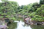
| Nijō Castle Ninomaru Palace Gardens (二条城二之丸庭園, nijōjō ninomaru teien)[18] |
1 |
— |
— |
|
Kyoto KyotoKyoto, Kyoto
35°0′48.27″N 135°44′57.22″E / 35.0134083°N 135.7492278°E / 35.0134083; 135.7492278 |
 |
| Hōkongō-in Seijo no taki waterfall and Mount Goisan (法金剛院青女滝 附 五位山, hōkongōin seijo no taki tsuketari goisan) |
1, 10 |
— |
— |
|
Kyoto KyotoKyoto, Kyoto
35°1′11.77″N 135°42′59.03″E / 35.0199361°N 135.7163972°E / 35.0199361; 135.7163972 |
 |
| Hongan-ji Ōshoin Garden (本願寺大書院庭園, honganji ōshoin teien) |
1 |
— |
— |
Also a historic site (hist-crit: 8) |
Kyoto KyotoKyoto, Kyoto
34°59′27.37″N 135°45′4.47″E / 34.9909361°N 135.7512417°E / 34.9909361; 135.7512417 |
|
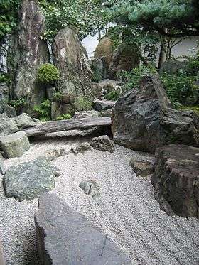
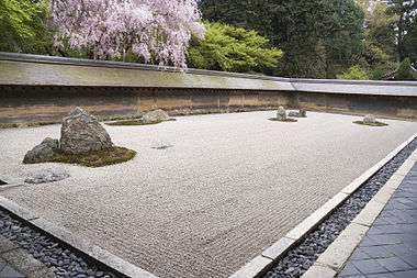
| Ryōan-ji Hōjō Garden (龍安寺方丈庭園, ryōanji hōjō teien) |
1 |
— |
— |
Also a historic site (hist-crit: 8) |
Kyoto KyotoKyoto, Kyoto
35°2′3.81″N 135°43′5.42″E / 35.0343917°N 135.7181722°E / 35.0343917; 135.7181722 |
 |
| Garden at the Eastern Heijō Palace (平城宮東院庭園, Heijō-kyū tōin teien)[19] |
1 |
— |
— |
Reconstruction of an 8th-century Imperial Palace Garden with ponds and pebble shore |
Nara NaraNara, Nara
34°41′28″N 135°47′44″E / 34.69111°N 135.79556°E / 34.69111; 135.79556 |
 |
| Heijō-kyō Sakyō Sanjō Nibō Palace Garden (平城京左京三条二坊宮跡庭園, heijōkyō sakyō sanjō nibō miyaato teien)[20] |
1 |
2, 8 |
— |
The ruins at the same site are a Special Historic Site. |
Nara NaraNara, Nara
34°41′1.45″N 135°48′8.44″E / 34.6837361°N 135.8023444°E / 34.6837361; 135.8023444 |
|
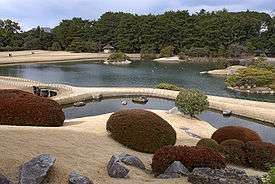
| Okayama Kōraku-en (岡山後楽園, okayama kōrakuen)[21] |
1 |
— |
— |
One of the Three Great Gardens of Japan |
Okayama OkayamaOkayama, Okayama
34°40′3.94″N 133°56′7.78″E / 34.6677611°N 133.9354944°E / 34.6677611; 133.9354944 |
 |
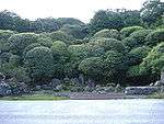
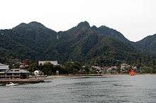
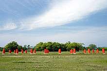
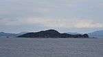
| Itsukushima (厳島)[22] |
8 |
2,3 |
— |
Includes one of the Three Views of Japan |
Hiroshima HatsukaichiHatsukaichi, Hiroshima
34°17′1.99″N 132°19′5.9″E / 34.2838861°N 132.318306°E / 34.2838861; 132.318306 |
 |
| Sandan-kyō ravine (三段峡, sandan-kyō) |
3,5,6 |
— |
— |
|
Hiroshima AkiotaAkiōta, Hiroshima
34°37′28.85″N 132°11′8.97″E / 34.6246806°N 132.1858250°E / 34.6246806; 132.1858250 |
 |
| Ritsurin Garden (栗林公園, ritsurin kōen)[23] |
1 |
— |
— |
|
Kagawa TakamatsuTakamatsu, Kagawa
34°19′39.2″N 134°2′35.76″E / 34.327556°N 134.0432667°E / 34.327556; 134.0432667 |
 |
| Nijinomatsubara (虹の松原)[24] |
3,9 |
— |
— |
|
Saga KaratsuKaratsu, Saga
33°26′35.99″N 130°0′34.37″E / 33.4433306°N 130.0095472°E / 33.4433306; 130.0095472 |
 |
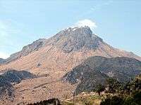
| Mount Unzen (雲仙岳, unzendake) |
1, 3, 9, 10 |
— |
— |
|
Nagasaki ShimabaraShimabara, Nagasaki
32°45′37.54″N 130°17′31.25″E / 32.7604278°N 130.2920139°E / 32.7604278; 130.2920139 |
 |
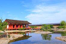
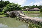
| Shikinaen Garden (識名園, shikinaen) |
1 |
— |
— |
|
Okinawa NahaNaha, Okinawa
26°12′14.1″N 127°42′55.32″E / 26.203917°N 127.7153667°E / 26.203917; 127.7153667 |
 |
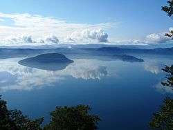
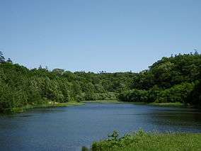
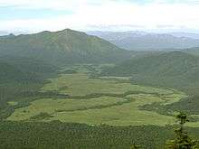
| Lake Towada and Oirase Mountain Stream (十和田湖および奥入瀬渓流, towadako oyobi oirasekeiryū) |
6, 7 |
— |
— |
Also a Natural Monument (4) |
various variousTowadako, Aomori and Kosaka, Akita
40°28′23.05″N 140°52′39.67″E / 40.4730694°N 140.8776861°E / 40.4730694; 140.8776861 |
|
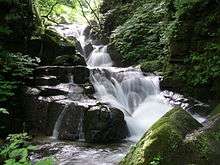
| Dorohacchō Gorge (瀞八丁, dorohacchō) |
5,6 |
— |
— |
Also a Natural Monument (3.1) |
various variousKumanogawa, Wakayama, Kiwa, Mie and Totsukawa, Nara
33°52′23.24″N 135°51′27.43″E / 33.8731222°N 135.8576194°E / 33.8731222; 135.8576194 |
 |
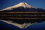
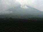
| Mount Fuji (富士山, fujisan) |
10 |
— |
— |
|
various variousYamanashi, Shizuoka
35°21′28.8″N 138°43′51.6″E / 35.358000°N 138.731000°E / 35.358000; 138.731000 |
 |
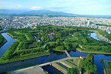
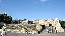
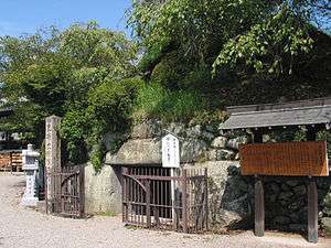
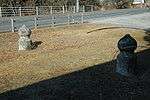
| Goryōkaku site (五稜郭跡, goryōkakuato)[25] |
— |
2 |
— |
Star fort of the Republic of Ezo |
Hokkaido HakodateHakodate, Hokkaidō
41°47′49.8″N 140°45′24.3″E / 41.797167°N 140.756750°E / 41.797167; 140.756750 |
 |
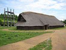
| Sannai-Maruyama site (三内丸山遺跡, sannai maruyama iseki)[26] |
— |
1 |
— |
Jōmon period archaeological site |
Aomori AomoriAomori, Aomori
40°48′40.24″N 140°41′44.3″E / 40.8111778°N 140.695639°E / 40.8111778; 140.695639 |
 |
| Chūson-ji compound (中尊寺境内, chūsonji keidai)[27] |
— |
3 |
— |
|
Iwate HiraizumiHiraizumi, Iwate
39°0′6.68″N 141°6′0.46″E / 39.0018556°N 141.1001278°E / 39.0018556; 141.1001278 |
 |
| Muryōkōin site (無量光院跡, muryōkōinato) |
— |
3 |
— |
|
Iwate HiraizumiHiraizumi, Iwate
38°59′36.08″N 141°6′56.81″E / 38.9933556°N 141.1157806°E / 38.9933556; 141.1157806 |
 |
| Site of a Chinjusha attached to the Mōtsū-ji compound (毛越寺境内 附 鎮守社跡, mōtsūji keidai tsuketari chinjushaato)[28] |
— |
3 |
— |
|
Iwate HiraizumiHiraizumi, Iwate
38°59′13.89″N 141°6′27.26″E / 38.9871917°N 141.1075722°E / 38.9871917; 141.1075722 |
|
| Site of a temple attached to the site of the Taga Castle (多賀城跡 附 寺跡, tagajōato tsuketari teraato)[29][30] |
— |
2, 3 |
— |
|
Miyagi TagajoTagajō, Miyagi
38°17′57.54″N 140°59′52.41″E / 38.2993167°N 140.9978917°E / 38.2993167; 140.9978917 |
 |
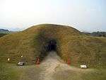
| Ōyu Stone Circle (大湯環状列石, ōyu kanjō resseki)[31] |
— |
1 |
— |
|
Akita KazunoKazuno, Akita
40°16′16.96″N 140°48′15.06″E / 40.2713778°N 140.8041833°E / 40.2713778; 140.8041833 |
 |
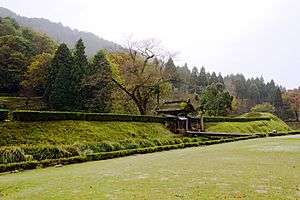
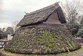
| Former Kōdōkan School (旧弘道館, kyūkōdōkan)[32] |
— |
4 |
— |
Former school of the Mito Clan, founded in 1841 by Tokugawa Nariaki |
Ibaraki MitoMito, Ibaraki
36°22′31.54″N 140°28′38.27″E / 36.3754278°N 140.4772972°E / 36.3754278; 140.4772972 |
 |
| Hitachi Kokubun-ji site (常陸国分寺跡, hitachi kokubunjiato)[33] |
— |
3 |
— |
|
Ibaraki IshiokaIshioka, Ibaraki
36°11′48.17″N 140°16′25.38″E / 36.1967139°N 140.2737167°E / 36.1967139; 140.2737167 |
|
| Hitachi Kokubun Nunnery site (常陸国分尼寺跡, hitachi kokubun nijiato)[34] |
— |
3 |
— |
|
Ibaraki IshiokaIshioka, Ibaraki
36°12′6.18″N 140°16′3.25″E / 36.2017167°N 140.2675694°E / 36.2017167; 140.2675694 |
|
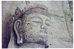
| Ōya Magaibutsu (大谷磨崖仏, ōya magaibutsu) |
— |
3 |
— |
Stone reliefs of Buddhist deities in a cave |
Tochigi UtsunomiyaUtsunomiya, Tochigi
36°35′46.35″N 139°49′16.94″E / 36.5962083°N 139.8213722°E / 36.5962083; 139.8213722 |
|
| Cedar Avenue of Nikkō and attached donation monuments (日光杉並木街道 附 並木寄進碑, nikkō suginamiki kaidō tsuketari namiki kishinhi)[35][36] |
— |
6 |
2.1 |
Three roads totalling 37 km (23 mi) |
Tochigi NikkoNikkō, Imaichi and Kanuma, Tochigi
36°35′46.35″N 139°49′16.94″E / 36.5962083°N 139.8213722°E / 36.5962083; 139.8213722 |
|
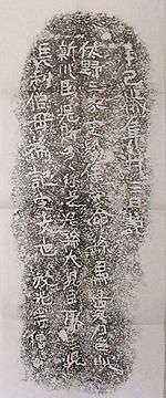
| Kanaizawa Stele (金井沢碑, kanaizawahi)[37] |
— |
3, 7 |
— |
110 cm (43 in) high stone stele from 726 |
Gunma TakasakiTakasaki, Gunma
36°17′8.37″N 139°0′58.21″E / 36.2856583°N 139.0161694°E / 36.2856583; 139.0161694 |
 |
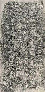
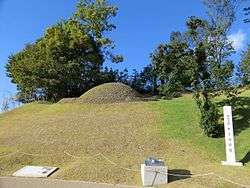
| Yamanoue stele and kofun (山上碑及び古墳, yamanouehi oyobi kofun)[38] |
— |
1, 7 |
— |
|
Gunma TakasakiTakasaki, Gunma
36°16′37.48″N 139°1′40.09″E / 36.2770778°N 139.0278028°E / 36.2770778; 139.0278028 |
 |
| Tago Stele (多胡碑, tagohi)[39] |
— |
2, 7 |
— |
|
Gunma TakasakiTakasaki, Gunma
36°15′54.1″N 138°59′46.67″E / 36.265028°N 138.9962972°E / 36.265028; 138.9962972 |
 |
| Edo Castle site (江戸城跡, edojōato) |
— |
2 |
— |
|
Tokyo TokyoTokyo
35°41′8.93″N 139°45′23.95″E / 35.6858139°N 139.7566528°E / 35.6858139; 139.7566528 |
 |
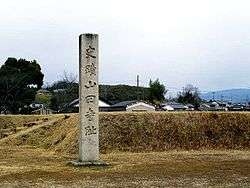
| Ichijōdani Asakura Family Historic Ruins (一乗谷朝倉氏遺跡, Ichijōdani Asakura-shi iseki)[40] |
— |
2, 3, 6, 7, 8 |
— |
The gardens at the same site are a Special Place of Scenic Beauty. |
Fukui FukuiFukui, Fukui
35°59′57.95″N 136°17′43.52″E / 35.9994306°N 136.2954222°E / 35.9994306; 136.2954222 |
 |
| Togari Ishi Stone Age ruins (尖石石器時代遺跡, togariishi sekkijidai iseki) |
— |
1 |
— |
Jōmon period archaeological site |
Nagano ChinoChino, Nagano
36°0′46.32″N 138°13′55.04″E / 36.0128667°N 138.2319556°E / 36.0128667; 138.2319556 |
|
| Tōtomi Kokubun-ji site (遠江国分寺跡, tōtomi kokubunjiato)[41] |
— |
3 |
— |
|
Shizuoka IwataIwata, Shizuoka
34°43′10.45″N 137°51′5.75″E / 34.7195694°N 137.8515972°E / 34.7195694; 137.8515972 |
|
| Arai Barrier site (新居関跡, arainosekiato)[42][43] |
— |
6 |
— |
Set up by Tokugawa Ieyasu |
Shizuoka AraiArai, Shizuoka
34°41′40.99″N 137°33′40.82″E / 34.6947194°N 137.5613389°E / 34.6947194; 137.5613389 |
 |
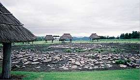
| Toro archaeological site (登呂遺跡, toro iseki)[44] |
— |
1 |
— |
Late Yayoi archaeological site |
Shizuoka ShizuokaShizuoka, Shizuoka
34°57′22.26″N 138°24′29.74″E / 34.9561833°N 138.4082611°E / 34.9561833; 138.4082611 |
 |
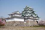
| Nagoya Castle site (名古屋城跡, nagoyajōato) |
— |
2 |
— |
|
Aichi NagoyaNagoya, Aichi
35°11′5.8″N 136°53′58.77″E / 35.184944°N 136.8996583°E / 35.184944; 136.8996583 |
 |
| Former residence of Motoori Norinaga (本居宣長旧宅 同 宅跡, Motoori Norinaga kyūtaku dōtakuato)[45] |
— |
8 |
— |
|
Mie MatsusakaMatsusaka, Mie
34°34′30.9″N 136°31′32.94″E / 34.575250°N 136.5258167°E / 34.575250; 136.5258167 |
 |
| Azuchi Castle site (安土城跡, azuchijōato) |
— |
2 |
— |
|
Shiga variousAzuchi and Higashiōmi, Shiga
35°9′21.25″N 136°8′21.79″E / 35.1559028°N 136.1393861°E / 35.1559028; 136.1393861 |
 |
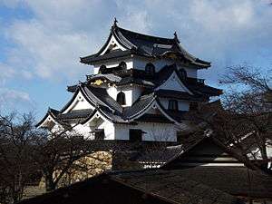
| Hikone Castle site (彦根城跡, hikonejōato) |
— |
2 |
— |
|
Shiga HikoneHikone, Shiga
35°16′35.87″N 136°15′9.02″E / 35.2766306°N 136.2525056°E / 35.2766306; 136.2525056 |
 |
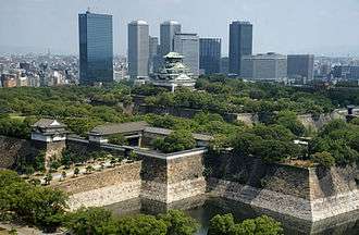
| Osaka Castle site (大坂城跡, osakajōato) |
— |
2 |
— |
|
Osaka OsakaOsaka, Osaka
34°41′14.3″N 135°31′35.04″E / 34.687306°N 135.5264000°E / 34.687306; 135.5264000 |
 |
| Kudara-dera site (百済寺, kuderaderaato) |
— |
3 |
— |
|
Osaka HirakataHirakata, Osaka
34°48′55.29″N 135°39′39.15″E / 34.8153583°N 135.6608750°E / 34.8153583; 135.6608750 |
 |
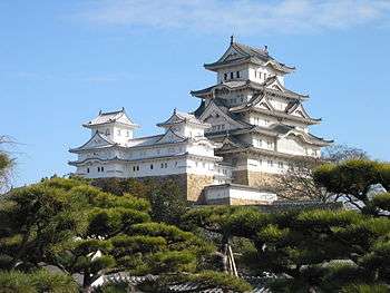
| Himeji Castle site (姫路城跡, himejijōato)[46] |
— |
2 |
— |
|
Hyogo HimejiHimeji, Hyōgo
34°50′18.85″N 134°41′34.97″E / 34.8385694°N 134.6930472°E / 34.8385694; 134.6930472 |
 |
| Kitora Tomb (キトラ古墳, kitora kofun)[47] |
— |
1 |
— |
|
Nara AsukaAsuka, Nara
34°27′5.25″N 135°48′18.49″E / 34.4514583°N 135.8051361°E / 34.4514583; 135.8051361 |
 |
| Takamatsuzuka Tomb (高松塚古墳, takamatsuzuka kofun)[48] |
— |
1 |
— |
|
Nara AsukaAsuka, Nara
34°27′43.94″N 135°48′23.2″E / 34.4622056°N 135.806444°E / 34.4622056; 135.806444 |
 |
| Yama-dera site (山田寺跡, yamadaderaato)[49] |
— |
3 |
— |
|
Nara SakuraiSakurai, Nara
34°29′4.02″N 135°49′48.09″E / 34.4844500°N 135.8300250°E / 34.4844500; 135.8300250 |
 |
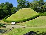
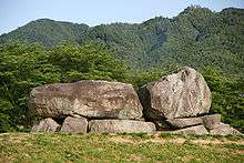
| Ishibutai Kofun (石舞台古墳)[50] |
— |
1 |
— |
|
Nara AsukaAsuka, Nara
34°28′0.15″N 135°49′33.88″E / 34.4667083°N 135.8260778°E / 34.4667083; 135.8260778 |
 |
| Suyama Kofun (巣山古墳)[51] |
— |
1 |
— |
|
Nara KoryoKōryō, Nara
34°33′23.06″N 135°44′27.63″E / 34.5564056°N 135.7410083°E / 34.5564056; 135.7410083 |
 |
| Fujiwara Palace site (藤原宮跡, fujiwara kyūseki)[52] |
— |
2 |
— |
Palace of the Fujiwara capital |
Nara KashiharaKashihara, Nara
34°30′8.71″N 135°48′26.44″E / 34.5024194°N 135.8073444°E / 34.5024194; 135.8073444 |
 |
| Monjuin Nishi Kofun (文殊院西古墳)[53] |
— |
1 |
— |
|
Nara SakuraiSakurai, Nara
34°30′13.55″N 135°50′33.21″E / 34.5037639°N 135.8425583°E / 34.5037639; 135.8425583 |
 |
| Heijō Palace site (平城宮跡, heijō kyūseki)[54] |
— |
2 |
— |
Palace of the Heijō capital; the gardens at the same site are a Special Place of Scenic Beauty |
Nara NaraNara, Nara
34°41′28.46″N 135°47′42.02″E / 34.6912389°N 135.7950056°E / 34.6912389; 135.7950056 |
.JPG) |
| Moto Yakushi-ji site (本薬師寺跡, motoyakushijiato)[55] |
— |
3 |
— |
Yakushi-ji of the Fujiwara capital |
Nara KashiharaKashihara, Nara
34°29′33.88″N 135°48′0.95″E / 34.4927444°N 135.8002639°E / 34.4927444; 135.8002639 |
|
| Iwase Senzuka Kofun Group (岩橋千塚古墳群, iwase senzuka kofungun)[56] |
— |
1 |
— |
|
Wakayama WakayamaWakayama, Wakayama
34°13′33.08″N 135°13′38.9″E / 34.2258556°N 135.227472°E / 34.2258556; 135.227472 |
 |
| Sai no Ohai-ji site (斎尾廃寺跡, sainoohaijiato) |
— |
3 |
— |
|
Tottori TohakuTōhaku, Tottori
35°28′53.65″N 133°42′41.13″E / 35.4815694°N 133.7114250°E / 35.4815694; 133.7114250 |
|
| Former Shizutani School with Camelia mound, stone gate, site of the residence of Tsuda Nagatada and tea house (旧閑谷学校 附 椿山石門津田永忠宅跡および黄葉亭, kyūshizutanigakkō tsuketari tsubakiyama sekimon tsudanagatadatakuato oyobi kōyōtei)[57][58] |
— |
4 |
— |
|
Okayama BizenBizen, Okayama
34°47′46.77″N 134°13′10.23″E / 34.7963250°N 134.2195083°E / 34.7963250; 134.2195083 |
|
| Renjuku Fourmer Chazan Kan house (廉塾ならびに菅茶山旧宅, renjuku narabini kansazankyūtaku)[59][60] |
— |
4, 8 |
— |
Chazan Kan (1748–1827) was a Confucian scholar. |
Hiroshima FukuyamaFukuyama, Hiroshima
34°32′41.26″N 133°23′4.1″E / 34.5447944°N 133.384472°E / 34.5447944; 133.384472 |
|
| Sanuki Kokubun-ji site (讃岐国分寺跡, sanuki kokubunjiato)[61] |
— |
3 |
— |
Temple 80 of the Shikoku pilgrimage |
Kagawa HiraizumiTakamatsu, Kagawa
34°18′13.18″N 133°56′39.65″E / 34.3036611°N 133.9443472°E / 34.3036611; 133.9443472 |
 |
| Ōzuka Kofun (王塚古墳)[62] |
— |
1 |
— |
|
Fukuoka KeisenKeisen, Fukuoka
33°35′19.47″N 130°39′49.84″E / 33.5887417°N 130.6638444°E / 33.5887417; 130.6638444 |
 |
| Mizuki site (水城跡, mizukiato) |
— |
2 |
— |
Low embankment built in 664 by the Dazaifu (大宰府), the imperial office governing Kyūshū, against an invasion from Tang Dynasty China and Korea |
Fukuoka variousDazaifu, Kasuga and Ōnojō, Fukuoka
33°31′2.41″N 130°29′28.42″E / 33.5173361°N 130.4912278°E / 33.5173361; 130.4912278 |
 |
| Dazaifu site (大宰府跡, dazaifuato)[63] |
— |
2 |
— |
Ruins of the governmental office with jurisdiction over Kyūshū |
Fukuoka DazaifuDazaifu, Fukuoka
33°30′52.43″N 130°30′54.55″E / 33.5145639°N 130.5151528°E / 33.5145639; 130.5151528 |
 |
| Ōnojō Castle Ruins (大野城跡, ōnojōato)[64] |
— |
2, 3 |
— |
Asuka period castle |
Fukuoka variousDazaifu, Umi and Ōnojō, Fukuoka
33°31′16.9″N 130°30′54.01″E / 33.521361°N 130.5150028°E / 33.521361; 130.5150028 |
 |
| Yoshinogari site (吉野ヶ里遺跡, yoshinogari iseki)[65] |
— |
1 |
— |
Yayoi period archaeological site |
Saga YoshinogariYoshinogari, Saga
33°19′25.18″N 130°23′6.43″E / 33.3236611°N 130.3851194°E / 33.3236611; 130.3851194 |
 |
| Nagoya Castle ruined foundations (名護屋城跡並陣跡, nagoyajōato narabini jinato)[66] |
— |
2 |
— |
|
Saga variousChinzei, Yobuko and Genkai, Saga
33°31′48.65″N 129°52′9.75″E / 33.5301806°N 129.8693750°E / 33.5301806; 129.8693750 |
 |
| Kaneda Castle site (金田城跡, kanedajōato)[67] |
— |
2 |
— |
Asuka period mountain castle |
Nagasaki TsushimaTsushima, Nagasaki
34°16′6.07″N 129°18′49.69″E / 34.2683528°N 129.3138028°E / 34.2683528; 129.3138028 |
|
| Haru no Tsuji Site (原の辻遺跡, haru no tsujii seki)[68] |
— |
1 |
— |
|
Nagasaki IkiIki, Nagasaki
33°45′48.68″N 129°44′55.04″E / 33.7635222°N 129.7486222°E / 33.7635222; 129.7486222 |
|
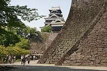
| Kumamoto Castle site (熊本城跡, kumamotojōato) |
— |
2 |
— |
|
Kumamoto KumamotoKumamoto, Kumamoto
32°48′20.55″N 130°42′21.21″E / 32.8057083°N 130.7058917°E / 32.8057083; 130.7058917 |
 |
| Usuki Stone Buddhas with five-storied stone pagoda and two gorintō with inscriptions from 1170 and 1172 (臼杵磨崖仏 附 日吉塔、嘉応二年在銘五輪塔 承安二年在銘五輪塔, usuki magaibutsu tsuketari hiyoshitō kaōninenzaimei gorintō jōanninenzaimei gorintō)[69][70] |
— |
3 |
— |
|
Oita UsukiUsuki, Ōita
33°5′26.18″N 131°45′47.04″E / 33.0906056°N 131.7630667°E / 33.0906056; 131.7630667 |
 |
| Saitobaru Burial Mounds (西都原古墳群, saitobaru kofun-guni)[71] |
— |
1 |
— |
|
Miyazaki SaitoSaito, Miyazaki
32°7′14.95″N 131°23′17.84″E / 32.1208194°N 131.3882889°E / 32.1208194; 131.3882889 |
 |
| Kii Castle site (基肄(椽)城跡, kiijōato)[72] |
— |
2 |
— |
|
variou variousChikushino, Fukuoka and Kiyama, Saga
33°26′39.34″N 130°30′36.09″E / 33.4442611°N 130.5100250°E / 33.4442611; 130.5100250 |
 |
| Mount Apoi alpine plant community (アポイ岳高山植物群落, apoidake kōzanshokubutsu gunraku) |
— |
— |
2.3 |
|
Hokkaido SamaniSamani, Hokkaidō
42°6′25.35″N 143°1′41.89″E / 42.1070417°N 143.0283028°E / 42.1070417; 143.0283028 |
|
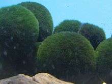
| Marimo of Lake Akan (阿寒湖のマリモ, akanko no marimo) |
— |
— |
2.12, 2.8 |
|
Hokkaido AkanAkan, Hokkaidō
43°27′1.54″N 144°5′57.93″E / 43.4504278°N 144.0994250°E / 43.4504278; 144.0994250 |
 |
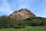
| Showashinzan (昭和新山) |
— |
— |
3.10 |
|
Hokkaido SobetsuSōbetsu, Hokkaidō
42°32′37.17″N 140°51′51.77″E / 42.5436583°N 140.8643806°E / 42.5436583; 140.8643806 |
 |
| Daisetsuzan (大雪山) |
— |
— |
4 |
|
Hokkaido variousKamikawa, Higashikawa, Biei and Shintoku, Hokkaidō
43°40′58.87″N 142°53′55.78″E / 43.6830194°N 142.8988278°E / 43.6830194; 142.8988278 |
 |
| Nopporo Forest Park (野幌原始林, nopporo genshirin) |
— |
— |
2.2 |
|
Hokkaido KitahiroshimaKitahiroshima, Hokkaidō
43°3′12.46″N 141°30′3.09″E / 43.0534611°N 141.5008583°E / 43.0534611; 141.5008583 |
 |
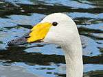
| Swans on Kominato beach and their wintering place (小湊のハクチョウおよびその渡来地, kominato no hakuchō oyobi sono toraichi) |
— |
— |
1.2 |
Whooper swans |
Aomori HiranaiHiranai, Aomori
40°56′14.09″N 140°58′23.88″E / 40.9372472°N 140.9733000°E / 40.9372472; 140.9733000 |
 |
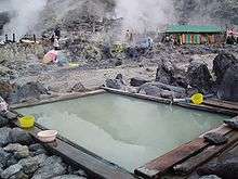
| Getō Onsen Tufa (夏油温泉の石灰華, getō onsen no sekkaika) |
— |
— |
3.8 |
|
Iwate KitakamiKitakami, Iwate
39°12′36.64″N 140°52′55.74″E / 39.2101778°N 140.8821500°E / 39.2101778; 140.8821500 |
|
| Nesori petrified wood (根反の大珪化木, nesori no daikeikaboku) |
— |
— |
3.1 |
15–20 million years old |
Iwate IchinoheIchinohe, Iwate
40°11′24.78″N 141°20′4.42″E / 40.1902167°N 141.3345611°E / 40.1902167; 141.3345611 |
|
| Yakehashiri lava flow (焼走り熔岩流, yakehashiri yōganryū) |
— |
— |
3.5, 3.10 |
|
Iwate NishineNishine, Iwate
39°52′30.82″N 141°2′51.16″E / 39.8752278°N 141.0475444°E / 39.8752278; 141.0475444 |
 |
| Mount Hayachine and Yakushidake alpine zone, forest vegetation (早池峰山および薬師岳の高山帯・森林植物群落, hayachinesan oyobi yakushidake no kōzantai shinrin shokubutsugunraku) |
— |
— |
2.3 |
|
Iwate variousHanamaki, Tōno and Kawai, Iwate
39°31′53.71″N 141°28′26.53″E / 39.5315861°N 141.4740361°E / 39.5315861; 141.4740361 |
|
| onikōbe no megama oyobi ogama kanketsu onsen (鬼首の雌釜および雄釜間歇温泉) |
— |
— |
3.8 |
|
Miyagi OsakiŌsaki, Miyagi
38°48′0.19″N 140°38′52.81″E / 38.8000528°N 140.6480028°E / 38.8000528; 140.6480028 |
|
| Tamagawa Hot Spring hokutolite (玉川温泉の北投石, tamagawa onsen no hokutōseki) |
— |
— |
3.1, 3.8 |
Hokutolite is a type of radioactive baryte. |
Akita SembokuSemboku, Akita
39°57′42.57″N 140°43′42.18″E / 39.9618250°N 140.7283833°E / 39.9618250; 140.7283833 |
 |
| Mount Haguro cedar avenue (羽黒山のスギ並木, hagursan no suginamiki) |
— |
— |
2.1 |
|
Yamagata TsuruokaTsuruoka, Yamagata
38°42′13.91″N 139°58′13.33″E / 38.7038639°N 139.9703694°E / 38.7038639; 139.9703694 |
 |
| Large zelkova tree of Higashine (東根の大ケヤキ, higashine no ōkeyaki) |
— |
— |
2.1 |
More than 1000 years old, and perimeter larger than 12 (m), largest zelkova tree in Japan |
Yamagata HigashineHigashine, Yamagata
38°26′31.16″N 140°24′6.28″E / 38.4419889°N 140.4017444°E / 38.4419889; 140.4017444 |
|
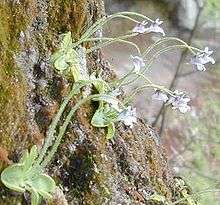
| Natural habitat Pinguicula ramosa (コウシンソウ自生地, higashine no ōkeyaki) |
— |
— |
2.12 |
A species of butterwort endemic to Nikkō National Park |
Tochigi NikkoNikkō, Tochigi
36°40′27.13″N 139°21′42.9″E / 36.6742028°N 139.361917°E / 36.6742028; 139.361917 |
 |
| Mount Asama lava tree mold (浅間山熔岩樹型, asamayama yōganjukei) |
— |
— |
3.2, 3.7, 3.10 |
|
Gunma TsumagoiTsumagoi, Gunma
36°26′53.57″N 138°30′56.25″E / 36.4482139°N 138.5156250°E / 36.4482139; 138.5156250 |
|
| Wisteria at Ushijima (牛島のフジ, ushijima no fuji) |
— |
— |
2.1 |
|
Saitama KasukabeKasukabe, Saitama
35°59′5.83″N 139°46′24.07″E / 35.9849528°N 139.7733528°E / 35.9849528; 139.7733528 |
|
| Kagami-iwa rock at Mount Mitake (御獄の鏡岩, mitake no kagamiiwa) |
— |
— |
3.1, 3.5 |
|
Saitama KamikawaKamikawa, Saitama
36°10′45.91″N 139°4′14.18″E / 36.1794194°N 139.0706056°E / 36.1794194; 139.0706056 |
|
| Tajimagahara Primula sieboldii primrose habitat (田島ヶ原サクラソウ自生地, tajimagahara sakurasō jiseichi) |
— |
— |
2.4 |
|
Saitama SaitamaSaitama, Saitama
35°50′17.41″N 139°36′56.66″E / 35.8381694°N 139.6157389°E / 35.8381694; 139.6157389 |
 |
| Tai-no-ura sea bream habitat (鯛の浦タイ生息地, tai no ura tai seisokuchi)[73] |
— |
— |
1.3 |
|
Chiba KamogawaKamogawa, Chiba
35°7′5.98″N 140°11′28.67″E / 35.1183278°N 140.1912972°E / 35.1183278; 140.1912972 |
 |
| Ōshima cherry tree (大島のサクラ株, ōshima no sakurakabu) |
— |
— |
2.1 |
Single tree, 7.9 m (26 ft) circumference; species is native to Ōshima and Izu Peninsula |
Tokyo OshimaŌshima, Tokyo
34°45′49.01″N 139°26′3.07″E / 34.7636139°N 139.4341861°E / 34.7636139; 139.4341861 |
 |
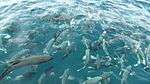
| Firefly squid sea surface group (ホタルイカ群遊海面, hotaruika-gun yūkaimen) |
— |
— |
1.3 |
|
Toyama variousToyama and Uozu, Toyama
36°46′36.01″N 137°20′40.69″E / 36.7766694°N 137.3446361°E / 36.7766694; 137.3446361 |
 |
| Uozu buried forest (魚津埋没林, uozu maibutsurin) |
— |
— |
3.1, 3.5 |
Tree trunks of a cedar forest partially buried about 2000 years ago; largest has a circumference of c. 12 m (39 ft) |
Toyama Uozu ShakadoShakadō, Uozu, Toyama
36°49′31.5″N 137°24′23.53″E / 36.825417°N 137.4065361°E / 36.825417; 137.4065361 |
 |
| Yakushidake cirque group (薬師岳の圏谷群, yakushidake no kenkokugun) |
— |
— |
3.11 |
|
Toyama ToyamaToyama, Toyama
36°28′5.64″N 137°32′38.48″E / 36.4682333°N 137.5440222°E / 36.4682333; 137.5440222 |
 |
| Sinter cones (岩間の噴泉塔群, iwama no funsentōgun) |
— |
— |
3.8 |
|
Ishikawa HakusanHakusan, Ishikawa
36°13′39.32″N 136°46′11.69″E / 36.2275889°N 136.7699139°E / 36.2275889; 136.7699139 |
|
| Narusawa lava tree mold (鳴沢熔岩樹型, narusawayōganjukei) |
— |
— |
3.6, 3.10 |
|
Yamanashi NarusawaNarusawa, Yamanashi
35°25′34.06″N 138°42′3.05″E / 35.4261278°N 138.7008472°E / 35.4261278; 138.7008472 |
 |
| Shirahone Onsen stalagmite and spherical limestones (白骨温泉の噴湯丘と球状石灰石, shirahone onsen no funtōkyū to kyūjōsekkaiseki) |
— |
— |
3.8 |
|
Nagano MatsumotoMatsumoto, Nagano
36°8′51.72″N 137°37′28.85″E / 36.1477000°N 137.6246806°E / 36.1477000; 137.6246806 |
|
| Neodani Fault (根尾谷断層, neodani dansō) |
— |
— |
3.5 |
|
Gifu MotosuMotosu, Gifu
35°37′1.62″N 136°37′14.98″E / 35.6171167°N 136.6208278°E / 35.6171167; 136.6208278 |
 |
| Itoshiro cedar (石徹白のスギ, itoshiro no sugi) |
— |
— |
2.1 |
Circumference 14 m (46 ft) |
Gifu GujoGujō, Gifu
36°0′5.83″N 136°46′18.49″E / 36.0016194°N 136.7718028°E / 36.0016194; 136.7718028 |
 |
| Kariyado gebazakura (狩宿の下馬ザクラ, kariyado no gebazakura) |
— |
— |
2.1 |
Oldest tree of the mountain sakura, crown 21.81 m (71.6 ft) (EW) and 16.33 m (53.6 ft) (NS) |
Shizuoka FujinomiyaFujinomiya, Shizuoka
35°18′6.92″N 138°35′19.59″E / 35.3019222°N 138.5887750°E / 35.3019222; 138.5887750 |
|
| Wakutama pond (湧玉池, wakutama no ike) |
— |
— |
3.10 |
|
Shizuoka FujinomiyaFujinomiya, Shizuoka
35°13′38.07″N 138°36′41.14″E / 35.2272417°N 138.6114278°E / 35.2272417; 138.6114278 |
 |
| Nagaoka fireflies and their habitat (長岡のゲンジボタルおよびその発生地, nagaoka no genjibotaru oyobi sono hassei) |
— |
— |
1.2 |
|
Shiga MaibaraMaibara, Shiga
35°21′22.54″N 136°22′4.84″E / 35.3562611°N 136.3680111°E / 35.3562611; 136.3680111 |
|
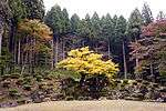
| Kasugayama Primeval Forest (春日山原始林, kasugayama genshirin) |
— |
— |
2.2 |
Part of the World Heritage Site "Historic Monuments of Ancient Nara" |
Nara NaraNara, Nara
34°40′56.19″N 135°51′46.13″E / 34.6822750°N 135.8628139°E / 34.6822750; 135.8628139 |
 |
| Daisen agarwood single species forest (大山のダイセンキャラボク純林, daisen no daisenkyaraboku junrin) |
— |
— |
2.2 |
|
Tottori DaisenDaisen, Tottori
35°29′0.95″N 133°30′28.51″E / 35.4835972°N 133.5079194°E / 35.4835972; 133.5079194 |
|
| Daikon Island lava tubes (大根島の熔岩隧道, daikonjima no yōganzuidō) |
— |
— |
3.6, 3.10 |
|
Shimane MatsueMatsue, Shimane
35°29′42.59″N 133°10′34.42″E / 35.4951639°N 133.1762278°E / 35.4951639; 133.1762278 |
|
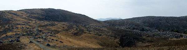
| Akiyoshi plateau (秋吉台, akiyoshidai) |
— |
— |
3.1, 3.3, 3.6, 3.9 |
Karst topography |
Yamaguchi MineMine, Yamaguchi
34°14′11.14″N 131°17′26.05″E / 34.2364278°N 131.2905694°E / 34.2364278; 131.2905694 |
 |
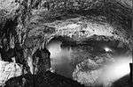
| Akiyoshi cave (秋芳洞, akiyoshidō) |
— |
— |
3.6, 3.9 |
At 8.7 km (5.4 mi) second longest cave in Japan |
Yamaguchi MineMine, Yamaguchi
34°13′40.17″N 131°18′12.32″E / 34.2278250°N 131.3034222°E / 34.2278250; 131.3034222 |
 |
| Cranes at Yashiro and their wintering place (八代のツルおよびその渡来地, yashiro no tsuru oyobi sono toraichi) |
— |
— |
1.2 |
Hooded cranes |
Yamaguchi variousShūnan and Kudamatsu, Yamaguchi
34°5′56.19″N 131°56′49.83″E / 34.0989417°N 131.9471750°E / 34.0989417; 131.9471750 |
|
| Giant camphor tree in Kamo (加茂の大クス, kamo no ōkusu) |
— |
— |
2.1 |
|
Tokushima HigashimiyoshiHigashimiyoshi, Tokushima
34°2′27.39″N 133°55′54.92″E / 34.0409417°N 133.9319222°E / 34.0409417; 133.9319222 |
|
| Chinese juniper at Hōshō-in (宝生院のシンパク, hōshōin no shinpaku) |
— |
— |
2.1 |
23 m (75 ft) high, 15 m (49 ft) circumference at ground level |
Kagawa TonoshoTonoshō, Kagawa
34°29′36.11″N 134°11′49.86″E / 34.4933639°N 134.1971833°E / 34.4933639; 134.1971833 |
|
| Yakama potholes (八釜の甌穴群, yakama no ōketsugun) |
— |
— |
3.9 |
|
Ehime KumakogenKumakōgen, Ehime
33°42′13.6″N 132°57′38.39″E / 33.703778°N 132.9606639°E / 33.703778; 132.9606639 |
|
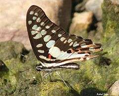
| Common jay at Kōchi and its habitat (高知市のミカドアゲハおよびその生息地, kōchishi no mikadoageha oyobi sono seisokuchi) |
— |
— |
1.2 |
|
Kochi KochiKōchi, Kōchi
33°33′13.06″N 133°32′24.07″E / 33.5536278°N 133.5400194°E / 33.5536278; 133.5400194 |
 |
| Giant cedars at Sugi (杉の大スギ, sugi no ōsugi) |
— |
— |
2.1 |
Two stems, each about 16 m (52 ft) circumference |
Kochi OtoyoŌtoyo, Kōchi
33°45′20.17″N 133°39′47.01″E / 33.7556028°N 133.6630583°E / 33.7556028; 133.6630583 |
|
| Japanese Box primeval forest at Mount Kosho (古処山ツゲ原始林, koshosan tsuge genshirin) |
— |
— |
2.1 |
|
Fukuoka variousAsakura and Kama, Fukuoka
33°28′54.67″N 130°43′29.8″E / 33.4818528°N 130.724944°E / 33.4818528; 130.724944 |
 |
| Camphor tree primeval forest at Mount Tachibana (立花山クスノキ原始林, tachibanayama kusunoki genshirin) |
— |
— |
2.2, 2.10 |
|
Fukuoka variousShingū and Hisayama, Fukuoka
33°40′45.67″N 130°28′6.23″E / 33.6793528°N 130.4683972°E / 33.6793528; 130.4683972 |
 |
| Mucuna sempervirens at Aira (相良のアイラトビカズラ, aira no airatobikazura) |
— |
— |
2.1, 2.12 |
|
Kumamoto KikukaKikuka, Kumamoto
33°3′51.16″N 130°46′5.53″E / 33.0642111°N 130.7682028°E / 33.0642111; 130.7682028 |
|
| Aoshima subtropical plant communities (青島亜熱帯性植物群落, aoshima anettai seishokubutsugunraku) |
— |
— |
2.2 |
|
Miyazaki MiyazakiAoshima, Miyazaki, Miyazaki
31°48′18.69″N 131°28′32.7″E / 31.8051917°N 131.475750°E / 31.8051917; 131.475750 |
 |
| Sago palm natural habitat at Cape Toi (都井岬ソテツ自生地, toimisaki sotetsu jiseichi) |
— |
— |
2.10 |
|
Miyazaki KushimaKushima, Miyazaki
31°21′54.78″N 131°20′24.03″E / 31.3652167°N 131.3400083°E / 31.3652167; 131.3400083 |
 |
| Mitrastema at Uchiumi (内海のヤッコソウ発生地, uchiumi no yakkosō hasseichi) |
— |
— |
2.12 |
Mitrastema yamamotoi |
Miyazaki MiyazakiMiyazaki, Miyazaki
31°44′28.97″N 131°28′3.81″E / 31.7413806°N 131.4677250°E / 31.7413806; 131.4677250 |
|
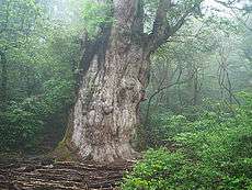
| Yakushima primeval cedar forest (屋久島スギ原始林, yakushima sugi genshirin) |
— |
— |
2.2 |
Includes with the Jōmon Sugi, the oldest specimen of Cryptomeria japonica |
Kagoshima YakushimaYakushima, Kagoshima
30°19′40.23″N 130°31′23.06″E / 30.3278417°N 130.5230722°E / 30.3278417; 130.5230722 |
 |
| Kamō camphor tree (蒲生のクス, kamō no kesu) |
— |
— |
2.1 |
Height: 30 m (98 ft), circumference: 24 m (79 ft) |
Kagoshima KamoKamō, Kagoshima
31°45′44.38″N 130°34′11.77″E / 31.7623278°N 130.5699361°E / 31.7623278; 130.5699361 |
 |
| Origin of Kandelia obovata at Kiire (喜入のリュウキュウコウガイ産地, kiire no ryūkyōkōgai sanchi) |
— |
— |
2.10 |
|
Kagoshima KagoshimaKagoshima, Kagoshima
31°22′29.34″N 130°32′49.26″E / 31.3748167°N 130.5470167°E / 31.3748167; 130.5470167 |
 |
| Natural habitat of the sago palm in Kagoshima Prefecture (鹿児島県のソテツ自生地, kagoshimaken no sotetsu jiseichi) |
— |
— |
2.10 |
|
Kagoshima variousYamagawa, Bonotsu, Sata and Uchinoura, Kagoshima
31°21′13.09″N 130°42′15.64″E / 31.3536361°N 130.7043444°E / 31.3536361; 130.7043444 |
 |
| Cranes in Kagoshima Prefecture and their wintering place (鹿児島県のツルおよびその渡来地, kagoshimaken no tsuru oyobi sono toraichi) |
— |
— |
1.2 |
Hooded cranes |
Kagoshima IzumiIzumi, Kagoshima
32°6′9.52″N 130°16′25.75″E / 32.1026444°N 130.2738194°E / 32.1026444; 130.2738194 |
 |
| Birōjima subtropical plant communities (枇榔島亜熱帯性植物群落, birōjima anettai seishokubutsugunraku) |
— |
— |
2.2, 2.10 |
|
Kagoshima ShibushiShibushi, Kagoshima
31°25′45.3″N 131°7′1.89″E / 31.429250°N 131.1171917°E / 31.429250; 131.1171917 |
 |
| Shirouma mountain range alpine plant zone (白馬連山高山植物帯, shiroumarenzan kōzanshokubutsutai) |
— |
— |
2.3 |
|
various variousAsahi and Kurobe in Toyama; Hakuba in Nagano; Itoigawa in Niigata
36°38′56.9″N 137°44′55.73″E / 36.649139°N 137.7488139°E / 36.649139; 137.7488139 |
 |
| Ozegahara (尾瀬, oze) |
— |
— |
4 |
|
various variousYunotani, Niigata; Katashina, Gunma; Hinoemata, Fukushima
36°56′33.93″N 139°13′59.41″E / 36.9427583°N 139.2331694°E / 36.9427583; 139.2331694 |
 |
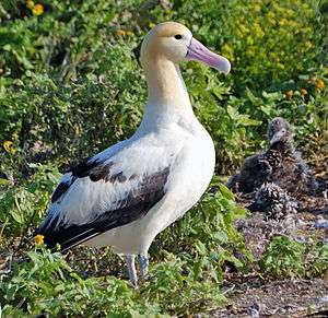
| Short-tailed albatross (アホウドリ, ahōdori) |
— |
— |
1.2 |
|
various variousOgasawara Islands (Tokyo) and Okinawa |
 |
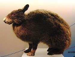
| Amami rabbit (アマミノクロウサギ, amami no kuro usagi) |
— |
— |
1.1 |
|
Kagoshima variousTokunoshima and Amami Ōshima, Kagoshima |
 |
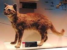
| Iriomote cat (イリオモテヤマネコ, iriomote yamaneko) |
— |
— |
1.1 |
Endemic to one island (Iriomote) |
Okinawa IriomoteIriomote, Okinawa |
 |
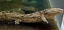
| Japanese giant salamander (オオサンショウウオ, ōsanshōuo) |
— |
— |
1.2 |
At up to 1.5 m (4 ft 11 in) length, the second largest salamander in the world[74] |
various Iriomote11 prefectures, among others: Gifu, Mie, Hyōgo, Hiroshima, Shimane, Tottori, Ōita |
 |
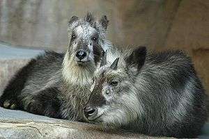
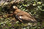
| Japanese serow (カモシカ, kamoshika) |
— |
— |
1.1 |
found on all main Japanese islands except for Hokkaidō |
various various29 prefectures including Aomori |
 |
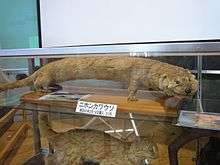
| Otter (カワウソ, kawauso) |
— |
— |
1.2 |
|
various variousvarious |
 |
| Crested serpent-eagle (カンムリワシ, kanmuriwashi) |
— |
— |
1.1 |
|
Okinawa variousOkinawa |
 |
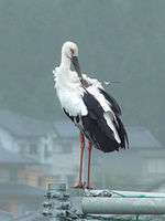
| Oriental stork (コウノトリ, kō no tori) |
— |
— |
1.2 |
|
various variousHyōgo and Fukui |
 |
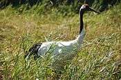
| Red-crowned crane (タンチョウ, tanchō) |
— |
— |
1.2 |
|
Hokkaido variousHokkaidō |
 |
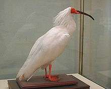
| Crested ibis (トキ, toki) |
— |
— |
1.2 |
|
various variousNiigata and Ishikawa |
 |
| Okinawa woodpecker (ノグチゲラ, noguchigera) |
— |
— |
1.1 |
Endemic to Okinawa Island |
Okinawa Okinawa IslandOkinawa Island, Okinawa |
 |
| Bonin white-eye (メグロ, meguro) |
— |
— |
1.1 |
Endemic to the Bonin Islands |
Tokyo Bonin IslandsBonin Islands, Tokyo |
|
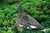
| Rock ptarmigan (ライチョウ, raichō) |
— |
— |
1.2 |
|
various variousToyama, Nagano, Niigata, Yamanashi, Shizuoka, Gifu |
 |
| Long-tailed fowl of Tosa (土佐のオナガドリ, tosa no onagadori) |
— |
— |
1.4 |
|
Kochi NankokuNankoku, Kōchi |
|