List of World Heritage Sites in Slovakia
Below is a list of World Heritage Sites that lie totally or partially in Slovakia.
* Trans-border site


Notes
- ↑ Extended in 2000 to include the Dobšinská Ice Cave and modification of boundaries in 2008: increase of property at Esztramos Hill from 107.2 (265) to 195 (480) and establishment of a 28,000 (69,000) buffer zone on the Hungarian side.
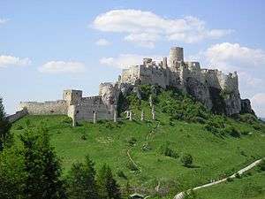
- ↑ Extended in 2009 to include Levoča and the Work of Master Paul in Spiš and name change from Spišský Hrad and its associated cultural monuments to the present name.
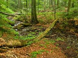
- ↑ Extended in 2011 to include the Ancient Beech Forests of Germany and name change from Primeval Beech Forests of the Carpathians to the present name.
References
- Notes
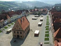
- ↑ "Bardejov". UNESCO. Retrieved 20 October 2011.
- ↑ "Caves of Aggtelek Karst and Slovak Karst". UNESCO. Retrieved 20 October 2011.
- ↑ "Decision - 32COM 8B.48 - Examination of nominations and minor modifications to the boundaries of naturel, mixed and cultural properties to the World Heritage List - Caves of Aggtelek Karst and Slovak Karst (HUNGARY / SLOVAKIA)". UNESCO. Retrieved 20 October 2011.
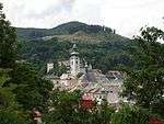
- ↑ "Historic Town of Banská Štiavnica and the Technical Monuments in its Vicinity". UNESCO. Retrieved 20 October 2011.
- ↑ "Levoča, Spišský Hrad and the Associated Cultural Monuments". UNESCO. Retrieved 20 October 2011.
- ↑ "Primeval Beech Forests of the Carpathians and the Ancient Beech Forests of Germany". UNESCO. Retrieved 20 October 2011.
- ↑ "IUCN Evaluations of Nominations of Natural and Mixed Properties to the World Heritage List" (PDF). UNESCO. pp. 111–120. Retrieved 20 October 2011.
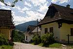
- ↑ "Vlkolínec". UNESCO. Retrieved 20 October 2011.
- ↑ "Wooden Churches of the Slovak part of the Carpathian Mountain Area". UNESCO. Retrieved 20 October 2011.
This article is issued from Wikipedia - version of the 4/2/2014. The text is available under the Creative Commons Attribution/Share Alike but additional terms may apply for the media files.