List of airports in Swaziland
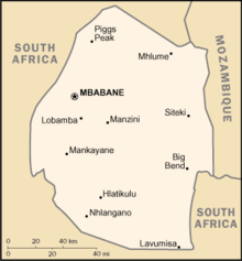
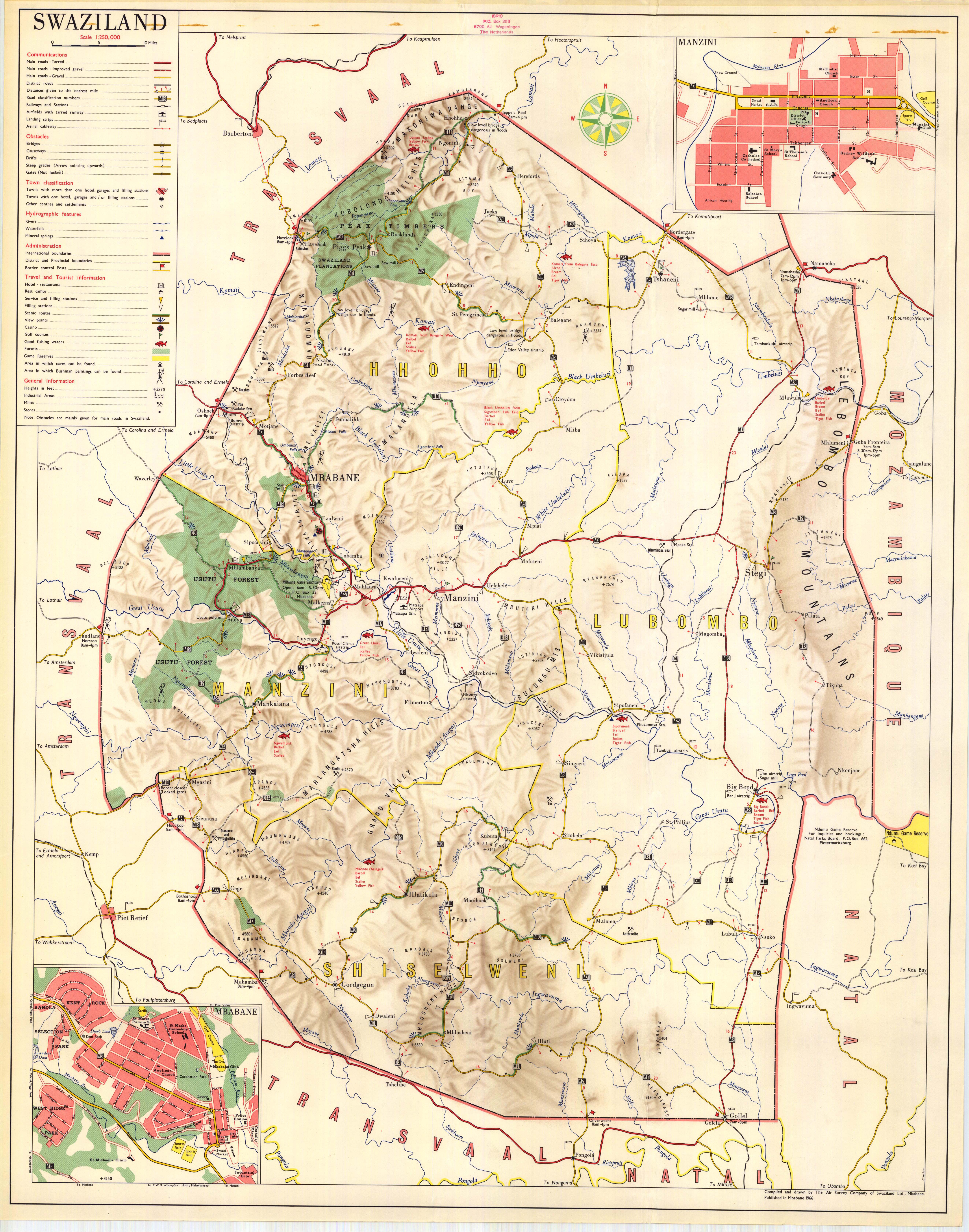
Map of Swaziland
This is a list of airports in Swaziland, sorted by location.
Swaziland, officially the Kingdom of Swaziland, is a landlocked country in southern Africa, bordered to the north, south, east and west by South Africa, and to the east by Mozambique. The nation, as well as its people, are named after the 19th-century king Mswati II. Swaziland is divided into four districts: Hhohho, Lubombo, Manzini, and Shiselweni. The capital of Swaziland is Mbabane, while the country's traditional and legislative capital is Lobamba.
Airports
Names shown in bold indicate the airport has scheduled passenger service on commercial airlines.
Most of the airfields listed below are private and unpaved. The exceptions are Matsapha Airport and Sikhuphe International Airport.
| Location served |
ICAO |
IATA |
Airport name |
Runway length/surface |
Coordinates |
| Big Bend |
FDBT |
|
Tambuti Airfield |
800 m (2,600 ft) Grass |
26°44′10″S 31°46′35″E / 26.73611°S 31.77639°E / -26.73611; 31.77639 (Tambuti Airfield) |
| Big Bend |
FDUB |
|
Ubombo Ranches Airfield |
730 m (2,400 ft) unpaved |
26°46′07″S 031°56′12″E / 26.76861°S 31.93667°E / -26.76861; 31.93667 (Big Bend Airfield) |
| Bhunya |
|
|
Bhunya Airfield |
1,250 m (4,100 ft) Gravel |
26°35′0″S 30°56′35″E / 26.58333°S 30.94306°E / -26.58333; 30.94306 (Bhunya Airfield) |
| Kubuta |
FDKS / FDKB |
|
Kubuta Airfield |
847 m (2,779 ft) grass |
26°52′54″S 031°29′23″E / 26.88167°S 31.48972°E / -26.88167; 31.48972 (Kubuta Airfield)[1][2] |
| Manzini |
FDMS |
MTS |
Matsapha (International) Airport |
2,600 m (8,500 ft) paved |
26°31′44″S 031°18′27″E / 26.52889°S 31.30750°E / -26.52889; 31.30750 (Matsapha Airport) |
| Manzini |
FDSK |
SHO |
King Mswati III International Airport |
3,600 m (11,800 ft) Asphalt |
26°21′24″S 31°43′01″E / 26.35667°S 31.71694°E / -26.35667; 31.71694 (King Mswati III Airport) |
| Mhlume |
FDMH |
|
Mhlume Airfield |
709 m (2,326 ft) unpaved |
26°01′33″S 031°48′36″E / 26.02583°S 31.81000°E / -26.02583; 31.81000 (Mhlume Airfield) |
| Ngonini |
FDNG |
|
Piggs Peak Airfield |
823 m (2,700 ft) unpaved |
25°47′53″S 031°24′43″E / 25.79806°S 31.41194°E / -25.79806; 31.41194 (Piggs Peak) |
| Nhlangano |
FDNH |
|
Nhlangano Airfield |
671 m (2,201 ft) unpaved |
27°07′12″S 031°12′45″E / 27.12000°S 31.21250°E / -27.12000; 31.21250 (Nhlangano) |
| Nsoko |
FDNS |
|
Nsoko Airfield |
671 m (2,201 ft) unpaved |
27°01′06″S 031°56′07″E / 27.01833°S 31.93528°E / -27.01833; 31.93528 (Nsoko Airfield) |
| Simunye |
FDSM |
|
Simunye Airfield |
1,100 m (3,600 ft) unpaved |
26°11′46″S 031°55′48″E / 26.19611°S 31.93000°E / -26.19611; 31.93000 (Simunye Airfield) |
| Siteki |
FDST |
|
Siteki Airfield |
1,006 m (3,301 ft) unpaved |
26°28′19″S 031°56′35″E / 26.47194°S 31.94306°E / -26.47194; 31.94306 (Siteki Airfield) |
| Tambankulu |
FDTM |
|
Tambankulu Airfield |
875 m (2,871 ft) unpaved |
26°06′22″S 031°55′11″E / 26.10611°S 31.91972°E / -26.10611; 31.91972 (Tambankulu Airfield) |
| Tshaneni |
FDTS |
|
Tshaneni Airfield |
756 m (2,480 ft) unpaved |
25°59′06″S 031°45′07″E / 25.98500°S 31.75194°E / -25.98500; 31.75194 (Tshaneni Airfield) |
The airstrip at Tshaneni is not to be confused with "Tshaneni Airport", a planned transportation hub based around the airstrip in Mkuze, a nearby town on the other side of the South African border.
See also
References
|
|---|
|
| Main Roads |
- MR1
- MR2
- MR3
- MR4
- MR5
- MR6
- MR7
- MR8
- MR9
- MR11
- MR13
- MR14
- MR18
- MR19
- MR21
- MR24
| |
|---|
|
| Rail | |
|---|
|
| Air | |
|---|
|
| Border posts | |
|---|
|
|
|
|---|
|
| History | |
|---|
|
| Geography | |
|---|
|
| Politics | |
|---|
|
| Economy | |
|---|
|
| Society | |
|---|
|
|