List of dams and reservoirs in Zimbabwe

This list is incomplete; you can help by expanding it.

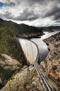
The following is a partial list of dams in Zimbabwe.

List of dams (reservoirs)

Name
(Alt.)
Nearest
locale
ProvinceImpoundsYear
completed
(commissioned)
Capacity
(MegaL)
Map
ref
Notes
Kariba Dam Karoi Mashonaland West Zambezi river 1959160 368
16°31′23″S 28°45′42″E / 16.523194°S 28.761542°E / -16.523194; 28.761542 (Kariba Dam) [1]
Tokwe Mukorsi Dam MasvingoMasvingo Province Tokwe River N/A 1 750
20°43′40″S 30°54′11″E / 20.727792°S 30.903142°E / -20.727792; 30.903142 (Tokwe Mukorsi Dam) [2]
Lake MutirikwiMasvingoMasvingo Province Mtilikwe river1961 1 425
20°14′56″S 31°02′00″E / 20.248922°S 31.033261°E / -20.248922; 31.033261 (Lake Mutirikwi) [3]
Lake ManyameHarareMashonaland WestManyame river1976 490
17°48′17″S 30°36′56″E / 17.8046°S 30.6156°E / -17.8046; 30.6156 (Darwendale Dam) [3]
Osborne Dam MutareManicalandOdzi River- 400
18°45′59″S 32°29′08″E / 18.766389°S 32.485556°E / -18.766389; 32.485556 (Osborne Dam) [4]
Mazvikadei Dam Banket Mashonaland West Mukwadzi River 1988 360
17°13′14″S 30°23′30″E / 17.220556°S 30.391667°E / -17.220556; 30.391667 (Mazvikadei Dam) [5]
Manyuchi dam Masvingo Masvingo Province Mwenezi River - 303
21°03′14″S 30°22′12″E / 21.054°S 30.370°E / -21.054; 30.370 (Manyuchi Dam) [6]
Manjirenji Dam Masvingo Masvingo Province Chiredzi river 1966 285
20°37′34″S 31°36′34″E / 20.6262°S 31.6094°E / -20.6262; 31.6094 (Manjerenji Dam) [3]
Lake Chivero Harare Mashonaland West Hunyani river 1952 250 17°54′01″S 30°47′28″E / 17.900278°S 30.791111°E / -17.900278; 30.791111 (Lake Chivero) [3]
Mayfair Dam EsigodiniMatabeleland SouthInsiza River 1976 182 [3]
Sebakwe Dam Kwekwe Midlands Sebakwe river 1957 154
19°02′00″S 30°15′00″E / 19.0333°S 30.2500°E / -19.0333; 30.2500 (Sebakwe Dam) [3][7]
Bangala Dam Triangle Lowveld Mtilikwe river 1963 130
20°41′41″S 31°13′58″E / 20.6947°S 31.2327°E / -20.6947; 31.2327 (Bangala Dam) [3][8]
Mzingwane Dam Esigodini Matabeleland South Umzingwani river 1958 57
20°23′35″S 28°58′26″E / 20.393056°S 28.973889°E / -20.393056; 28.973889 (Mzingwane Dam) [3]
Ncema Upper Dam Esigodini Matabeleland SouthNcema river 1973 45
20°21′00″S 29°01′00″E / 20.3500°S 29.0167°E / -20.3500; 29.0167 (Upper Ncema Dam) [3]
Mushandike DamMasvingoMasvingo ProvinceMushandike river 193838
20°09′00″S 30°38′00″E / 20.1500°S 30.6333°E / -20.1500; 30.6333 (Mushandike Dam) [3]
Mazowe Dam Mazowe Mashonaland Central Mazowe river 1920 35
17°31′18″S 30°59′19″E / 17.521667°S 30.988611°E / -17.521667; 30.988611 (Mazowe Dam) [3]
Gwenoro Dam Gweru Midlands Lundi river 1958 32
19°45′00″S 29°52′00″E / 19.75°S 29.86667°E / -19.75; 29.86667 (Gwenoro Dam) [3]
Ngezi Dam KwekweMashonaland WestNgezi River 1945 26 18°41′59″S 29°23′58″E / 18.69962°S 29.39954°E / -18.69962; 29.39954 (Ncema Dam)[3]
Silalbuhwa Dam EsigodiniMatabeleland SouthMzingwane River 1966 24 20°45′30″S 29°21′38″E / 20.7584°S 29.36061°E / -20.7584; 29.36061 (Ncema Dam) [3]
Claw Dam Zimbabwe Mashonaland West Muzvezve river 1973 21
18°26′22″S 29°52′50″E / 18.4395124283902°S 29.8805165290833°E / -18.4395124283902; 29.8805165290833 (Claw Dam) [3]
Ncema Dam Esigodini Matabeleland SouthNcema river 1943 18
20°21′00″S 29°01′00″E / 20.3500°S 29.0167°E / -20.3500; 29.0167 (Ncema Dam)
Suri Suri Dam ChegutuMashonaland WestSuri Suri River 1968 9 18°05′09″S 29°58′46″E / 18.08597°S 29.97944°E / -18.08597; 29.97944 (Ncema Dam)[3]
Ngondoma DamEmpress MineMidlandsNgondoma River 19677
18°27′26″S 29°24′50″E / 18.457222°S 29.413889°E / -18.457222; 29.413889 (Ngondoma Dam) [3]
Siya Dam BikitaMasvingo ProvinceTurgwe River 1977 106 20°16′00″S 31°37′00″E / 20.2667°S 31.6167°E / -20.2667; 31.6167 (Siya Dam) [9]
Ruti Dam BuheraMashonaland East Nyazvidzi River 1976 140 19°32′27″S 31°43′38″E / 19.5407°S 31.7272°E / -19.5407; 31.7272 (Rutu Dam) [10]
Inyankuni Dam Esigodini Matabeleland South Inyankuni River 1964 82 20°20′34″S 29°06′55″E / 20.3428°S 29.1153°E / -20.3428; 29.1153 (Inyankuni Dam) [10]
Palawan Dam Zvishavane Midlands Ingesi River 1978 69 20°08′06″S 29°48′38″E / 20.135125°S 29.810608°E / -20.135125; 29.810608 (Palawan Dam) [10]
Amapongokwe Dam SomabulaMidlands Mapongokwe River 1980 39 19°47′40″S 29°50′18″E / 19.794528°S 29.838414°E / -19.794528; 29.838414 (Amapongokwe Dam) [10]
Antelope Dam Maphisa Matabeleland South Shashani River 1971 15 [10]
Tiyabenzi Dam Shangani Midlands Shangani River 1972 14 [10]
Mananda Dam Solusi Matabeleland South Nata River 1967 12 20°13′05″S 28°03′21″E / 20.218°S 28.0557°E / -20.218; 28.0557 (Mananda Dam) [10]
Makado Ranch Dam Beitbridge Matabeleland South Umchabezi River 1968 12 [10]
Eben Dam Shamva Mashonaland Central Mupfurudzi River 1968 12 [10]
Harava Dam Chitungwiza Harare South Province Manyame River 1973 9 17°59′14″S 31°06′15″E / 17.987222°S 31.104166°E / -17.987222; 31.104166 (Harava Dam) [10][11]
Pampoenpoort Dam JM Nkomo Int. Airport Matabeleland North Trib. of Mguza River 1970 8 19°52′03″S 28°35′54″E / 19.8674°S 28.5983°E / -19.8674; 28.5983 (Pampoenpoort Dam) [10]
Odzani Dam Penhalonga Manicaland Odzani River 1965 6 [10]

See also

References

  1. Dr. V.V. Sugunan |November 1997 | FAO Fisheries Circular No. 933 FIRI/C933 |2.3 Small water bodies | Table 2.3 Major dams in Zimbabwe FAO|Fisheries
  2. Nelson Chenga |15 February 2016 Cheap design linked to problems at Tokwe-Mukosi Nehanda Radio |Local News |Retrieved 3 2016
  3. 1 2 3 4 5 6 7 8 9 10 11 12 13 14 15 16 17 Dr. V.V. Sugunan |November 1997 | FAO Fisheries Circular No. 933 FIRI/C933 |2.3 Small water bodies | Table 2.3 Major dams in Zimbabwe FAO|Fisheries Management of Small Water Bodies in Seven Countries in Africa, Asia and Latin America | Retrieved 3 February 2016
  4. Info Osborne dam on the Odzi river Salini Impregilo |Dams, hydroelectric plants |Retrieved 3 February 2016
  5. INFORMATION ON FISHERIES MANAGEMENT IN THE REPUBLIC OF ZIMBABWE |January 2003 Zimbabwe__LOCATION OF MAIN LANDING PLACES FAO|Retrieved 3 February 2016
  6. UNfccc CC:INFO/AIJ: REPORT___Assessment of the E7 Group (including EDF) Proposal for a Mini-hydroelectric Power Station in Zimbabwe; A1 UNfccc|Retrieved 3 February 2016
  7. Info Sebakwe Profile: Sebakwe Recreational Park is situated in the Midlands of Zimbabwe and is easily accessed by all regions of the country. Initially built with a small dam, an enlargement project was undertaken in 1981 to increase the size of the lake. After the enlargement, the main wall including the spillway, had been lengthened from 225 metres to 305 metres. The maximum height of the dam was raised to 47,2 metres. Consequently, the maximum depth of the water increased from 33,3 metres to 39,4 metres. The surface area of the water body became 2 600 hectares from the original 1 510 hectares, making it one of the largest in-land dams in Zimbabwe. Zimparks| Parks overview| Retrieved 3 February 2016
  8. ZINWA Home Dam | Zimbabwe National Water Authority ZINWA|Dams|Retrieved 3 February 2016
  9. Dr V Sugunan |Zimbabwe: FAO Fisheries and Aquaculture Department | Corporate Document Repository | Title:Fisheries Management of small water bodies in seven Countries in Africa, Asia ...|Retrieved 3 February 2016
  10. 1 2 3 4 5 6 7 8 9 10 11 12 Fao Fisheries |Zimbabwe: FAO Fisheries and Aquaculture Department | Corporate Document Repository | Title:Fisheries Management of small water bodies in seven Countries in Africa, Asia ...|Retrieved 3 February 2016
  11. Pamela Sibanda | June 2005 Nutrient Limitation of Phytoplankto in Five Impoundmentson the Manyame River, Zimbabwe "Figure 2: The location of the Manyame lakes in relation to urban centres of Harare and Chitungwiza, and the location of the sampling stations." Harava ( formerly Henry Hallam ) Dam is located 15 km south of Harare at the junction of the Manyame and Ruwa Rivers. ir.uz.ac.zw |Sibanda-Pamela-MSc-Thesis.pdf.txt |Retrieved 5 February 2016

Media related to Bodies of water in Zimbabwe at Wikimedia Commons

This article is issued from Wikipedia - version of the 11/30/2016. The text is available under the Creative Commons Attribution/Share Alike but additional terms may apply for the media files.