| Name |
Address |
Municipality |
PC |
Coordinates |
IDF |
IDP |
IDM |
 |
Image |
|---|
| Union Point United Church |
|
Morris |
|
49°31′22″N 97°13′39″W / 49.5229°N 97.2275°W / 49.5229; -97.2275 (Union Point United Church) |
|
|
15746 |
|
 |
| Bryce House |
99 Assiniboine Street |
Emerson |
R0A |
49°00′23″N 97°12′42″W / 49.0065°N 97.2118°W / 49.0065; -97.2118 (Bryce House) |
|
|
3217 |
|
|
| Masonic Lodge |
1 First Street |
Emerson |
R0A |
49°00′23″N 97°12′48″W / 49.0065°N 97.2132°W / 49.0065; -97.2132 (Masonic Lodge) |
|
|
3330 |
|
|
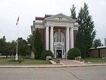
| Emerson Court House and Town Hall |
104 Church Street |
Emerson |
R0A |
49°00′20″N 97°12′43″W / 49.0056°N 97.2119°W / 49.0056; -97.2119 (Emerson Court House and Town Hall) |
|
3431 |
|
|
More images |
| Presbyterian Church Manse |
129 Park Street |
Emerson |
R0A |
49°00′27″N 97°12′52″W / 49.0074°N 97.2145°W / 49.0074; -97.2145 (Presbyterian Church Manse) |
|
|
8234 |
|
|
| Fort Dufferin National Historic Site of Canada |
Highway 75, 3 miles north of Emerson |
Emerson |
R0C |
49°01′53″N 97°12′14″W / 49.0314°N 97.2039°W / 49.0314; -97.2039 (Fort Dufferin National Historic Site of Canada) |
12688 |
|
|
|

More images |
| Rodmond Roblin House |
NE 24-6-4 WPM |
Carman |
R0G |
49°29′48″N 97°52′05″W / 49.4968°N 97.868°W / 49.4968; -97.868 (Rodmond Roblin House) |
|
|
2768 |
|
|
| Carman Canadian National Railways Station |
38 Centre Avenue West |
Carman |
R0G |
49°30′26″N 98°00′31″W / 49.5071°N 98.0086°W / 49.5071; -98.0086 (Carman Canadian National Railways Station) |
|
|
2769 |
|
|
| Sexsmith House |
18 Kings Park Road |
Carman |
R0G |
49°30′10″N 98°01′01″W / 49.5028°N 98.017°W / 49.5028; -98.017 (Sexsmith House) |
|
|
3176 |
|

More images |
| Bergthaler Waisenamt |
48 Main Street |
Altona |
R0G |
49°06′24″N 97°33′27″W / 49.1067°N 97.5576°W / 49.1067; -97.5576 (Bergthaler Waisenamt) |
|
|
3214 |
|
|
| Manitou Town Hall |
325 Main Street |
Manitou |
R0G |
49°14′23″N 98°32′15″W / 49.2398°N 98.5374°W / 49.2398; -98.5374 (Manitou Town Hall) |
|
|
3324 |
|
|
| Memorial Hall |
12-2nd Avenue SW |
Carman |
R0G |
49°30′23″N 98°00′11″W / 49.5063°N 98.0031°W / 49.5063; -98.0031 (Memorial Hall) |
|
|
16254 |
|
|
| Log Cabin |
Highway Number 3 and Main Street Junction |
Manitou |
R0G |
49°14′03″N 98°32′10″W / 49.2342°N 98.5361°W / 49.2342; -98.5361 (Log Cabin) |
|
|
3361 |
|
|
| Friesen Interpretive Centre |
89 Road 1 West |
Altona |
R0G |
49°02′32″N 97°17′10″W / 49.0421°N 97.286°W / 49.0421; -97.286 (Friesen Interpretive Centre) |
|
|
3367 |
|
|
| Herdsman's House |
89 Road 1 West |
Altona |
R0G |
49°06′N 97°33′W / 49.1°N 97.55°W / 49.1; -97.55 (Herdsman's House) |
|
|
3369 |
|
|
| Darlingford Consolidated School |
20 Bradburn Street |
Pembina |
R0G |
49°12′18″N 98°22′52″W / 49.205°N 98.381°W / 49.205; -98.381 (Darlingford Consolidated School) |
|
|
3755 |
|
|
| Miami Railway Station (Canadian Northern) National Historic Site of Canada |
|
Miami |
R0G |
49°22′16″N 98°14′38″W / 49.3711°N 98.2439°W / 49.3711; -98.2439 (Miami Railway Station (Canadian Northern) National Historic Site of Canada) |
4229 |
|
|
|
|
| Carman Dominion Post Office |
15 1st Avenue SW |
Carman |
R0G |
49°30′26″N 98°00′11″W / 49.5072°N 98.0031°W / 49.5072; -98.0031 (Carman Dominion Post Office) |
|
|
4259 |
|
|
| Hamm House |
#68 Road 2 West |
Rhineland |
R0G |
49°02′32″N 97°17′10″W / 49.0421°N 97.286°W / 49.0421; -97.286 (Hamm House) |
|
|
4501 |
|
|
| Carman United Church |
143 First Street SW |
Carman |
R0G |
49°30′13″N 98°00′12″W / 49.5036°N 98.0032°W / 49.5036; -98.0032 (Carman United Church) |
|
|
4566 |
|

More images |
| Boyne School |
|
Carman |
R0G |
49°30′09″N 97°55′46″W / 49.5024°N 97.9294°W / 49.5024; -97.9294 (Boyne School) |
|
|
5053 |
|

More images |
| Schwartz House |
245 10th Avenue NW |
Altona |
R0G |
49°06′41″N 97°34′11″W / 49.1113°N 97.5698°W / 49.1113; -97.5698 (Schwartz House) |
|
|
5444 |
|
|
| Mount Prospect School |
350 Broadway Avenue |
Cartwright |
R0G |
49°05′24″N 99°20′31″W / 49.09°N 99.3419°W / 49.09; -99.3419 (Mount Prospect School) |
|
|
5475 |
|
|
| La Rivière Canadian Pacific Railway Station |
|
Pembina |
R0G |
49°17′52″N 98°38′14″W / 49.2977°N 98.6373°W / 49.2977; -98.6373 (La Rivière Canadian Pacific Railway Station) |
|
5797 |
|
|
|
| Archibald United Church |
|
Pembina |
R0G |
49°17′52″N 98°38′14″W / 49.2977°N 98.6373°W / 49.2977; -98.6373 (Archibald United Church) |
|
|
5833 |
|
|
| Star Mound School |
SE 27-1-10 WPM |
Pembina |
R0G |
49°03′35″N 98°43′30″W / 49.0597°N 98.7249°W / 49.0597; -98.7249 (Star Mound School) |
|
|
5844 |
|

More images |
| Lea House |
|
Pembina |
R0G |
49°07′49″N 98°35′26″W / 49.1303°N 98.5906°W / 49.1303; -98.5906 (Lea House) |
|
|
5993 |
|
|
| Darlingford Memorial and Park |
Mountain Avenue |
Pembina |
R0G |
49°12′19″N 98°22′48″W / 49.2054°N 98.38°W / 49.2054; -98.38 (Darlingford Memorial and Park) |
|
6731 |
|
|
|
| Klippenstein House |
14 Centre Avenue East |
Altona |
R0G |
49°06′21″N 97°33′08″W / 49.1057°N 97.5522°W / 49.1057; -97.5522 (Klippenstein House) |
|
|
6827 |
|
|
| Mowbray School |
|
Manitou |
R0G |
49°01′49″N 98°26′08″W / 49.0302°N 98.4355°W / 49.0302; -98.4355 (Mowbray School) |
|
6853 |
|
|
|
| Roseisle School |
1st Avenue |
Dufferin |
R0G |
49°29′56″N 98°20′33″W / 49.4988°N 98.3424°W / 49.4988; -98.3424 (Roseisle School) |
|
|
6933 |
|
|
| Ste. Therese Roman Catholic Church |
|
Lorne |
R0G |
49°29′39″N 98°33′15″W / 49.4942°N 98.5543°W / 49.4942; -98.5543 (Ste. Therese Roman Catholic Church) |
|
|
7398 |
|
 |
| Hooper House |
35161, Road 10W |
Morris |
R0G |
49°31′44″N 97°41′00″W / 49.529°N 97.6834°W / 49.529; -97.6834 (Hooper House) |
|
|
8505 |
|
|
| Neubergthal Street Village National Historic Site of Canada |
Provincial Road 421 |
Rhineland |
R0G |
49°04′30″N 97°28′55″W / 49.075°N 97.482°W / 49.075; -97.482 (Neubergthal Street Village National Historic Site of Canada) |
13161 |
|
|
|
|
| Ens Heritage Homestead |
141 Reinland Avenue |
Stanley |
R0G |
49°02′27″N 97°51′58″W / 49.0407°N 97.8661°W / 49.0407; -97.8661 (Ens Heritage Homestead) |
|
|
17761 |
|
|
| Sidney United Church and Manse |
Maple Street |
North Norfolk |
R0H |
49°53′54″N 99°04′52″W / 49.8982°N 99.0812°W / 49.8982; -99.0812 (Sidney United Church and Manse) |
|
|
4253 |
|
|
| Crystal City Courier Building |
218 Broadway Street |
Crystal City |
R0K |
49°08′46″N 98°56′53″W / 49.146°N 98.948°W / 49.146; -98.948 (Crystal City Courier Building) |
|
|
3759 |
|
|
| Frikirkju (Bru) Lutheran Church |
NE 30-6-12 WPM |
Somerset |
R0K |
49°30′45″N 99°04′20″W / 49.5124°N 99.0722°W / 49.5124; -99.0722 (Frikirkju (Bru) Lutheran Church) |
|
|
3902 |
|
|
| Clearwater Canadian Pacific Railway Water Tower |
11th Street |
Louise |
R0K |
49°07′58″N 99°02′15″W / 49.1328°N 99.0374°W / 49.1328; -99.0374 (Clearwater Canadian Pacific Railway Water Tower) |
|
5114 |
|
|
|
| Menarey House |
|
Cartwright |
R0K |
49°07′45″N 99°24′57″W / 49.1292°N 99.4158°W / 49.1292; -99.4158 (Menarey House) |
|
|
5476 |
|
|
| Manitoba Telephone System Building |
350 Broadway Avenue |
Cartwright |
R0K |
49°05′27″N 99°20′41″W / 49.0909°N 99.3446°W / 49.0909; -99.3446 (Manitoba Telephone System Building) |
|
|
5482 |
|
|
| Thomas Greenway Cemetery |
|
Crystal City |
R0K |
49°09′12″N 98°57′11″W / 49.1534°N 98.9531°W / 49.1534; -98.9531 (Thomas Greenway Cemetery) |
|
|
6430 |
|
|
| Courier Publishing Company Building |
218 Broadway Street |
Crystal City |
R0K |
49°08′47″N 98°56′54″W / 49.1463°N 98.9483°W / 49.1463; -98.9483 (Courier Publishing Company Building) |
|
9402 |
|
|
|
| Morden Dominion Post Office |
352 Stephen Street |
Morden |
R6M |
49°11′26″N 98°06′00″W / 49.1905°N 98.1001°W / 49.1905; -98.1001 (Morden Dominion Post Office) |
|
8969 |
3187 |
|
|
| Maple Leaf School |
555 Thornhill Avenue |
Morden |
R6M |
49°11′32″N 98°06′20″W / 49.1923°N 98.1055°W / 49.1923; -98.1055 (Maple Leaf School) |
|
|
3188 |
|
|
| Stodders House |
180 Nelson Street |
Morden |
R6M |
49°11′32″N 98°06′11″W / 49.1921°N 98.1031°W / 49.1921; -98.1031 (Stodders House) |
|
|
5129 |
|
|
| McConnell House |
577 Stephen Street |
Morden |
R6M |
49°11′24″N 98°06′28″W / 49.1899°N 98.1077°W / 49.1899; -98.1077 (McConnell House) |
11396 |
|
6628 |
|
|
| McElroy House |
645 Thornhill Street |
Morden |
R6M |
49°11′33″N 98°06′34″W / 49.1924°N 98.1095°W / 49.1924; -98.1095 (McElroy House) |
|
|
6814 |
|
|