List of historic places in Southwestern Ontario
This is a list of historic places in Southwestern Ontario, containing heritage sites listed on the Canadian Register of Historic Places (CRHP), all of which are designated as historic places either locally, provincially, territorially, nationally, or by more than one level of government.
The following subregions have separate listings:
- County of Brant
- Essex County
- Middlesex County
- Perth County
- Regional Municipality of Waterloo
- Wellington County
List of historic places in other subregions
Bruce County
| Name | Address | Municipality | PC | Coordinates | IDF | IDP | IDM | |
Image |
|---|---|---|---|---|---|---|---|---|---|
| Keeper's House | Huron-Kinloss | 44°04′47″N 81°45′00″W / 44.0796°N 81.75°W | 4678 |  | |||||
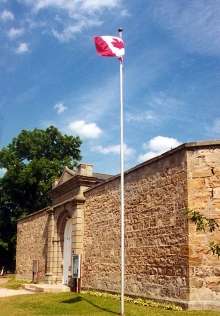
| Point Clark Lighthouse National Historic Site of Canada | Amberly | Huron-Kinloss (Point Clark) | 44°04′22″N 81°45′26″W / 44.0728°N 81.7573°W | 16772 |  More images | ||||
| Kincardine Lighthouse | 236 Harbour Street | Kincardine | 44°10′38″N 81°38′18″W / 44.1771°N 81.6382°W | 11095 |  More images | ||||
| Lightstation: Annex | Cove Island | Northern Bruce Peninsula | 45°19′37″N 81°44′06″W / 45.3269°N 81.735°W | 7035 |  More images | ||||
| Chantry Island Lightstation Tower | Lightstation, Chantry Island | Saugeen Shores | 44°28′59″N 81°24′00″W / 44.483°N 81.4°W | 3293 |  More images |
Chatham-Kent
| Name | Address | Municipality | PC | Coordinates | IDF | IDP | IDM | |
Image |
|---|---|---|---|---|---|---|---|---|---|
| Buxton Settlement National Historic Site of Canada | 7th Concession, Dillon and Drake Roads | Chatham-Kent | N0P | 42°16′00″N 82°11′00″W / 42.2667°N 82.1833°W | 1206 | 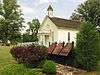 More images | |||
| Fairfield on the Thames National Historic Site of Canada | Chatham-Kent | 42°37′55″N 81°52′11″W / 42.632°N 81.8696°W | 15726 | | |||||
| Uncle Tom's Cabin - Harris House | 29251 Uncle Tom's Road | Chatham-Kent | N0P | 42°35′06″N 82°11′45″W / 42.585°N 82.1958°W | 8199 | _Grave_Site.jpg) | |||
| Uncle Tom's Cabin - Henson House | 29251 Uncle Tom's Road | Chatham-Kent | N0P | 42°35′08″N 82°11′45″W / 42.5856°N 82.1958°W | 8200 | | |||
| Uncle Tom's Cabin - Pioneer Church | 29251 Uncle Tom's Road | Chatham-Kent | N0P | 42°35′07″N 82°11′46″W / 42.5854°N 82.196°W | 8198 | |
Elgin County
| Name | Address | Municipality | PC | Coordinates | IDF | IDP | IDM | |
Image |
|---|---|---|---|---|---|---|---|---|---|
| Port Burwell Lighthouse | 17 Robinson | Bayham | N0J | 42°38′43″N 80°48′24″W / 42.6453°N 80.8068°W | 7787 |  More images | |||
| Port Stanley National Historic Site of Canada | junction of Bridge, Main and Colbourne Streets | Central Elgin (Port Stanley) | 42°39′58″N 81°12′43″W / 42.6661°N 81.212°W | 15722 | 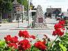 | ||||
| Southwold Earthworks National Historic Site of Canada | Southwold | 42°40′27″N 81°21′37″W / 42.6741°N 81.3602°W | 11706 | 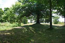 More images | |||||
| Canada Southern Railway Station | 810 Talbot Street | St. Thomas | N5R | 42°46′41″N 81°11′10″W / 42.778°N 81.186°WCanada Southern Railway Station) | 6495 | More images | |||
| St. Thomas City Hall National Historic Site of Canada | 545 Talbot Street | St. Thomas | N5P | 42°46′45″N 81°11′34″W / 42.7792°N 81.1927°W | 9166 | 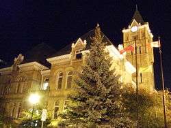 More images | |||
| St. Thomas Pioneer Church | 55 Walnut Street | St. Thomas | N5R | 42°46′38″N 81°12′22″W / 42.7772°N 81.2062°W | 10581 |  |
Grey County
| Name | Address | Municipality | PC | Coordinates | IDF | IDP | IDM | |
Image |
|---|---|---|---|---|---|---|---|---|---|
| Tower | Griffith Island | Georgian Bluffs | 44°51′04″N 80°53′24″W / 44.851°N 80.89°W | 3292 | 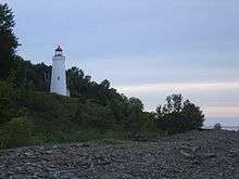 | ||||
| Billy Bishop Boyhood Home National Historic Site of Canada | 948 Third Avenue West | Owen Sound | N4K | 44°33′59″N 80°56′54″W / 44.5663°N 80.9484°W | 4028 | 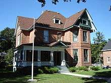 More images | |||
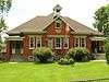
| Former Owen Sound Bus Terminal | 1023 2nd Avenue East | Owen Sound | 44°34′06″N 80°56′34″W / 44.5682°N 80.9428°W | 15128 | | ||||
| Former Reitman's Store | 992 2nd Avenue East | Owen Sound | 44°34′03″N 80°56′36″W / 44.5675°N 80.9434°W | 15129 | |
Haldimand County


Huron County


Lambton County
| Name | Address | Municipality | PC | Coordinates | IDF | IDP | IDM | |
Image |
|---|---|---|---|---|---|---|---|---|---|
| First Commercial Oil Field National Historic Site of Canada | Oil Springs | N0N | 42°47′00″N 82°07′00″W / 42.7833°N 82.1167°W | 1148 | 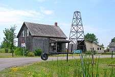 More images | ||||
| Independent Order Odd Fellows Ridgely Lodge #250 | 2594 Kelly Road | Oil Springs | N0N | 42°47′03″N 82°07′12″W / 42.7841°N 82.1199°W | 17941 | 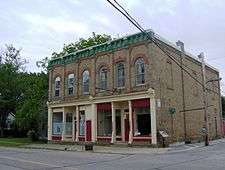 | |||
| Langbank Post Office | 2423 Kelly Road | Oil Springs | N0N | 42°46′27″N 82°07′12″W / 42.7741°N 82.1199°W | 17962 | | |||
| Oil Springs Community Hall | 4596 Oil Springs Line | Oil Springs | N0N | 42°46′27″N 82°07′12″W / 42.7741°N 82.1199°W | 17961 |  | |||
| Oil Springs Railway Station | 2423 Kelly Road | Oil Springs | N0N | 42°46′22″N 82°07′18″W / 42.7729°N 82.1216°W | 18021 |  | |||
| Petrolia Orange Hall | 4224 Petrolia Line | Petrolia | N0N | 42°52′55″N 82°08′42″W / 42.8819°N 82.1451°W | 1505 | | |||
| Victoria Hall / Petrolia Town Hall National Historic Site of Canada | 411 Greenfield Street | Petrolia | N0N | 42°52′50″N 82°08′47″W / 42.8805°N 82.1464°W | 7551 | 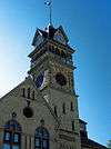 More images |
Norfolk County
| Name | Address | Municipality | PC | Coordinates | IDF | IDP | IDM | |
Image |
|---|---|---|---|---|---|---|---|---|---|
| Backhouse Grist Mill National Historic Site of Canada | RR 3 | Norfolk | N0E | 42°37′00″N 80°28′00″W / 42.6167°N 80.4667°W | 7554 | 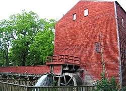 More images | |||
| Cliff Site National Historic Site of Canada | Brant Hill in Port Dover | Norfolk | N0A | 42°47′08″N 80°11′46″W / 42.7856°N 80.1961°W | 13398 |  | |||
| Fort Norfolk National Historic Site of Canada | Norfolk | 42°41′56″N 80°19′31″W / 42.6989°N 80.3252°W | 16785 | 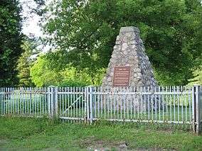 | |||||
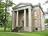
| Lynnwood/Campbell-Reid House National Historic Site of Canada | 21 Lynnwood Avenue | Norfolk | N3Y | 42°50′16″N 80°18′12″W / 42.8379°N 80.3034°W | 12402 | 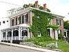 | |||
| Van Norman-Guiler House | 2318 Front Road | Norfolk (Normandale) | 42°42′39″N 80°18′45″W / 42.7108°N 80.3125°W | 15347 | |
Oxford County
| Name | Address | Municipality | PC | Coordinates | IDF | IDP | IDM | |
Image |
|---|---|---|---|---|---|---|---|---|---|
| African Methodist Episcopal Cemetery | Church St (Pick Line), Otterville | Norwich | N0J | 42°55′53″N 80°36′30″W / 42.931463°N 80.608332°W | 10775 |  | |||
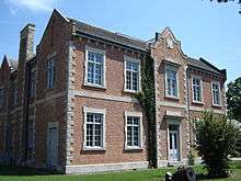
| Annandale House | 30 Tillson Avenue, Tillsonburg | Tillsonburg | N4G | 42°51′44″N 80°43′18″W / 42.862284°N 80.721668°W | 4178 | 18001 | 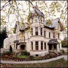 More images | ||
| Curries United Church | 465003 Curries Road, Curries | Norwich | N0J | 43°04′17″N 80°43′14″W / 43.071443°N 80.720418°W | 10925 |  | |||
| Knox Presbyterian Church (Norwich) | 67 Main Street West, Norwich | Norwich | N0J | 42°59′13″N 80°36′04″W / 42.986948°N 80.601176°W | 11678 |  | |||
| Museum School | 656 Main Street North, Burgessville | Norwich | N0J | 43°01′39″N 80°39′18″W / 43.027463°N 80.654954°W | 11828 |  | |||
| Norwich Gore United Church | 89 Stover Street North, Norwich | Norwich | N0J | 42°59′44″N 80°36′01″W / 42.995429°N 80.6003244°W | 11848 |  | |||
| Norwich United Church and Manse | 80 Main Street West, Norwich | Norwich | N0J | 42°59′14″N 80°36′05″W / 42.987211°N 80.601301°W | 11849 |  | |||
| Otter Creek Bridge | Middletown Line (just west of Otterville) | Norwich | N0J | 42°53′50″N 80°37′10″W / 42.897193°N 80.619385°W | 11865 |  More images | |||
| Otterville Mill | Main St W, Otterville | Norwich | N0J | 42°55′30″N 80°36′22″W / 42.925061°N 80.605988°W | 11864 | 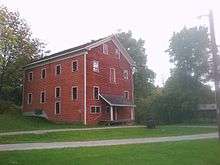 | |||
| Otterville Park | William St, Otterville | Norwich | N0J | 42°55′43″N 80°36′11″W / 42.928722°N 80.603032°W | 11866 |  | |||
| Otterville Railway Museum | Main Street W, Otterville | Norwich | N0J | 42°55′25″N 80°37′11″W / 42.923611°N 80.619742°W | 11867 |  | |||
| Quaker Meeting House (Norwich Museum) | 89 Stover Street North, Norwich | Norwich | N0J | 42°59′42″N 80°36′00″W / 42.995066°N 80.600006°W | 11893 |  | |||
| Quaker Street Burying Ground | 8 Quaker Street (just north of Norwich village) | Norwich | N0J | 43°00′06″N 80°36′24″W / 43.001532°N 80.606562°W | 11894 |  | |||
| Woodlawn Place | Main Street West, Otterville | Norwich | N0J | 42°55′25″N 80°37′09″W / 42.923682°N 80.619205°W | 9941 |  | |||
| Old St. Paul's Church (Anglican) | 723 Dundas Street, Woodstock | Woodstock | N4S | 43°07′56″N 80°44′47″W / 43.132356°N 80.746321°W | 10544 |  | |||
| Woodstock Railway Station | 94 Victoria Street South, Woodstock | Woodstock | N4S | 43°07′35″N 80°45′07″W / 43.12639°N 80.752077°W | 4610 |  More images | |||
| Old Woodstock Town Hall | 500 Dundas Street, Woodstock | Woodstock | N4S | 43°07′46″N 80°45′27″W / 43.1295°N 80.7575°W | 4257 | 8207 |  More images |
See also
| Wikimedia Commons has media related to Cultural heritage monuments in Ontario. |
References
This article is issued from Wikipedia - version of the 8/20/2016. The text is available under the Creative Commons Attribution/Share Alike but additional terms may apply for the media files.