List of listed buildings in Dunfermline, Fife
This is a list of listed buildings in the parish of Dunfermline in Fife, Scotland.
List
| Name | Location | Date Listed | Grid Ref. [note 1] | Geo-coordinates | Notes | HB Number [note 2] | Image |
|---|---|---|---|---|---|---|---|
| St Margaret's Drive, Dunfermline Public Park, Drinking Fountain | 56°04′20″N 3°27′05″W / 56.072191°N 3.45141°W | Category C(S) | 45590 | 
| |||
| 46-51 (Inclusive Numbers) Charlestown Village, (Double Row) | 56°02′12″N 3°29′55″W / 56.036637°N 3.498596°W | Category B | 43647 | 
| |||
| Leys Park Road, Former Fever Hospital (Mclean House) | 56°04′36″N 3°26′45″W / 56.076578°N 3.445887°W | Category C(S) | 26030 | 
| |||
| Leys Park Road, Former Poorhouse Probationary Ward ('The Lodge'), Including Gatepiers And Boundary Wall | 56°04′32″N 3°26′51″W / 56.075455°N 3.447404°W | Category C(S) | 26031 | 
| |||
| Bothwell Street, The Rhodes, Including Gatepiers To Bothwell Street | 56°03′57″N 3°27′16″W / 56.06593°N 3.454355°W | Category B | 26044 |
| |||
| Garvock Hill (Corner Of Appin Crescent), Former North Lodge To Transy Estate, Including Railed Wall And Gatepiers To North And East | 56°04′26″N 3°26′42″W / 56.073793°N 3.445124°W | Category C(S) | 26063 |
| |||
| Kingseat Road, South Bellyeoman Farmhouse, Including Boundary Wall | 56°05′03″N 3°26′10″W / 56.084088°N 3.43606°W | Category B | 26064 |
| |||
| East Port, Carnegie Hall, Including Boundary Wall And Steps To North | 56°04′19″N 3°27′13″W / 56.071877°N 3.453712°W | Category B | 26066 | 
| |||
| 80 Rose Street, Albany House Including Pavilions And Boundary And Garden Walls | 56°04′34″N 3°27′13″W / 56.076136°N 3.453743°W | Category B | 26074 |
| |||
| Dunfermline Abbey, Nave | 56°04′12″N 3°27′50″W / 56.069923°N 3.463903°W | Category A | 25960 | .jpg)
| |||
| Pittencrieff Park, Tower Bridge | 56°04′11″N 3°28′04″W / 56.069626°N 3.467779°W | Category B | 25967 |
| |||
| 21 Maygate And Abbot Street, Abbot House, Including Gateways And Decorative Ironwork To East And West | 56°04′14″N 3°27′46″W / 56.070557°N 3.462771°W | Category A | 25978 |
| |||
| Abbot Street, Carnegie Library | 56°04′13″N 3°27′43″W / 56.070253°N 3.461876°W | Category B | 25979 | 
| |||
| 24-32 (Even Nos) Canmore Street | 56°04′13″N 3°27′32″W / 56.070351°N 3.458907°W | Category C(S) | 25988 |
| |||
| 5 Abbey Park Place, Including Boundary Walls | 56°04′11″N 3°27′40″W / 56.069687°N 3.461083°W | Category B | 25995 |
| |||
| 25-27 (Odd Nos) East Port | 56°04′17″N 3°27′28″W / 56.071478°N 3.457809°W | Category B | 26012 | 
| |||
| Brucefield Avenue, St Leonard's Church (Church Of Scotland), Including Boundary Wall And Gatepiers And Church Hall To East | 56°04′00″N 3°27′15″W / 56.066597°N 3.454139°W | Category B | 26024 |
| |||
| Limekilns, 3 Brucehaven Road, Viewforth Including Garden Wall | 56°02′01″N 3°28′48″W / 56.033582°N 3.479989°W | Category B | 3727 |
| |||
| Limekilns, 4 Academy Square, Academy Cottage Including Garden Wall | 56°02′05″N 3°29′01″W / 56.03476°N 3.483661°W | Category B | 3736 |
| |||
| Charlestown, Harbour Road, Limekilns | 56°02′09″N 3°30′12″W / 56.035761°N 3.503409°W | Category A | 3741 |
| |||
| Rosyth Old Kirk, Burial Ground, Mort House | 56°01′46″N 3°28′11″W / 56.029571°N 3.469693°W | Category B | 3752 |
| |||
| Limekilns, 8 The Wellheads, The Elms Including Boundary Wall, Outhouses And Hand Pump | 56°02′02″N 3°28′43″W / 56.033751°N 3.478615°W | Category C(S) | 3753 |
| |||
| Limekilns, Ramsay Lane, Murray House | 56°01′59″N 3°28′50″W / 56.03301°N 3.480464°W | Category B | 3754 |
| |||
| Pitliver House Including Estate Square, Tennis Pavilion, Polo Stables, Garden Walls And Gatepiers | 56°02′58″N 3°30′31″W / 56.049318°N 3.508705°W | Category B | 3757 |
| |||
| Pitfirrane Castle Including Gatepiers | 56°03′31″N 3°30′21″W / 56.058664°N 3.505746°W | Category A | 3759 |
| |||
| Limekilns, 16 Halketshall, The Ship Inn | 56°02′06″N 3°29′22″W / 56.034907°N 3.489332°W | Category C(S) | 3768 |
| |||
| Dunfermline, Headwell Avenue, Headwell House Including Boundary Wall | 56°04′49″N 3°27′13″W / 56.080316°N 3.453547°W | Category B | 3773 |
| |||
| Logie House Including Garden Wall, Greenhouse And Gatepiers | 56°03′33″N 3°28′52″W / 56.059152°N 3.481016°W | Category A | 3776 |
| |||
| Limekilns, 9 Academy Square, Oriel House | 56°02′05″N 3°29′03″W / 56.034754°N 3.48411°W | Category C(S) | 1644 |
| |||
| Leckerstone Farmhouse Including Wall And Gatepiers | 56°02′53″N 3°28′05″W / 56.048174°N 3.46796°W | Category C(S) | 1645 |
| |||
| Charlestown, Rocks Road, Old School | 56°02′18″N 3°30′03″W / 56.038326°N 3.500796°W | Category B | 172 |
| |||
| Pitreavie Castle, Former East Lodge (The Laich) | 56°02′52″N 3°24′55″W / 56.047766°N 3.415235°W | Category C(S) | 46407 |
| |||
| 12 Abbey Park Place | 56°04′12″N 3°27′32″W / 56.069929°N 3.458875°W | Category C(S) | 46877 |
| |||
| 95-101 (Odd Nos) Appin Crescent And 2-6 (Even Nos) Couston Street, Former Dunfermline Co-Operative Building | 56°04′25″N 3°26′53″W / 56.073659°N 3.448124°W | Category C(S) | 46879 |
| |||
| Bothwell Street Railway Viaduct | 56°04′00″N 3°27′19″W / 56.066646°N 3.455314°W | Category B | 46881 |
| |||
| 14-18 (Even Nos) Buchanan Street, Including Outhouse To Nw | 56°04′08″N 3°27′38″W / 56.068784°N 3.460663°W | Category C(S) | 46882 |
| |||
| 1 Canmore Street, St Margaret's Hotel | 56°04′13″N 3°27′41″W / 56.070268°N 3.46133°W | Category C(S) | 46886 |
| |||
| 12 Chapel Street | 56°04′21″N 3°27′47″W / 56.072494°N 3.463037°W | Category C(S) | 46889 |
| |||
| Chisholm Street, Townhill Primary School, Including Gatepiers And Boundary Wall To N, S And W | 56°05′28″N 3°26′17″W / 56.091012°N 3.43799°W | Category C(S) | 46890 |
| |||
| Dunfermline Abbey, Entrance Gateways And Boundary Walls And Railings, Including Toolhouse, To Abbey Nave And New Church | 56°04′12″N 3°27′44″W / 56.070033°N 3.462237°W | Category B | 46893 |
| |||
| East Port, Pair Of Gatepiers To West Of Carnegie Hall At Nt 0952 8751 | 56°04′16″N 3°27′19″W / 56.070996°N 3.455253°W | Category C(S) | 46902 |
| |||
| Off Grange Road To West, Easter Gellet Farm, Original Courtyard-Plan Steading Including Farmhouse | 56°03′05″N 3°27′04″W / 56.05143°N 3.451064°W | Category C(S) | 46908 |
| |||
| 6-12 (Even Nos) New Row | 56°04′17″N 3°27′31″W / 56.071325°N 3.458591°W | Category C(S) | 46924 |
| |||
| Phoenix Lane, Footbridge Over Former Stirling And Dunfermline Railway | 56°04′32″N 3°28′14″W / 56.075647°N 3.470676°W | Category C(S) | 46928 |
| |||
| Pittencrieff Park, South East Gateway, West Nethertown Street | 56°03′59″N 3°27′42″W / 56.066419°N 3.461634°W | Category C(S) | 46936 |
| |||
| Pittencrieff Park, West Gateway, Coal Road | 56°04′08″N 3°28′16″W / 56.068786°N 3.471105°W | Category C(S) | 46941 |
| |||
| Queen Anne Street, Statue Of Ralph Erskine To South Of Former St Andrew's Erskine Church | 56°04′20″N 3°27′38″W / 56.072129°N 3.460501°W | Category B | 46944 |
| |||
| Queensferry Road, Rosyth Parish Church (Church Of Scotland), Including Gatepiers And Boundary Wall | 56°02′20″N 3°25′16″W / 56.039°N 3.421191°W | Category B | 46945 |
| |||
| Woodmill Road, Southwood, Including Garage | 56°04′04″N 3°26′49″W / 56.067795°N 3.446988°W | Category C(S) | 46955 |
| |||
| Balmule Including Walled Garden, Coach House, Granary And Gatepiers | 56°06′26″N 3°26′44″W / 56.107133°N 3.445586°W | Category C(S) | 47798 |
| |||
| 7-12 (Inclusive Numbers) Charlestown Village, (North Row) | 56°02′14″N 3°29′59″W / 56.037272°N 3.4996°W | Category B | 47808 |
| |||
| 13-18 (Inclusive Numbers) Charlestown Village, (North Row) | 56°02′14″N 3°29′57″W / 56.037269°N 3.49907°W | Category B | 47809 |
| |||
| 31-33 (Inclusive Numbers) Charlestown Village (Cross Row) And 34-35 Charlestown Village, (Double Row) | 56°02′13″N 3°29′50″W / 56.036959°N 3.497228°W | Category B | 47812 |
| |||
| 40-45 (Inclusive Numbers) Charlestown Village, (Double Row) | 56°02′13″N 3°29′54″W / 56.036855°N 3.498412°W | Category B | 47813 |
| |||
| 73-78 (Inclusive Numbers) Charlestown Village, (South Row) | 56°02′10″N 3°29′53″W / 56.03621°N 3.498194°W | Category B | 47818 |
| |||
| 80-84 (Inclusive Numbers) Charlestown Village, South Row | 56°02′10″N 3°29′57″W / 56.036245°N 3.499062°W | Category B | 47819 |
| |||
| Crossford, Main Street, War Memorial | 56°03′50″N 3°29′43″W / 56.063986°N 3.495176°W | Category C(S) | 47827 |
| |||
| Priory Lane, Former High School Lodge, Including Gateposts And Boundary Wall To South/ South-East | 56°04′07″N 3°27′33″W / 56.068658°N 3.459229°W | Category C(S) | 26027 |
| |||
| Primrose Lane, Primrose Farm Cottage | 56°02′31″N 3°26′26″W / 56.042029°N 3.440437°W | Category C(S) | 26055 |
| |||
| Glen Bridge, Over Tower Burn | 56°04′31″N 3°28′08″W / 56.075238°N 3.46886°W | Category B | 26072 |
| |||
| 2-18 (Even Nos) Maygate | 56°04′15″N 3°27′48″W / 56.070819°N 3.463375°W | Category B | 25977 |
| |||
| 15 Abbey Park Place, Abbey Park House, Including Gateway, Boundary Wall, Railings And Lamp Standards | 56°04′10″N 3°27′33″W / 56.069394°N 3.459289°W | Category B | 25994 |
| |||
| 7-9 (Odd Nos) High Street | 56°04′16″N 3°27′49″W / 56.071015°N 3.463479°W | Category C(S) | 26000 |
| |||
| 15 East Port, Former Prudential Assurance Offices | 56°04′18″N 3°27′29″W / 56.071538°N 3.458052°W | Category B | 26011 |
| |||
| 44-46 (Even Nos) East Port, Robins Cinema | 56°04′19″N 3°27′26″W / 56.071837°N 3.457084°W | Category B | 26015 |
| |||
| 1-7 (Inclusive Nos) Queen's Court, Former Commercial School | 56°04′15″N 3°27′22″W / 56.070916°N 3.455973°W | Category B | 26016 |
| |||
| Broomhall Policies, Courthill Cottage | 56°02′34″N 3°30′03″W / 56.042658°N 3.500772°W | Category B | 3734 |
| |||
| Craigluscar Doocot Including Wall Flanking Driveway | 56°06′03″N 3°30′14″W / 56.100811°N 3.50395°W | Category C(S) | 3739 |
| |||
| Charlestown, Fiddler's Hall | 56°02′21″N 3°30′23″W / 56.039291°N 3.506468°W | Category B | 3761 |
| |||
| Limekilns, 11 And 13 Main Street | 56°02′04″N 3°29′02″W / 56.034425°N 3.483825°W | Category C(S) | 3765 |
| |||
| Limekilns, 13 Halketshall | 56°02′05″N 3°29′20″W / 56.034841°N 3.48888°W | Category C(S) | 3770 |
| |||
| 1-6 (Inclusive Numbers) Charlestown Village (North Row) | 56°02′15″N 3°30′04″W / 56.037515°N 3.501022°W | Category B | 1637 |
| |||
| 8-14 (Even Nos) Bruce Street, Including The Bruce Tavern | 56°04′17″N 3°27′50″W / 56.071443°N 3.463784°W | Category C(S) | 46287 |
| |||
| Baldridgeburn, Mclean Primary School, Including Gatepiers And Boundary Wall To South | 56°04′37″N 3°28′18″W / 56.076866°N 3.471686°W | Category C(S) | 46880 |
| |||
| 58 -62 (Even Nos) Buffies Brae | 56°04′30″N 3°28′03″W / 56.074877°N 3.467481°W | Category C(S) | 46884 |
| |||
| Comely Park, To North West Of Nos 13-15, Edward Viii Post Box | 56°04′06″N 3°27′16″W / 56.068453°N 3.454466°W | Category B | 46891 |
| |||
| Dunfermline Abbey, Remains Of Dorter And Reredorter Ranges | 56°04′10″N 3°27′48″W / 56.069327°N 3.463399°W | Category A | 46894 |
| |||
| 26-28 (Even Nos) Maygate | 56°04′15″N 3°27′46″W / 56.070807°N 3.462909°W | Category C(S) | 46920 |
| |||
| Old Linburn Road To East, Entrance Gateway At No 43 (Formerly To Southfod House) | 56°04′25″N 3°25′03″W / 56.073566°N 3.417434°W | Category C(S) | 46925 |
| |||
| Park Place, Barum House | 56°04′15″N 3°26′49″W / 56.070769°N 3.447083°W | Category C(S) | 46926 |
| |||
| Pittencrieff Park, Summerhouse To North Of Tower Bridge | 56°04′12″N 3°28′05″W / 56.069909°N 3.468079°W | Category C(S) | 46940 |
| |||
| St Leonard's Street, St Leonard's Primary School, Including Gateways, Railings And Boundary Wall | 56°03′48″N 3°27′03″W / 56.063329°N 3.45082°W | Category C(S) | 46949 |
| |||
| Balmule Farm, Former Farmhouse | 56°06′28″N 3°27′08″W / 56.107748°N 3.452121°W | Category B | 47799 |
| |||
| 25-30 (Inclusive Numbers) Charlestown Village, (North Row) | 56°02′14″N 3°29′52″W / 56.037204°N 3.497767°W | Category B | 47811 |
| |||
| 62-66 (Inclusive Numbers) Charlestown Village, (Hall Row) | 56°02′11″N 3°29′48″W / 56.036302°N 3.496609°W | Category B | 47816 |
| |||
| 67-72 (Inclusive Numbers) Charlestown Village, (South Row) | 56°02′10″N 3°29′51″W / 56.036184°N 3.497407°W | Category B | 47817 |
| |||
| 85-90 (Inclusive Numbers) Charlestown Village, (South Row) | 56°02′11″N 3°29′59″W / 56.036291°N 3.499706°W | Category B | 47823 |
| |||
| Colton House, Stables Including Walled Garden | 56°05′38″N 3°27′46″W / 56.093756°N 3.462911°W | Category C(S) | 47825 |
| |||
| Limekilns, 12 Halketshall | 56°02′05″N 3°29′20″W / 56.034842°N 3.488752°W | Category C(S) | 47833 |
| |||
| Limekilns, War Memorial | 56°02′06″N 3°29′29″W / 56.035099°N 3.491298°W | Category C(S) | 47837 |
| |||
| 10 Forth Street To Rear, Former Nethertown Railway Bridge | 56°03′53″N 3°27′44″W / 56.064822°N 3.462136°W | Category C(S) | 43674 |
| |||
| Leys Park Road, Former Dunfermline Poorhouse And Northern Hospital (Ley's Park Nursing Home), Including Gatepiers And Boundary Wall | 56°04′34″N 3°26′48″W / 56.076148°N 3.446594°W | Category B | 26029 |
| |||
| 6-8 (Even Nos) Pilmuir Street, Former Women's Institute | 56°04′22″N 3°27′39″W / 56.072674°N 3.460746°W | Category C(S) | 26038 |
| |||
| Carnegie Drive, Dunfermline Fire Station | 56°04′23″N 3°27′45″W / 56.07313°N 3.46245°W | Category B | 26042 |
| |||
| Off Woodmill Road To North, Woodmill Bridge Over Lyne Burn | 56°04′17″N 3°25′42″W / 56.0713°N 3.428468°W | Category C(S) | 26049 |
| |||
| Pattiesmuir, East Thorne Cottage | 56°02′14″N 3°27′19″W / 56.037244°N 3.455362°W | Category C(S) | 26054 |
| |||
| 16-18 (Even Nos) Douglas Street | 56°04′19″N 3°27′39″W / 56.07183°N 3.460698°W | Category C(S) | 26071 |
| |||
| Pittencrieff Park, Dovecot | 56°04′18″N 3°28′04″W / 56.071595°N 3.467646°W | Category B | 25971 |
| |||
| Pittencrieff Park, Louise Carnegie Memorial Gateway, Including Detached Lamp Standards, Junction Of Bridge Street And Chalmers Street | 56°04′16″N 3°27′59″W / 56.071063°N 3.466292°W | Category A | 25972 | 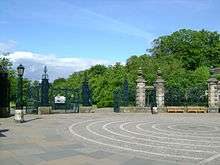
| |||
| 4 Canmore Street, Former Burgh Of Dunfermline Gas Department | 56°04′21″N 3°27′40″W / 56.072393°N 3.460977°W | Category C(S) | 25983 |
| |||
| 6 Canmore Street, Dunfermline Congregational Church, Including Boundary Wall | 56°04′14″N 3°27′38″W / 56.070619°N 3.460572°W | Category B | 25984 |
| |||
| 25 Canmore Street | 56°04′13″N 3°27′37″W / 56.070219°N 3.460171°W | Category B | 25985 |
| |||
| High Street, Market Cross To North Of Guildhall Street | 56°04′17″N 3°27′42″W / 56.071423°N 3.461663°W | Category B | 26003 |
| |||
| 100 And 102 High Street | 56°04′18″N 3°27′37″W / 56.071611°N 3.460208°W | Category B | 26008 |
| |||
| East Port, Holy Trinity Episcopal Church | 56°04′18″N 3°27′20″W / 56.071594°N 3.455597°W | Category B | 26017 |
| |||
| Viewfield Terrace, 3-8 (Inclusive Nos) Viewfield House | 56°04′16″N 3°27′18″W / 56.071081°N 3.454903°W | Category B | 26019 |
| |||
| Limekilns, 2 And 3 Halketshall | 56°02′05″N 3°29′11″W / 56.034745°N 3.486357°W | Category C(S) | 3730 |
| |||
| Limekilns, 8 Red Row, Seaview | 56°02′00″N 3°28′52″W / 56.033316°N 3.481134°W | Category C(S) | 3748 |
| |||
| Mid Mill Of Pitliver | 56°02′51″N 3°30′14″W / 56.047456°N 3.503768°W | Category C(S) | 3760 |
| |||
| Limekilns, 8 Academy Square, The King's Cellar | 56°02′06″N 3°29′02″W / 56.034935°N 3.484005°W | Category A | 1643 |
| |||
| 7 Canmore Street | 56°04′13″N 3°27′40″W / 56.070325°N 3.461091°W | Category C(S) | 46887 |
| |||
| East Port, Viewfield Baptist Church, Including Hall | 56°04′18″N 3°27′22″W / 56.071553°N 3.456045°W | Category B | 46903 |
| |||
| Elgin Street, Grange Bridge Over Lyne Burn | 56°03′52″N 3°27′30″W / 56.064321°N 3.458214°W | Category C(S) | 46904 |
| |||
| Gardeners Street, Former Albany Works Office Building (Albany Business Centre), Including Gatepiers And Boundary Wall | 56°04′28″N 3°27′21″W / 56.074385°N 3.455846°W | Category C(S) | 46906 |
| |||
| 34 And 36 Garvock Hill | 56°04′24″N 3°26′20″W / 56.073406°N 3.438973°W | Category C(S) | 46907 |
| |||
| Off Grange Road To West, Wester Gellet Farmhouse, Including Boundary Wall | 56°02′55″N 3°27′28″W / 56.048475°N 3.45776°W | Category C(S) | 46909 |
| |||
| 23 Guildhall Street | 56°04′14″N 3°27′42″W / 56.070668°N 3.461731°W | Category C(S) | 46911 |
| |||
| Halbeath Road, Entrance Gateway To Dunfermline Cemetery, Including Cemetery Dividing Wall And Gateways To North West And Boundary Wall To Bellyeoman Road | 56°04′39″N 3°26′32″W / 56.077476°N 3.442113°W | Category C(S) | 46912 |
| |||
| Hilton Road, 1-4 (Inclusive Nos) Hilton Cottages | 56°02′05″N 3°27′19″W / 56.03471°N 3.455395°W | Category C(S) | 46915 |
| |||
| Pittencrieff Park, Bridge To West Of Tower Bridge | 56°04′10″N 3°28′07″W / 56.069408°N 3.468671°W | Category C(S) | 46930 |
| |||
| Pittencrieff Park, Footbridge Over Tower Burn At Nt 0884 8733 | 56°04′13″N 3°27′57″W / 56.070152°N 3.465856°W | Category C(S) | 46933 |
| |||
| Queensferry Road, Former St Leonard's Hill House, Including Entrance Gateway To South East | 56°03′38″N 3°26′42″W / 56.060575°N 3.445079°W | Category C(S) | 46946 |
| |||
| Broomhall Policies, East Lodge Including Gatepiers | 56°02′25″N 3°28′18″W / 56.040321°N 3.471739°W | Category C(S) | 47803 |
| |||
| 19-24 (Inclusive Numbers) Charlestown Village, (North Row) | 56°02′14″N 3°29′55″W / 56.037247°N 3.498668°W | Category B | 47810 |
| |||
| Colton House Including Sundial And Gatepiers | 56°05′36″N 3°27′49″W / 56.093433°N 3.463622°W | Category C(S) | 47824 |
| |||
| Keavil House Hotel | 56°03′31″N 3°30′05″W / 56.05852°N 3.50134°W | Category C(S) | 47829 |
| |||
| Leckerstone Farm | 56°02′54″N 3°28′04″W / 56.048312°N 3.467773°W | Category C(S) | 47830 |
| |||
| Lochhead | 56°05′59″N 3°28′36″W / 56.099719°N 3.476786°W | Category C(S) | 47839 |
| |||
| St Margaret's Drive, Dunfermline Public Park, Bandstand | 56°04′12″N 3°27′04″W / 56.070048°N 3.451008°W | Category B | 45589 |
| |||
| Milepost, A823, North West Of Outh | 56°08′18″N 3°31′01″W / 56.138238°N 3.517031°W | Category C(S) | 45591 |
| |||
| 33 East Port | 56°04′18″N 3°27′26″W / 56.071566°N 3.457234°W | Category B | 43886 |
| |||
| 34 Queen Anne Street | 56°04′19″N 3°27′42″W / 56.07197°N 3.461764°W | Category B | 26033 |
| |||
| 42-44 (Even Nos) Queen Anne Street, Head Post Office, Including Former Stable Yard And Boundary Wall | 56°04′20″N 3°27′41″W / 56.072138°N 3.461256°W | Category B | 26034 |
| |||
| Bothwell Street, Former St Leonard's Works Warehouse And Office Block (Erskine Beveridge Court), Including Entrance Piers To West | 56°03′55″N 3°27′09″W / 56.065278°N 3.452483°W | Category B | 26045 |
| |||
| Off Old Mill Court, Brucefield House | 56°03′56″N 3°26′44″W / 56.065576°N 3.445459°W | Category B | 26046 |
| |||
| Off Woodmill Road To North, Woodmill Farmhouse, Including Attached Outbuilding To West | 56°04′17″N 3°25′42″W / 56.071356°N 3.428277°W | Category C(S) | 26047 |
| |||
| Pittencrieff Park, Telephone Kiosk To West Of Pittencrieff House | 56°04′08″N 3°28′09″W / 56.068889°N 3.469278°W | Category B | 26067 |
| |||
| Pittencrieff Park, Statue Of Andrew Carnegie | 56°04′16″N 3°28′06″W / 56.071066°N 3.468284°W | Category B | 25970 |
| |||
| 5-7 (Odd Nos) Abbot Street | 56°04′13″N 3°27′44″W / 56.070375°N 3.462185°W | Category B | 25980 |
| |||
| 33 Canmore Street, Alhambra Bingo Hall | 56°04′11″N 3°27′29″W / 56.069795°N 3.458003°W | Category B | 25991 |
| |||
| 11 Abbey Park Place | 56°04′11″N 3°27′37″W / 56.069695°N 3.460393°W | Category B | 25996 |
| |||
| New Row, Comely Park House, Including Boundary Wall, Walled Garden And Outhouses To North | 56°04′10″N 3°27′25″W / 56.06951°N 3.457012°W | Category C(S) | 26022 |
| |||
| New Row, Comely Park House Sundial | 56°04′09″N 3°27′24″W / 56.069127°N 3.456757°W | Category B | 26023 |
| |||
| Limekilns, Kiln North Of 12 And 14 Main Street | 56°02′05″N 3°28′59″W / 56.034812°N 3.483053°W | Category C(S) | 3728 |
| |||
| Limekilns, 10 Halketshall | 56°02′06″N 3°29′19″W / 56.034863°N 3.48848°W | Category B | 3737 |
| |||
| Limekilns, 1 Brucehaven Road, The Gables Including Garden Wall | 56°02′02″N 3°28′47″W / 56.033997°N 3.47986°W | Category B | 3738 |
| |||
| Broomhall Including Garden Balustrade, Kitchen Court Walls Larder And Stables | 56°02′14″N 3°28′59″W / 56.037102°N 3.483189°W | Category A | 3745 |
| |||
| Broomhall, Ice-House And Summer-House | 56°02′10″N 3°29′06″W / 56.036102°N 3.484884°W | Category B | 3746 |
| |||
| Limekilns, 11 Halketshall | 56°02′05″N 3°29′19″W / 56.034844°N 3.488624°W | Category B | 3747 |
| |||
| Crossford, 57 And 59 Main Street | 56°03′48″N 3°29′53″W / 56.063467°N 3.497966°W | Category C(S) | 3758 |
| |||
| Limekilns, 26 Main Street Including Boundary Wall | 56°02′05″N 3°29′03″W / 56.034609°N 3.484201°W | Category B | 3764 |
| |||
| 2-8 (Even Nos) Abbot Street | 56°04′14″N 3°27′42″W / 56.070587°N 3.461695°W | Category B | 46878 |
| |||
| Monastery Street (South Side), World War I Memorial | 56°04′08″N 3°27′48″W / 56.068951°N 3.463272°W | Category C(S) | 46921 |
| |||
| 7 Nethertown Broad Street, Former Nethertown Institute (Dell Farquharson Community Leisure Centre) | 56°03′59″N 3°27′27″W / 56.066387°N 3.457456°W | Category C(S) | 46923 |
| |||
| Pittencrieff Park, Pittencrieff Lodge And Gateway (Pittencrieff Street) | 56°04′18″N 3°28′11″W / 56.071552°N 3.469748°W | Category C(S) | 46935 |
| |||
| 123 Rose Street, Including Walled Yard To North | 56°04′37″N 3°27′07″W / 56.076903°N 3.451876°W | Category C(S) | 46947 |
| |||
| Rumblingwell, Milesmark Primary School, Including Boundary Wall | 56°04′43″N 3°29′00″W / 56.078676°N 3.483437°W | Category C(S) | 46948 |
| |||
| Walmer Drive (East Side), Former Villa To South Of And Forming Part Of Fife Council Housing Service | 56°04′16″N 3°27′25″W / 56.071173°N 3.456994°W | Category C(S) | 46953 |
| |||
| 56-59 (Inclusive Numbers) Charlestown Village, (Lochaber) | 56°02′13″N 3°29′46″W / 56.036917°N 3.496247°W | Category B | 47814 |
| |||
| 1 Moodie Street, Old Kirk House (Former Abbey Church Manse), Including Gateway And Boundary Wall | 56°04′04″N 3°27′44″W / 56.067913°N 3.462124°W | Category B | 26028 |
| |||
| Queen Anne Street, Former Saint Andrew's Erskine Church, Including Boundary Wall | 56°04′21″N 3°27′37″W / 56.072454°N 3.460336°W | Category B | 26035 |
| |||
| Limekilns Road, Remains Of Windmill To East Of Hill House | 56°03′26″N 3°27′36″W / 56.057319°N 3.459876°W | Category B | 26051 |
| |||
| Off Grange Road To West, Blackhall Farmhouse | 56°02′37″N 3°27′06″W / 56.043721°N 3.451721°W | Category B | 26052 |
| |||
| Murray Road, Rosyth Castle | 56°01′24″N 3°25′54″W / 56.023469°N 3.431563°W | Category A | 26060 |
| |||
| 5-11 (Odd Nos) Douglas Street | 56°04′18″N 3°27′40″W / 56.071745°N 3.461032°W | Category C(S) | 26070 |
| |||
| Dunfermline Abbey, Gatehouse | 56°04′10″N 3°27′51″W / 56.069416°N 3.46427°W | Category A | 25963 |
| |||
| Pittencrieff Park, Pittencrieff House, Including Parapet Wall To North | 56°04′09″N 3°28′02″W / 56.069029°N 3.467339°W | Category A | 25968 |
| |||
| 11 Guildhall Street, Former Employment Exchange Building | 56°04′15″N 3°27′43″W / 56.070854°N 3.461898°W | Category C(S) | 25998 |
| |||
| 81-85 (Odd Nos) High Street And 4 Guildhall Street, Former Guildhall | 56°04′16″N 3°27′41″W / 56.07122°N 3.461366°W | Category A | 25999 |
| |||
| 38 High Street | 56°04′17″N 3°27′45″W / 56.071403°N 3.46261°W | Category C(S) | 26006 |
| |||
| 1-3 (Odd Nos) East Port, Former Bank Of Scotland | 56°04′17″N 3°27′31″W / 56.071423°N 3.458691°W | Category B | 26010 | 
| |||
| East Port, St Margaret's Roman Catholic Church | 56°04′21″N 3°27′17″W / 56.072423°N 3.454648°W | Category B | 26018 |
| |||
| 2-4 (Even Nos) Moodie Street And 5 Priory Lane, Andrew Carnegie Birthplace Memorial, Including Boundary Walls And Railings | 56°04′05″N 3°27′40″W / 56.067952°N 3.46113°W | Category B | 26026 |
| |||
| Rosyth Old Kirk Including Burial Ground And Boundary Wall | 56°01′47″N 3°28′10″W / 56.029728°N 3.469346°W | Category B | 3751 |
| |||
| South Fod House Including Gatepiers | 56°04′30″N 3°24′31″W / 56.074935°N 3.408487°W | Category B | 3774 |
| |||
| Broomhall, Limekilns, 9 The Old Orchard Garden, Broomhall Doocot | 56°02′06″N 3°28′51″W / 56.034966°N 3.4807°W | Category B | 1639 |
| |||
| Limekilns, 10 Church Street, Manse And Boundary Wall | 56°02′04″N 3°28′50″W / 56.03433°N 3.480499°W | Category B | 1641 |
| |||
| Charlestown, Rocks Road, Former Estate Workshop, Scottish Lime Centre | 56°02′15″N 3°30′03″W / 56.037581°N 3.500735°W | Category C(S) | 207 |
| |||
| Golfdrum Street, North Parish Church (Church Of Scotland) | 56°04′31″N 3°28′08″W / 56.075238°N 3.46886°W | Category C(S) | 45779 |
| |||
| 13 Abbey Park Place | 56°04′11″N 3°27′36″W / 56.069663°N 3.460038°W | Category C(S) | 46876 |
| |||
| 5-7 (Odd Nos) East Port, Including East Port Bar | 56°04′17″N 3°27′31″W / 56.071497°N 3.458501°W | Category C(S) | 46896 |
| |||
| Monastery Street (North Side), World War Ii Memorial | 56°04′10″N 3°27′47″W / 56.069431°N 3.462937°W | Category C(S) | 46922 |
| |||
| Priory Lane, Dunfermline Bowling Club Pavilion, Including Boundary Wall | 56°04′06″N 3°27′35″W / 56.068327°N 3.459811°W | Category C(S) | 46943 |
| |||
| 60-61 Charlestown Village, (Hall Row) | 56°02′11″N 3°29′47″W / 56.036349°N 3.496434°W | Category B | 47815 |
| |||
| Limekilns, 6 Dunfermline Road, The Old School House Including Boundary Wall | 56°02′06″N 3°28′39″W / 56.034877°N 3.477631°W | Category C(S) | 47831 |
| |||
| Limekilns, Dunfermline Road, Limekilns Primary School Including Boundary Wall | 56°02′08″N 3°28′35″W / 56.035431°N 3.476352°W | Category C(S) | 47832 |
| |||
| Limekilns, 3 Warrington Court | 56°02′04″N 3°28′55″W / 56.034384°N 3.482058°W | Category C(S) | 47838 |
| |||
| Logie House, Lodge And Gatepiers | 56°03′52″N 3°29′23″W / 56.064483°N 3.489782°W | Category C(S) | 47843 |
| |||
| Milepost, A823, South Of Muirside | 56°05′57″N 3°27′56″W / 56.099152°N 3.465511°W | Category C(S) | 47845 |
| |||
| Wester Craigduckie Farmhouse Including Gatepiers And Wall | 56°06′26″N 3°26′20″W / 56.107354°N 3.438985°W | Category C(S) | 47846 |
| |||
| Pilmuir Street, Victoria Works (Castleblair Ltd), Including Boundary Wall To South And West | 56°04′32″N 3°27′37″W / 56.0756°N 3.460262°W | Category B | 26041 |
| |||
| Limekilns Road, Hill House, Including Walled Garden And Two Pairs Of Gatepiers To West | 56°03′29″N 3°27′37″W / 56.057945°N 3.460173°W | Category A | 26050 |
| |||
| Pattiesmuir, Ingleneuk And Ingleside | 56°02′14″N 3°27′17″W / 56.03717°N 3.454798°W | Category C(S) | 26053 |
| |||
| East Port, Carnegie Music Institute | 56°04′19″N 3°27′12″W / 56.072071°N 3.453205°W | Category B | 26065 |
| |||
| 3-13 (Odd Nos) Bruce Street | 56°04′17″N 3°27′51″W / 56.071403°N 3.464152°W | Category C(S) | 26068 |
| |||
| 28-34 (Even Nos) Bruce Street | 56°04′19″N 3°27′49″W / 56.072011°N 3.463677°W | Category C(S) | 26069 |
| |||
| Dunfermline Abbey, New Abbey Parish Church, Church Of Scotland | 56°04′12″N 3°27′50″W / 56.069923°N 3.463903°W | Category A | 25961 |
| |||
| 3 Bridge Street, City Chambers | 56°04′15″N 3°27′51″W / 56.070837°N 3.464131°W | Category A | 25973 |
| |||
| 27 Canmore Street | 56°04′13″N 3°27′36″W / 56.070223°N 3.459866°W | Category B | 25986 |
| |||
| 29 Canmore Street | 56°04′13″N 3°27′34″W / 56.070145°N 3.459574°W | Category B | 25987 |
| |||
| 25 High Street | 56°04′16″N 3°27′47″W / 56.071066°N 3.462999°W | Category B | 26001 |
| |||
| 125 High Street | 56°04′16″N 3°27′36″W / 56.071226°N 3.460113°W | Category C(S) | 26002 |
| |||
| 82 High Street And 1 Douglas Street | 56°04′18″N 3°27′40″W / 56.071548°N 3.460977°W | Category B | 26007 |
| |||
| 104-106 High Street | 56°04′18″N 3°27′36″W / 56.071622°N 3.460048°W | Category B | 26009 |
| |||
| 35-41 (Odd Nos) East Port, Including Railings | 56°04′18″N 3°27′25″W / 56.071568°N 3.457042°W | Category B | 26013 |
| |||
| 43-45 (Odd Nos) East Port, Century House | 56°04′18″N 3°27′24″W / 56.071592°N 3.456544°W | Category B | 26014 | 
| |||
| 60 New Row, British Legion Club (Front Building) | 56°04′13″N 3°27′27″W / 56.070242°N 3.457489°W | Category B | 26020 |
| |||
| Limekilns, 7 Halketshall | 56°02′06″N 3°29′17″W / 56.034886°N 3.488096°W | Category C(S) | 3731 |
| |||
| Brucehaven Farmhouse Including Garden Wall | 56°02′07″N 3°27′41″W / 56.035196°N 3.461384°W | Category C(S) | 3732 |
| |||
| Charlestown, 8, 10, 14, The Sutlery, 16, 18 Rocks Road, Including Letterbox | 56°02′16″N 3°30′03″W / 56.037768°N 3.500903°W | Category B | 3742 |
| |||
| Limekilns, 11 Academy Square, Hope Cottage | 56°02′05″N 3°29′03″W / 56.034593°N 3.484088°W | Category B | 3763 |
| |||
| Limekilns, 5 Halketshall | 56°02′06″N 3°29′15″W / 56.034865°N 3.487565°W | Category B | 3767 |
| |||
| Limekilns, 14A, 14B Halketshall, Kingcraig, 15 Halketshall, Somervail Including Garden Wall | 56°02′06″N 3°29′21″W / 56.034865°N 3.489122°W | Category B | 3769 |
| |||
| Craigluscar House Including Garden Walls | 56°06′03″N 3°30′13″W / 56.100806°N 3.503629°W | Category C(S) | 3772 |
| |||
| 22-24 (Even Nos) Buchanan Street, Including Outhouse To Nw | 56°04′07″N 3°27′37″W / 56.068692°N 3.460162°W | Category C(S) | 46883 |
| |||
| 5 Guildhall Street, Somewhere Else | 56°04′16″N 3°27′42″W / 56.071126°N 3.4617°W | Category C(S) | 46910 |
| |||
| 53 And 55 High Street | 56°04′16″N 3°27′44″W / 56.0712°N 3.462345°W | Category C(S) | 46913 |
| |||
| Pittencrieff Park, East Gateway, St Catherine's Wynd, Including Boundary Wall | 56°04′12″N 3°27′53″W / 56.069914°N 3.464642°W | Category B | 46932 |
| |||
| Broomhall Policies, Former Brick Works, Drying Shed And Chimney | 56°02′29″N 3°29′24″W / 56.041502°N 3.4901°W | Category C(S) | 47804 |
| |||
| Craigduckie Cottage | 56°06′36″N 3°25′48″W / 56.110018°N 3.430111°W | Category C(S) | 47826 |
| |||
| Dunfermline, Broomhead Mews Including Gatepiers | 56°04′45″N 3°27′50″W / 56.079204°N 3.463982°W | Category C(S) | 47828 |
| |||
| Limekilns, Main Street, K6 Telephone Kiosk | 56°02′03″N 3°28′58″W / 56.034222°N 3.482806°W | Category B | 47834 |
| |||
| Rosyth Dockyard, Power Station (Building No 333) | 56°01′31″N 3°26′46″W / 56.025385°N 3.446075°W | Category B | 50783 |
| |||
| Rosyth Dockyard, Barham Road, Signal Box At Nt 10953 82170 | 56°01′27″N 3°25′49″W / 56.024131°N 3.430255°W | Category C(S) | 50785 |
| |||
| 30-32 (Even Nos) Queen Anne Street, Including Railings And Gatepiers To West | 56°04′19″N 3°27′43″W / 56.072021°N 3.462023°W | Category B | 26032 |
| |||
| Chapel Street, Gillespie Memorial Church, (Church Of Scotland), Including Boundary Wall And Gatepiers To West | 56°04′21″N 3°27′45″W / 56.072457°N 3.462393°W | Category C(S) | 26037 |
| |||
| 65 Inglis Street And Pilmuir Street, Carnegie Clinic | 56°04′26″N 3°27′37″W / 56.073795°N 3.46021°W | Category B | 26040 |
| |||
| Hilton Road, Hilton Farmhouse | 56°02′05″N 3°27′05″W / 56.03473°N 3.451416°W | Category B | 26056 |
| |||
| Off Queensferry Road, Pitreavie Castle | 56°02′54″N 3°25′06″W / 56.048432°N 3.418326°W | Category A | 26058 |
| |||
| Off Ferry Toll Road To South Rosyth Castle, Dovecot | 56°01′29″N 3°25′45″W / 56.02471°N 3.429154°W | Category A | 26061 |
| |||
| Pilmuir Street, And Returns To Foundry Street And Cousins Lane, Pilmuir Works, Including Gatepiers And Boundary Wall To West | 56°04′27″N 3°27′43″W / 56.07425°N 3.462027°W | Category A | 26073 |
| |||
| Dunfermline Abbey, Remains Of Palace And Kitchen | 56°04′10″N 3°27′53″W / 56.069474°N 3.464609°W | Category A | 25965 |
| |||
| 32-36 (Even Nos) Bridge Street | 56°04′17″N 3°27′56″W / 56.071431°N 3.465583°W | Category C(S) | 25974 |
| |||
| 13-15 (Odd Nos) Kirkgate, The Old Inn | 56°04′15″N 3°27′52″W / 56.070709°N 3.464335°W | Category C(S) | 25976 |
| |||
| 2 Canmore Street | 56°04′14″N 3°27′41″W / 56.070627°N 3.461392°W | Category B | 25982 |
| |||
| 66 High Street | 56°04′17″N 3°27′42″W / 56.071505°N 3.46157°W | Category B | 26004 |
| |||
| 60-64 High Street, Clydesdale Bank | 56°04′17″N 3°27′43″W / 56.071493°N 3.461874°W | Category B | 26005 |
| |||
| Off Reid Street To E, Priory House, Formerly Dunfermline And West Fife Hospital Nurses' Home | 56°04′00″N 3°27′26″W / 56.066787°N 3.457118°W | Category B | 26025 |
| |||
| Broomhall Policies, Hillock | 56°02′29″N 3°28′22″W / 56.041495°N 3.472715°W | Category C(S) | 3735 |
| |||
| Charlestown, Camsie House Including Ancillary Buildings And Garden Wall | 56°02′13″N 3°30′17″W / 56.036913°N 3.504658°W | Category B | 3740 |
| |||
| Charlestown Village, The Queen's Hall | 56°02′11″N 3°29′46″W / 56.036488°N 3.496022°W | Category B | 3743 |
| |||
| Charlestown, Saltpans, Easter Cottage Including Boundary Wall | 56°02′08″N 3°29′52″W / 56.035613°N 3.497818°W | Category B | 3744 |
| |||
| Limekilns, Brucehaven Road Forth Cruising Club, Club House Including Boundary Wall | 56°01′54″N 3°28′40″W / 56.031666°N 3.477861°W | Category B | 3749 |
| |||
| Charlestown, Bridge Of Former Elgin Railway | 56°02′13″N 3°30′25″W / 56.036932°N 3.506809°W | Category B | 3755 |
| |||
| Charlestown Harbour | 56°02′06″N 3°30′02″W / 56.03497°N 3.500457°W | Category B | 3756 |
| |||
| Dunfermline, Broomhead House Including Balustraded Wall | 56°04′45″N 3°27′50″W / 56.079144°N 3.463755°W | Category B | 3775 |
| |||
| Logie House, Steading | 56°03′41″N 3°29′06″W / 56.06144°N 3.485007°W | Category A | 3777 |
| |||
| Broomhall, Limekilns, 9 The Old Orchard Including Outhouse | 56°02′05″N 3°28′51″W / 56.034748°N 3.480868°W | Category B | 1638 |
| |||
| 31 Canmore Street | 56°04′12″N 3°27′29″W / 56.070072°N 3.458142°W | Category C(S) | 46888 |
| |||
| Dunfermline Abbey, Remains Of Frater Range | 56°04′10″N 3°27′50″W / 56.069483°N 3.463903°W | Category A | 46895 |
| |||
| 58-64 (Even Nos) East Port, Lorne House | 56°04′19″N 3°27′22″W / 56.071867°N 3.456041°W | Category C(S) | 46901 |
| |||
| Foundry Street, St Margaret's Works (Castleblair Ltd) | 56°04′31″N 3°27′44″W / 56.075209°N 3.462224°W | Category B | 46905 |
| |||
| 78-80 High Street | 56°04′18″N 3°27′40″W / 56.071582°N 3.461155°W | Category C(S) | 46914 |
| |||
| 6 Kirkgate, Tappie Toories | 56°04′15″N 3°27′49″W / 56.070941°N 3.463685°W | Category C(S) | 46916 |
| |||
| Parkgate, Former Rosyth Institute (Parkgate Community Leisure Centre) | 56°02′22″N 3°25′07″W / 56.039541°N 3.418626°W | Category C(S) | 46927 |
| |||
| 58-73 (Inclusive Nos) Skibo Court, Former High School, Including Gateway To Buchanan Street | 56°04′07″N 3°27′33″W / 56.068658°N 3.459229°W | Category B | 46951 |
| |||
| Woodmill Road, Brucefield Manor Hotel | 56°04′08″N 3°26′28″W / 56.068763°N 3.441113°W | Category C(S) | 46954 |
| |||
| Charlestown, Iron Mill Road, Towers | 56°02′30″N 3°30′43″W / 56.041541°N 3.512014°W | Category C(S) | 47805 |
| |||
| Charlestown, 12 Rocks Road, The School House Including Boundary Wall | 56°02′17″N 3°30′00″W / 56.038041°N 3.499902°W | Category C(S) | 47807 |
| |||
| Limekilns, Sandilands Lane, Wellhead House Including The Neuk And Garden Wall | 56°02′03″N 3°28′44″W / 56.034142°N 3.478951°W | Category C(S) | 47836 |
| |||
| Milesmark, Elgin Cottage Including Greenhouse, Boundary Wall And Gatepiers | 56°04′53″N 3°29′46″W / 56.081433°N 3.496189°W | Category C(S) | 47844 |
| |||
| 19, 21, 23 Kirkgate | 56°04′14″N 3°27′51″W / 56.070548°N 3.464248°W | Category B | 49094 |
| |||
| Rosyth, Hms Caledonia, Figurehead Of Admiral Duncan | 56°01′56″N 3°26′53″W / 56.032343°N 3.448116°W | Category C(S) | 50979 |
| |||
| 42 Pilmuir Street, Carnegie Leisure Centre | 56°04′27″N 3°27′38″W / 56.074069°N 3.460558°W | Category B | 26039 |
| |||
| Pitreavie Castle, Dovecot To North East | 56°02′56″N 3°25′01″W / 56.048772°N 3.41683°W | Category B | 26059 |
| |||
| St John's Drive, Garvock House Hotel, Including Boundary Wall And Gatepiers | 56°04′17″N 3°26′36″W / 56.071397°N 3.443299°W | Category B | 26062 |
| |||
| 26-30 (Even Nos) Bridge Street | 56°04′17″N 3°27′55″W / 56.0713°N 3.465257°W | Category C(S) | 25975 |
| |||
| 26-28 (Inclusive Nos) Guildhall Street | 56°04′15″N 3°27′41″W / 56.070753°N 3.46138°W | Category C(S) | 25997 |
| |||
| 85 New Row, Wilson's Institution | 56°04′10″N 3°27′28″W / 56.069385°N 3.457762°W | Category B | 26021 |
| |||
| Limekilns, Sandilands, Forth Cottage | 56°02′02″N 3°28′47″W / 56.033854°N 3.479742°W | Category C(S) | 3726 |
| |||
| Limekilns Harbour, Limekilns Pier | 56°02′01″N 3°29′10″W / 56.033697°N 3.486092°W | Category C(S) | 3729 |
| |||
| Gallowridge Hill Farmhouse And Granary | 56°03′16″N 3°28′31″W / 56.054367°N 3.475373°W | Category B | 3733 |
| |||
| Limekilns, Brucehaven Harbour, Capernaum Pier | 56°01′51″N 3°28′43″W / 56.030813°N 3.478599°W | Category C(S) | 3750 |
| |||
| Limekilns, 16 Main Street, Green Island (Formerly Sunnyside), Including Garden Wall | 56°02′05″N 3°29′01″W / 56.034669°N 3.483738°W | Category C(S) | 3762 |
| |||
| Dunnygask Farmhouse | 56°07′12″N 3°30′51″W / 56.119898°N 3.514073°W | Category C(S) | 3771 |
| |||
| Limekilns, Church Street, Limekilns Parish Church (Church Of Scotland) And Boundary Wall | 56°02′03″N 3°28′51″W / 56.034182°N 3.480878°W | Category B | 1640 |
| |||
| Limekilns, 6 Main Street, Brewstead | 56°02′04″N 3°28′58″W / 56.034473°N 3.482815°W | Category B | 1642 |
| |||
| Former Viaduct To East Of Buffies Brae At Nt 0888 8786 | 56°04′31″N 3°28′02″W / 56.075285°N 3.467111°W | Category C(S) | 46885 |
| |||
| Douglas Street, The Commercial Inn | 56°04′19″N 3°27′40″W / 56.071871°N 3.461021°W | Category C(S) | 46892 |
| |||
| Pittencrieff Park, Music Pavilion And Cafeteria, Including Terraced Seating To North | 56°04′09″N 3°28′12″W / 56.069088°N 3.469944°W | Category B | 46934 |
| |||
| 39 Priory Lane, Former Masonic Lodge | 56°04′05″N 3°27′35″W / 56.067934°N 3.459619°W | Category B | 46942 |
| |||
| 1-57 (Inclusive Nos) Skibo Court, Former Lauder Technical College | 56°04′07″N 3°27′31″W / 56.068639°N 3.458553°W | Category B | 46950 |
| |||
| 33 Townhill Road | 56°04′35″N 3°27′01″W / 56.076366°N 3.450233°W | Category C(S) | 46952 |
| |||
| Bowleys | 56°07′12″N 3°27′11″W / 56.119985°N 3.453049°W | Category C(S) | 47800 |
| |||
| Charlestown, K6 Telephone Kiosk | 56°02′12″N 3°30′03″W / 56.036546°N 3.500904°W | Category B | 47806 |
| |||
| Rosyth Dockyard, Pumping Station (Building No 500) | 56°01′27″N 3°26′48″W / 56.024299°N 3.446676°W | Category B | 50784 |
|
Key
The scheme for classifying buildings in Scotland is:
- Category A: "buildings of national or international importance, either architectural or historic, or fine little-altered examples of some particular period, style or building type."[1]
- Category B: "buildings of regional or more than local importance, or major examples of some particular period, style or building type which may have been altered."[1]
- Category C(S): "buildings of local importance, lesser examples of any period, style, or building type, as originally constructed or moderately altered; and simple traditional buildings which group well with others in categories A and B."[1]
There are approximately 47,400 listed buildings in Scotland. Of these, around 8 per cent (some 3,800) are Category A, and 51 per cent (24,000) are Category B, with the rest listed at Category C(s).[2]
See also
Notes
- ↑ Sometimes known as OSGB36, the grid reference (where provided) is based on the British national grid reference system used by the Ordnance Survey.
• "Guide to National Grid". Ordnance Survey. Retrieved 2007-12-12.
• "Get-a-map". Ordnance Survey. Retrieved 2007-12-17. - ↑ The "HB Number" is a unique number assigned to each listed building by Historic Scotland.
References
- All entries, addresses and coordinates are based on data from Historic Scotland. This data falls under the Open Government Licence
- 1 2 3 "What is Listing?". Historic Scotland. Retrieved 2010-07-06.
- ↑ Guide to the Protection of Scotland’s Listed Buildings (PDF). Historic Scotland. 2009. p. 17. ISBN 978-1-84917-013-0. Retrieved 2010-07-06.
This article is issued from Wikipedia - version of the 11/7/2016. The text is available under the Creative Commons Attribution/Share Alike but additional terms may apply for the media files.