List of locks and dams of the Upper Mississippi River
Upper Mississippi locks and dams
This is a list of current and former locks and dams of the Upper Mississippi River which ends at the Mississippi River's confluence with the Ohio River at Cairo, Illinois.
- This transport-related list is incomplete; you can help by expanding it.
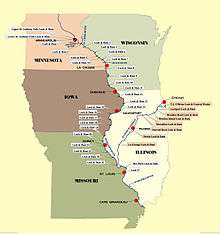
Locks and Dams
Expansion proposals for upper Mississippi locks
The Army Corps of Engineers has studied the expansion of some locks on the Upper Mississippi.[2] Since at least 1999, the Corps has considered expanding 600 ft locks 20, 21, 22, 24, and 25 to 1,200 ft.[2][3]
- Gallery
-
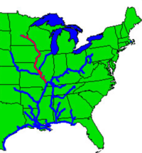
The inland and intercoastal waterways, with the Upper Mississippi highlighted in red.
-
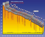
Upper Mississippi River Stairway of Water.
-
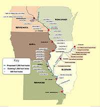
Upper Mississippi locks expansion study
References
- ↑ Sepic, Matt. "End of an era: Upper St. Anthony Falls lock closes". MPR News. Retrieved 24 June 2015.
- 1 2 "Big Price - Little Benefit (The case against lock expansion on the Mississippi River)" (PDF). Nicollet Island Coalition. February 2010.
- ↑ "Lock System Expansion Proposal is Aired". Milwaukee Journal Sentinel. Associated Press. August 8, 1999.
See also
- List of crossings of the Upper Mississippi River
- Mississippi Valley Division
- List of locks and dams of the Ohio River
External links
- USACE St. Paul District Locks and Dams
- HAER - Upper Mississippi River 9-Foot Channel Project History, Mississippi River between Minneapolis & Guttenberg, IA, Red Wing vicinity, Goodhue County, MN Lock & Dams 3-10
- HAER - Upper Mississippi River 9-Foot Channel Project, Lock & Dams 11-22, Upper Mississippi River, Dubuque, Dubuque County, IA - 126 data pages
- HAER - Upper Mississippi River Nine-Foot Channel Project, Lock & Dam Nos. 24-27, Clarksville, Pike County, MO - 126 data pages
This article is issued from Wikipedia - version of the 2/14/2016. The text is available under the Creative Commons Attribution/Share Alike but additional terms may apply for the media files.