List of trails of Powell County, Montana
There are at least 29 named trails in Powell County, Montana according to the U.S. Geological Survey, Board of Geographic Names. A trail is defined as: "Route for passage from one point to another; does not include roads or highways (jeep trail, path, ski trail)."[1]
- Blackfoot Divide Trail, 47°15′24″N 113°21′48″W / 47.25667°N 113.36333°W, el. 7,290 feet (2,220 m) [2]
- Camp Creek Pass Trail, 47°28′04″N 113°06′23″W / 47.46778°N 113.10639°W, el. 6,227 feet (1,898 m) [3]
- Catchem Creek Trail, 47°28′25″N 113°11′37″W / 47.47361°N 113.19361°W, el. 4,734 feet (1,443 m) [4]
- Center Creek Trail, 47°15′14″N 113°11′23″W / 47.25389°N 113.18972°W, el. 6,339 feet (1,932 m) [5]
- Center Ridge Trail, 47°11′36″N 113°11′02″W / 47.19333°N 113.18389°W, el. 6,237 feet (1,901 m) [6]
- Conger Creek Trail, 47°12′53″N 113°04′45″W / 47.21472°N 113.07917°W, el. 6,614 feet (2,016 m) [7]
- Conger Point Trail, 47°12′41″N 113°05′45″W / 47.21139°N 113.09583°W, el. 7,743 feet (2,360 m) [8]
- Danaher Hahn Creek Trail, 47°21′13″N 113°04′45″W / 47.35361°N 113.07917°W, el. 5,958 feet (1,816 m) [9]
- Dunham Lodgepole Trail, 47°09′48″N 113°11′33″W / 47.16333°N 113.19250°W, el. 4,390 feet (1,340 m) [10]
- Dunham Trail, 47°11′25″N 113°15′26″W / 47.19028°N 113.25722°W, el. 5,394 feet (1,644 m) [11]
- Dwight Creek Trail, 47°14′03″N 113°05′53″W / 47.23417°N 113.09806°W, el. 7,880 feet (2,400 m) [12]
- Falls Canyon Trail, 47°11′23″N 113°04′03″W / 47.18972°N 113.06750°W, el. 6,588 feet (2,008 m) [13]
- Fenn Mountain Trail, 47°11′55″N 113°06′54″W / 47.19861°N 113.11500°W, el. 7,631 feet (2,326 m) [14]
- Foolhen Creek Trail, 47°21′45″N 113°07′41″W / 47.36250°N 113.12806°W, el. 5,620 feet (1,710 m) [15]
- Foolhen Mountain Trail, 47°20′06″N 113°03′39″W / 47.33500°N 113.06083°W, el. 5,610 feet (1,710 m) [16]
- Haystack Mountain Trail, 47°35′11″N 113°09′32″W / 47.58639°N 113.15889°W, el. 6,565 feet (2,001 m) [17]
- Holland Gordon Trail, 47°25′46″N 113°26′43″W / 47.42944°N 113.44528°W, el. 5,407 feet (1,648 m) [18]
- Jumbo Lookout Trail, 47°24′38″N 113°08′14″W / 47.41056°N 113.13722°W, el. 6,099 feet (1,859 m) [19]
- Lake Otatsy Trail, 47°09′47″N 113°01′53″W / 47.16306°N 113.03139°W, el. 6,201 feet (1,890 m) [20]
- Limestone Pass Trail, 47°15′37″N 113°08′03″W / 47.26028°N 113.13417°W, el. 6,657 feet (2,029 m) [21]
- Lodgepole Trail, 47°13′25″N 113°11′48″W / 47.22361°N 113.19667°W, el. 5,338 feet (1,627 m) [22]
- McCabe Lake Creek Trail, 47°08′39″N 113°02′32″W / 47.14417°N 113.04222°W, el. 5,853 feet (1,784 m) [23]
- McDermott Trail, 47°08′31″N 112°56′32″W / 47.14194°N 112.94222°W, el. 4,902 feet (1,494 m) [24]
- Meadow Creek Trail, 47°04′51″N 112°50′18″W / 47.08083°N 112.83833°W, el. 6,489 feet (1,978 m) [25]
- Mineral Creek Trail, 47°07′17″N 112°54′41″W / 47.12139°N 112.91139°W, el. 6,598 feet (2,011 m) [26]
- Monture Haun Trail, 47°11′39″N 113°09′20″W / 47.19417°N 113.15556°W, el. 4,754 feet (1,449 m) [27]
- Monture Trail, 47°16′24″N 113°10′59″W / 47.27333°N 113.18306°W, el. 5,574 feet (1,699 m) [28]
- Morrell Falls National Recreation Trail, 47°17′07″N 113°27′44″W / 47.28528°N 113.46222°W, el. 4,793 feet (1,461 m) [29]
- Pyramid Pass Trail, 47°15′28″N 113°24′25″W / 47.25778°N 113.40694°W, el. 5,951 feet (1,814 m) [30]
Further reading
- Arthur, Jean (2000). Winter Trails Montana: The Best Cross-Country Ski & Snowshoe Trails. Guilford, CT: Globe Pequot. ISBN 0-7627-0730-5.
- Spring, Ira (1974). Wilderness trails Northwest;: A hiker's and climber's overview-guide to national parks and wilderness areas in Wyoming, Montana, Idaho, Northern California, . British Columbia, Canadian Rockies. Touchstone Press. ISBN 0-911518-25-8.
- Willard, John A. (1986). Adventure Trails in Montana. Pruett Publishing Co. ISBN 0-87108-726-X.
- Howard, Lynna and Leland (2000). Along Montana & Idaho's Continental Divide Trail. Westcliff Publishers. ISBN 1-56579-343-9.
- Wolf, John R. (1992). Guide to the Continental Divide Trail: Northern Montana. Continental Divide Trail Society. ISBN 0-934326-01-0.
- Barnett, Carellen (1997). Trail Riding Western Montana. Guilford, CT: Falcon Press Publishing. ISBN 1-56044-336-7.
- Schneider, Bill (1995). Hiking Montana. Guilford, CT: Falcon Press Publishing. ISBN 1-56044-381-2.
See also
Notes
- ↑ "Geographic Names Information System (GNIS) Feature Class Definitions". U.S. Geological Survey. Retrieved 2011-07-26.
- ↑ "Blackfoot Divide Trail". Geographic Names Information System. United States Geological Survey.
- ↑ "Camp Creek Pass Trail". Geographic Names Information System. United States Geological Survey.
- ↑ "Catchem Creek Trail". Geographic Names Information System. United States Geological Survey.
- ↑ "Center Creek Trail". Geographic Names Information System. United States Geological Survey.
- ↑ "Center Ridge Trail". Geographic Names Information System. United States Geological Survey.
- ↑ "Conger Creek Trail". Geographic Names Information System. United States Geological Survey.
- ↑ "Conger Point Trail". Geographic Names Information System. United States Geological Survey.
- ↑ "Danaher Hahn Creek Trail". Geographic Names Information System. United States Geological Survey.
- ↑ "Dunham Lodgepole Trail". Geographic Names Information System. United States Geological Survey.
- ↑ "Dunham Trail". Geographic Names Information System. United States Geological Survey.
- ↑ "Dwight Creek Trail". Geographic Names Information System. United States Geological Survey.
- ↑ "Falls Canyon Trail". Geographic Names Information System. United States Geological Survey.
- ↑ "Fenn Mountain Trail". Geographic Names Information System. United States Geological Survey.
- ↑ "Foolhen Creek Trail". Geographic Names Information System. United States Geological Survey.
- ↑ "Foolhen Mountain Trail". Geographic Names Information System. United States Geological Survey.
- ↑ "Haystack Mountain Trail". Geographic Names Information System. United States Geological Survey.
- ↑ "Holland Gordon Trail". Geographic Names Information System. United States Geological Survey.
- ↑ "Jumbo Lookout Trail". Geographic Names Information System. United States Geological Survey.
- ↑ "Lake Otatsy Trail". Geographic Names Information System. United States Geological Survey.
- ↑ "Limestone Pass Trail". Geographic Names Information System. United States Geological Survey.
- ↑ "Lodgepole Trail". Geographic Names Information System. United States Geological Survey.
- ↑ "McCabe Lake Creek Trail". Geographic Names Information System. United States Geological Survey.
- ↑ "McDermott Trail". Geographic Names Information System. United States Geological Survey.
- ↑ "Meadow Creek Trail". Geographic Names Information System. United States Geological Survey.
- ↑ "Mineral Creek Trail". Geographic Names Information System. United States Geological Survey.
- ↑ "Monture Haun Trail". Geographic Names Information System. United States Geological Survey.
- ↑ "Monture Trail". Geographic Names Information System. United States Geological Survey.
- ↑ "Morrell Falls National Recreation Trail". Geographic Names Information System. United States Geological Survey.
- ↑ "Pyramid Pass Trail". Geographic Names Information System. United States Geological Survey.
Municipalities and communities of Powell County, Montana, United States | ||
|---|---|---|
| City | 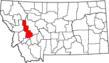 | |
| CDPs | ||
| Unincorporated community | ||
This article is issued from Wikipedia - version of the 10/30/2013. The text is available under the Creative Commons Attribution/Share Alike but additional terms may apply for the media files.