List of trails of Ravalli County, Montana
There are at least 31 named trails in Ravalli County, Montana according to the U.S. Geological Survey, Board of Geographic Names. A trail is defined as: "Route for passage from one point to another; does not include roads or highways (jeep trail, path, ski trail)."[1]
- B-2 Ski Trail, 45°41′35″N 113°57′08″W / 45.69306°N 113.95222°W, el. 7,054 feet (2,150 m) [2]
- Big Hole National Recreation Trail, 45°44′50″N 113°55′54″W / 45.74722°N 113.93167°W, el. 6,421 feet (1,957 m) [3]
- Castle Rock Trail, 45°43′01″N 114°25′49″W / 45.71694°N 114.43028°W, el. 7,014 feet (2,138 m) [4]
- Chicken Out Ski Trail, 45°41′35″N 113°57′08″W / 45.69306°N 113.95222°W, el. 7,054 feet (2,150 m) [5]
- Coal Ridge Trail, 45°38′24″N 114°20′07″W / 45.64000°N 114.33528°W, el. 5,889 feet (1,795 m) [6]
- Divide Trail, 45°28′47″N 114°17′08″W / 45.47972°N 114.28556°W, el. 8,127 feet (2,477 m) [7]
- Drifter Ski Trail, 45°41′35″N 113°57′08″W / 45.69306°N 113.95222°W, el. 7,054 feet (2,150 m) [8]
- Far Out Ski Trail, 45°41′35″N 113°57′08″W / 45.69306°N 113.95222°W, el. 7,054 feet (2,150 m) [9]
- Hideout Ski Trail, 45°41′35″N 113°57′08″W / 45.69306°N 113.95222°W, el. 7,054 feet (2,150 m) [10]
- Lightning Ski Trail, 45°41′35″N 113°57′08″W / 45.69306°N 113.95222°W, el. 7,054 feet (2,150 m) [11]
- Lookout Mountain Trail, 45°38′54″N 114°16′25″W / 45.64833°N 114.27361°W, el. 6,840 feet (2,080 m) [12]
- Meadow Run Ski Trail, 45°41′35″N 113°57′08″W / 45.69306°N 113.95222°W, el. 7,054 feet (2,150 m) [13]
- Meadow Trail Ski Trail, 45°41′35″N 113°57′08″W / 45.69306°N 113.95222°W, el. 7,054 feet (2,150 m) [14]
- North Bowl Ski Trail, 45°41′35″N 113°57′08″W / 45.69306°N 113.95222°W, el. 7,054 feet (2,150 m) [15]
- North Face Ski Trail, 45°41′35″N 113°57′08″W / 45.69306°N 113.95222°W, el. 7,054 feet (2,150 m) [16]
- North Route of Old Nez Perce Trail, 45°44′31″N 114°28′41″W / 45.74194°N 114.47806°W, el. 6,565 feet (2,001 m) [17]
- Old Nez Perce Indian Trail, 45°45′40″N 114°20′00″W / 45.76111°N 114.33333°W, el. 5,587 feet (1,703 m) [18]
- Old Nez Perce Trail, 45°44′24″N 114°32′16″W / 45.74000°N 114.53778°W, el. 7,172 feet (2,186 m) [19]
- Powder Bowl Ski Trail, 45°41′35″N 113°57′08″W / 45.69306°N 113.95222°W, el. 7,054 feet (2,150 m) [20]
- Saint Mary Peak Trail, 46°30′26″N 114°13′20″W / 46.50722°N 114.22222°W, el. 7,989 feet (2,435 m) [21]
- Salmon Ski Trail, 45°41′35″N 113°57′08″W / 45.69306°N 113.95222°W, el. 7,054 feet (2,150 m) [22]
- South Face Ski Trail, 45°41′35″N 113°57′08″W / 45.69306°N 113.95222°W, el. 7,054 feet (2,150 m) [23]
- South Route of Old Nez Perce Trail, 45°42′47″N 114°26′37″W / 45.71306°N 114.44361°W, el. 7,142 feet (2,177 m) [24]
- Southern Comfort Ski Trail, 45°41′35″N 113°57′08″W / 45.69306°N 113.95222°W, el. 7,054 feet (2,150 m) [25]
- Speedway Ski Trail, 45°41′35″N 113°57′08″W / 45.69306°N 113.95222°W, el. 7,054 feet (2,150 m) [26]
- Sweeney Ridge Trail, 46°38′00″N 114°12′17″W / 46.63333°N 114.20472°W, el. 7,221 feet (2,201 m) [27]
- Thunder Ski Trail, 45°41′35″N 113°57′08″W / 45.69306°N 113.95222°W, el. 7,054 feet (2,150 m) [28]
- Trapper Peak Trail, 45°52′28″N 114°16′22″W / 45.87444°N 114.27278°W, el. 8,136 feet (2,480 m) [29]
- Upper Far Out Ski Trail, 45°41′35″N 113°57′08″W / 45.69306°N 113.95222°W, el. 7,054 feet (2,150 m) [30]
- Ward Mountain Trail, 46°10′58″N 114°14′43″W / 46.18278°N 114.24528°W, el. 6,194 feet (1,888 m) [31]
- West Meadow Ski Trail, 45°41′35″N 113°57′08″W / 45.69306°N 113.95222°W, el. 7,054 feet (2,150 m) [32]
Further reading
- Arthur, Jean (2000). Winter Trails Montana: The Best Cross-Country Ski & Snowshoe Trails. Guilford, CT: Globe Pequot. ISBN 0-7627-0730-5.
- Spring, Ira (1974). Wilderness trails Northwest;: A hiker's and climber's overview-guide to national parks and wilderness areas in Wyoming, Montana, Idaho, Northern California, . British Columbia, Canadian Rockies. Touchstone Press. ISBN 0-911518-25-8.
- Willard, John A. (1986). Adventure Trails in Montana. Pruett Publishing Co. ISBN 0-87108-726-X.
- Howard, Lynna and Leland (2000). Along Montana & Idaho's Continental Divide Trail. Westcliff Publishers. ISBN 1-56579-343-9.
- Wolf, John R. (1992). Guide to the Continental Divide Trail: Northern Montana. Continental Divide Trail Society. ISBN 0-934326-01-0.
- Barnett, Carellen (1997). Trail Riding Western Montana. Guilford, CT: Falcon Press Publishing. ISBN 1-56044-336-7.
- Schneider, Bill (1995). Hiking Montana. Guilford, CT: Falcon Press Publishing. ISBN 1-56044-381-2.
See also
Notes
- ↑ "Geographic Names Information System (GNIS) Feature Class Definitions". U.S. Geological Survey. Retrieved 2011-07-26.
- ↑ "B-2 Ski Trail". Geographic Names Information System. United States Geological Survey.
- ↑ "Big Hole National Recreation Trail". Geographic Names Information System. United States Geological Survey.
- ↑ "Castle Rock Trail". Geographic Names Information System. United States Geological Survey.
- ↑ "Chicken Out Ski Trail". Geographic Names Information System. United States Geological Survey.
- ↑ "Coal Ridge Trail". Geographic Names Information System. United States Geological Survey.
- ↑ "Divide Trail". Geographic Names Information System. United States Geological Survey.
- ↑ "Drifter Ski Trail". Geographic Names Information System. United States Geological Survey.
- ↑ "Far Out Ski Trail". Geographic Names Information System. United States Geological Survey.
- ↑ "Hideout Ski Trail". Geographic Names Information System. United States Geological Survey.
- ↑ "Lightning Ski Trail". Geographic Names Information System. United States Geological Survey.
- ↑ "Lookout Mountain Trail". Geographic Names Information System. United States Geological Survey.
- ↑ "Meadow Run Ski Trail". Geographic Names Information System. United States Geological Survey.
- ↑ "Meadow Trail Ski Trail". Geographic Names Information System. United States Geological Survey.
- ↑ "North Bowl Ski Trail". Geographic Names Information System. United States Geological Survey.
- ↑ "North Face Ski Trail". Geographic Names Information System. United States Geological Survey.
- ↑ "North Route of Old Nez Perce Trail". Geographic Names Information System. United States Geological Survey.
- ↑ "Old Nez Perce Indian Trail". Geographic Names Information System. United States Geological Survey.
- ↑ "Old Nez Perce Trail". Geographic Names Information System. United States Geological Survey.
- ↑ "Powder Bowl Ski Trail". Geographic Names Information System. United States Geological Survey.
- ↑ "Saint Mary Peak Trail". Geographic Names Information System. United States Geological Survey.
- ↑ "Salmon Ski Trail". Geographic Names Information System. United States Geological Survey.
- ↑ "South Face Ski Trail". Geographic Names Information System. United States Geological Survey.
- ↑ "South Route of Old Nez Perce Trail". Geographic Names Information System. United States Geological Survey.
- ↑ "Southern Comfort Ski Trail". Geographic Names Information System. United States Geological Survey.
- ↑ "Speedway Ski Trail". Geographic Names Information System. United States Geological Survey.
- ↑ "Sweeney Ridge Trail". Geographic Names Information System. United States Geological Survey.
- ↑ "Thunder Ski Trail". Geographic Names Information System. United States Geological Survey.
- ↑ "Trapper Peak Trail". Geographic Names Information System. United States Geological Survey.
- ↑ "Upper Far Out Ski Trail". Geographic Names Information System. United States Geological Survey.
- ↑ "Ward Mountain Trail". Geographic Names Information System. United States Geological Survey.
- ↑ "West Meadow Ski Trail". Geographic Names Information System. United States Geological Survey.
Municipalities and communities of Ravalli County, Montana, United States | ||
|---|---|---|
| City | 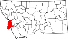 | |
| Towns | ||
| CDPs | ||
| Other communities | ||
This article is issued from Wikipedia - version of the 10/30/2013. The text is available under the Creative Commons Attribution/Share Alike but additional terms may apply for the media files.