List of trails of Sanders County, Montana
There are at least 35 named trails in Sanders County, Montana according to the U.S. Geological Survey, Board of Geographic Names. A trail is defined as: "Route for passage from one point to another; does not include roads or highways (jeep trail, path, ski trail)."[1]
- Bear Creek Trail, 47°50′24″N 115°21′50″W / 47.84000°N 115.36389°W, el. 5,971 feet (1,820 m) [2]
- Bear Paw Trail, 47°57′56″N 115°37′57″W / 47.96556°N 115.63250°W, el. 3,635 feet (1,108 m) [3]
- Berray Mountain Trail, 48°08′10″N 115°47′49″W / 48.13611°N 115.79694°W, el. 4,816 feet (1,468 m) [4]
- Black Peak Trail, 47°45′26″N 115°41′52″W / 47.75722°N 115.69778°W, el. 5,856 feet (1,785 m) [5]
- Cabinet Divide Trail, 47°56′20″N 115°33′29″W / 47.93889°N 115.55806°W, el. 6,050 feet (1,840 m) [6]
- Canyon Peak Trail, 47°53′50″N 115°32′58″W / 47.89722°N 115.54944°W, el. 5,679 feet (1,731 m) [7]
- Cataract Creek Trail, 47°49′21″N 115°23′19″W / 47.82250°N 115.38861°W, el. 6,001 feet (1,829 m) [8]
- Daisy Creek Trail, 47°49′28″N 115°05′33″W / 47.82444°N 115.09250°W, el. 5,508 feet (1,679 m) [9]
- Elk Mountain Trail, 47°52′33″N 115°26′18″W / 47.87583°N 115.43833°W, el. 4,639 feet (1,414 m) [10]
- Emma Peak Pack Trail, 47°40′16″N 115°38′25″W / 47.67111°N 115.64028°W, el. 4,242 feet (1,293 m) [11]
- Engle Lake Trail, 47°59′04″N 115°39′18″W / 47.98444°N 115.65500°W, el. 4,101 feet (1,250 m) [12]
- Engle Peak Trail, 48°00′28″N 115°39′47″W / 48.00778°N 115.66306°W, el. 5,325 feet (1,623 m) [13]
- Goat Peak Trail, 47°59′07″N 115°36′27″W / 47.98528°N 115.60750°W, el. 5,489 feet (1,673 m) [14]
- Goat Ridge Trail, 47°57′57″N 115°36′21″W / 47.96583°N 115.60583°W, el. 5,220 feet (1,590 m) [15]
- Green Mountain Trail, 47°57′19″N 115°40′14″W / 47.95528°N 115.67056°W, el. 4,734 feet (1,443 m) [16]
- Grouse Mountain Trail, 47°50′11″N 115°24′05″W / 47.83639°N 115.40139°W, el. 5,860 feet (1,790 m) [17]
- Huckleberry Mountain Trail, 47°56′47″N 115°47′32″W / 47.94639°N 115.79222°W, el. 4,885 feet (1,489 m) [18]
- Loveland Peak Trail, 47°59′14″N 115°53′45″W / 47.98722°N 115.89583°W, el. 4,974 feet (1,516 m) [19]
- Miller Creek Trail, 47°49′22″N 115°21′47″W / 47.82278°N 115.36306°W, el. 5,738 feet (1,749 m) [20]
- Moose Peak Trail, 47°52′58″N 115°18′46″W / 47.88278°N 115.31278°W, el. 4,944 feet (1,507 m) [21]
- Old Daly Trail, 48°06′12″N 115°43′10″W / 48.10333°N 115.71944°W, el. 5,817 feet (1,773 m) [22]
- Reader Gulch Pack Trail, 47°44′53″N 115°36′51″W / 47.74806°N 115.61417°W, el. 3,881 feet (1,183 m) [23]
- Revais Creek Trail, 47°14′59″N 114°25′11″W / 47.24972°N 114.41972°W, el. 4,308 feet (1,313 m) [24]
- Rice Draw Trail, 48°00′37″N 115°56′00″W / 48.01028°N 115.93333°W, el. 3,871 feet (1,180 m) [25]
- Slide Rock Mountain Trail, 47°47′22″N 115°20′49″W / 47.78944°N 115.34694°W, el. 6,227 feet (1,898 m) [26]
- State Line Trail, 47°53′19″N 115°56′13″W / 47.88861°N 115.93694°W, el. 5,620 feet (1,710 m) [27]
- Stevens Creek Trail, 47°55′40″N 115°47′53″W / 47.92778°N 115.79806°W, el. 4,157 feet (1,267 m) [28]
- Stevens Ridge Trail, 47°55′22″N 115°51′02″W / 47.92278°N 115.85056°W, el. 4,997 feet (1,523 m) [29]
- Thompson River Mount Headley Trail, 47°45′14″N 115°13′35″W / 47.75389°N 115.22639°W, el. 6,900 feet (2,100 m) [30]
- Twenty Odd Peak Trail, 47°53′08″N 115°34′41″W / 47.88556°N 115.57806°W, el. 5,095 feet (1,553 m) [31]
- Water Hill Trail, 47°48′41″N 115°27′15″W / 47.81139°N 115.45417°W, el. 6,142 feet (1,872 m) [32]
- West Fork Fishtrap Trail, 47°46′19″N 115°13′04″W / 47.77194°N 115.21778°W, el. 6,063 feet (1,848 m) [33]
- West Fork Trail, 47°49′34″N 115°27′35″W / 47.82611°N 115.45972°W, el. 4,534 feet (1,382 m) [34]
- White Pine Ridge Trail, 47°46′27″N 115°34′53″W / 47.77417°N 115.58139°W, el. 4,360 feet (1,330 m) [35]
- Windfall Peak Trail, 47°47′17″N 115°44′40″W / 47.78806°N 115.74444°W, el. 4,695 feet (1,431 m) [36]
Further reading
- Arthur, Jean (2000). Winter Trails Montana: The Best Cross-Country Ski & Snowshoe Trails. Guilford, CT: Globe Pequot. ISBN 0-7627-0730-5.
- Spring, Ira (1974). Wilderness trails Northwest;: A hiker's and climber's overview-guide to national parks and wilderness areas in Wyoming, Montana, Idaho, Northern California, . British Columbia, Canadian Rockies. Touchstone Press. ISBN 0-911518-25-8.
- Willard, John A. (1986). Adventure Trails in Montana. Pruett Publishing Co. ISBN 0-87108-726-X.
- Howard, Lynna and Leland (2000). Along Montana & Idaho's Continental Divide Trail. Westcliff Publishers. ISBN 1-56579-343-9.
- Wolf, John R. (1992). Guide to the Continental Divide Trail: Northern Montana. Continental Divide Trail Society. ISBN 0-934326-01-0.
- Barnett, Carellen (1997). Trail Riding Western Montana. Guilford, CT: Falcon Press Publishing. ISBN 1-56044-336-7.
- Schneider, Bill (1995). Hiking Montana. Guilford, CT: Falcon Press Publishing. ISBN 1-56044-381-2.
See also
Notes
- ↑ "Geographic Names Information System (GNIS) Feature Class Definitions". U.S. Geological Survey. Retrieved 2011-07-26.
- ↑ "Bear Creek Trail". Geographic Names Information System. United States Geological Survey.
- ↑ "Bear Paw Trail". Geographic Names Information System. United States Geological Survey.
- ↑ "Berray Mountain Trail". Geographic Names Information System. United States Geological Survey.
- ↑ "Black Peak Trail". Geographic Names Information System. United States Geological Survey.
- ↑ "Cabinet Divide Trail". Geographic Names Information System. United States Geological Survey.
- ↑ "Canyon Peak Trail". Geographic Names Information System. United States Geological Survey.
- ↑ "Cataract Creek Trail". Geographic Names Information System. United States Geological Survey.
- ↑ "Daisy Creek Trail". Geographic Names Information System. United States Geological Survey.
- ↑ "Elk Mountain Trail". Geographic Names Information System. United States Geological Survey.
- ↑ "Emma Peak Pack Trail". Geographic Names Information System. United States Geological Survey.
- ↑ "Engle Lake Trail". Geographic Names Information System. United States Geological Survey.
- ↑ "Engle Peak Trail". Geographic Names Information System. United States Geological Survey.
- ↑ "Goat Peak Trail". Geographic Names Information System. United States Geological Survey.
- ↑ "Goat Ridge Trail". Geographic Names Information System. United States Geological Survey.
- ↑ "Green Mountain Trail". Geographic Names Information System. United States Geological Survey.
- ↑ "Grouse Mountain Trail". Geographic Names Information System. United States Geological Survey.
- ↑ "Huckleberry Mountain Trail". Geographic Names Information System. United States Geological Survey.
- ↑ "Loveland Peak Trail". Geographic Names Information System. United States Geological Survey.
- ↑ "Miller Creek Trail". Geographic Names Information System. United States Geological Survey.
- ↑ "Moose Peak Trail". Geographic Names Information System. United States Geological Survey.
- ↑ "Old Daly Trail". Geographic Names Information System. United States Geological Survey.
- ↑ "Reader Gulch Pack Trail". Geographic Names Information System. United States Geological Survey.
- ↑ "Revais Creek Trail". Geographic Names Information System. United States Geological Survey.
- ↑ "Rice Draw Trail". Geographic Names Information System. United States Geological Survey.
- ↑ "Slide Rock Mountain Trail". Geographic Names Information System. United States Geological Survey.
- ↑ "State Line Trail". Geographic Names Information System. United States Geological Survey.
- ↑ "Stevens Creek Trail". Geographic Names Information System. United States Geological Survey.
- ↑ "Stevens Ridge Trail". Geographic Names Information System. United States Geological Survey.
- ↑ "Thompson River Mount Headley Trail". Geographic Names Information System. United States Geological Survey.
- ↑ "Twenty Odd Peak Trail". Geographic Names Information System. United States Geological Survey.
- ↑ "Water Hill Trail". Geographic Names Information System. United States Geological Survey.
- ↑ "West Fork Fishtrap Trail". Geographic Names Information System. United States Geological Survey.
- ↑ "West Fork Trail". Geographic Names Information System. United States Geological Survey.
- ↑ "White Pine Ridge Trail". Geographic Names Information System. United States Geological Survey.
- ↑ "Windfall Peak Trail". Geographic Names Information System. United States Geological Survey.
Municipalities and communities of Sanders County, Montana, United States | ||
|---|---|---|
| City | 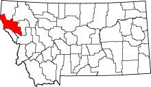 | |
| Towns | ||
| CDPs | ||
| Indian reservation | ||
| Footnotes | ‡This populated place also has portions in an adjacent county or counties | |
This article is issued from Wikipedia - version of the 10/30/2013. The text is available under the Creative Commons Attribution/Share Alike but additional terms may apply for the media files.