Lokoja
| Lokoja | |
|---|---|
| LGA and city | |
 Lokoja | |
| Coordinates: 7°49′N 6°45′E / 7.817°N 6.750°E | |
| Country |
|
| State | Kogi State |
| Time zone | WAT (UTC+1) |
| Climate | Aw |
Lokoja is a city in Nigeria. It lies at the confluence of the Niger and Benue rivers and is the capital of Nigeria's Kogi State.[1]
History
The area that would become Lokoja has been inhabited for thousands of years by people from different ethnic groups prior to the coming of early Europeans and missionaries. The migrations of these groups to the area could be in part accounted for by its nearness to the banks of the Niger and Benue rivers. It has been documented in many sources that, the first group of people to originally settle in Lokoja were the Oworo people. It is said that they migrated from Ile-Ife to the adjacent Agbaja plateau, and then finally on mount Patti overlooking the river Niger.[2] They saw the Patti hill as a location of refuge from the then Etsu Nupe Massaba, who was attacking all the surrounding ethnic groups. The Oworos were part of the larger Eyagi group of people, which is the Nupe exonym for the Yorubas. They were able to sustain themselves by engaging in farming and hunting activities. This was the status quo until the Europeans arrived. When Dr William Balfour Baikie arrived at Lokoja first in 1854 and later in 1857, through his efforts and encouragements, the people descended from Mount Patti. He did this through Chief Menaha, the last Oworo Chief on the hill.[3]
The present modern settlement at Lokoja was established in 1857 by the British explorer William Baikie at the site of an earlier model farm constructed during the failed Niger expedition of 1841. Lokoja was the capital of the British Northern Nigeria Protectorate and remained a convenient administrative town for the British colonial government after the amalgamation of Northern and Southern Nigeria in 1914.[4] The first Governor-General, Sir Frederick Lugard, governed the new nation of Nigeria from Lokoja. Other subsequent settlers into the city include the Nupes, the Yorubas (mainstream), the Igalas, the Igbirras (Igbirra Tao and Igbirra Koto), the Hausa and the Bassa-Nge people. However, there are other groups apart from the ones mentioned above but they are classified as temporary visitors and non indigenous. They include the Igbos, Tivs, Edos, e.t.c.
Different groups in the city lay claims to having named the city. To the Yorubas, the city's name is derived from "Ilu Oke Oja" meaning: The settlement located on the hill did not fall. The Hausas believe the name is derived from "Loko" and "Ja" meaning: An Iroko tree with a red bark. The Nupes on their own part believe the city's name was derived from "Patti Lukongi" meaning: The hill of doves, while to the Igalas, the name of the city was derived from the expression 'Lia ka je Eja" meaning: Let us go and eat fish. The Bassa-Nges are of the belief that they settled at the foot of mount Patti when they came into Lokoja before later moving again and migrating to settle across the Benue just to the north of the igalas. Whatever the case may be, it is difficult to categorically state in what order any or each of these groups came after the Oworos to settle in Lokoja town. These different groups lived in their different quarters of town (Anguas) but were closely related socio-politically. They interacted freely and tolerated one another. Present day Lokoja is ruled by the "Maigari" (chief) of Lokoja, under whom there are 21 local assisting chiefs.[5] It is important to note however, that each group have their own local criteria: for example, the Maigari has no jurisdiction over the Olu of Oworo.
The city's population has since grown to an estimated count of over 90,000 inhabitants.[6] It is a trade center with respect to its agricultural products; this is because it is situated at the confluence of the Niger and Benue rivers, and is close to the new federal capital of Nigeria in Abuja. It is also home to Kogi State Polytechnic and the newly established Federal University Lokoja.[7]
Near Lokoja, in Ajaokuta, are metallurgy facilities and iron ore mines.
The LGA
Lokoja is also a Local Government Area of Kogi State with an area of 3,180 km² and a population of 195,261 at the 2006 census. It is bounded by the Niger in the north and east upstream from the capital until the border with Kwara State, and includes the city of Lokoja. The postal code of the area is 260.[8]
Climate
| Climate data for Lokoja | |||||||||||||
|---|---|---|---|---|---|---|---|---|---|---|---|---|---|
| Month | Jan | Feb | Mar | Apr | May | Jun | Jul | Aug | Sep | Oct | Nov | Dec | Year |
| Record high °C (°F) | 38.9 (102) |
38.9 (102) |
40.0 (104) |
38.9 (102) |
38.3 (100.9) |
38.9 (102) |
37.2 (99) |
36.7 (98.1) |
37.2 (99) |
37.2 (99) |
37.2 (99) |
37.8 (100) |
40.0 (104) |
| Average high °C (°F) | 33.2 (91.8) |
35.2 (95.4) |
35.5 (95.9) |
34.3 (93.7) |
32.5 (90.5) |
31.2 (88.2) |
30.2 (86.4) |
29.7 (85.5) |
30.1 (86.2) |
31.3 (88.3) |
33.0 (91.4) |
32.9 (91.2) |
32.4 (90.3) |
| Daily mean °C (°F) | 26.9 (80.4) |
28.8 (83.8) |
29.9 (85.8) |
29.2 (84.6) |
28.0 (82.4) |
26.8 (80.2) |
26.4 (79.5) |
25.8 (78.4) |
25.9 (78.6) |
26.6 (79.9) |
26.9 (80.4) |
25.8 (78.4) |
27.3 (81.1) |
| Average low °C (°F) | 20.8 (69.4) |
23.0 (73.4) |
25.0 (77) |
24.8 (76.6) |
23.8 (74.8) |
23.1 (73.6) |
22.7 (72.9) |
22.6 (72.7) |
22.5 (72.5) |
22.5 (72.5) |
21.5 (70.7) |
19.9 (67.8) |
22.7 (72.9) |
| Record low °C (°F) | 6.1 (43) |
12.8 (55) |
11.1 (52) |
16.1 (61) |
15.0 (59) |
12.8 (55) |
17.2 (63) |
17.2 (63) |
14.4 (57.9) |
15.6 (60.1) |
15.0 (59) |
10.6 (51.1) |
6.1 (43) |
| Average precipitation mm (inches) | 4.6 (0.181) |
12.8 (0.504) |
43.5 (1.713) |
95.0 (3.74) |
151.0 (5.945) |
158.8 (6.252) |
172.6 (6.795) |
165.8 (6.528) |
208.8 (8.22) |
137.7 (5.421) |
14.4 (0.567) |
2.0 (0.079) |
1,167.1 (45.949) |
| Average precipitation days (≥ 0.3 mm) | 0.8 | 1.0 | 3.2 | 6.0 | 9.5 | 10.2 | 12.7 | 12.8 | 15.2 | 9.5 | 1.2 | 0.3 | 82.4 |
| Average relative humidity (%) | 63 | 61 | 65 | 71 | 76 | 80 | 82 | 82 | 83 | 82 | 75 | 70 | 74 |
| Mean monthly sunshine hours | 229.4 | 237.3 | 226.3 | 198.0 | 217.0 | 192.0 | 164.3 | 124.0 | 147.0 | 210.8 | 252.0 | 257.3 | 2,455.4 |
| Mean daily sunshine hours | 7.4 | 8.4 | 7.3 | 6.6 | 7.0 | 6.4 | 5.3 | 4.0 | 4.9 | 6.8 | 8.4 | 8.3 | 6.7 |
| Source: Deutscher Wetterdienst[9] | |||||||||||||
Geography
Lokoja lies about 7.8023° North of the equator and 6.7333° E east of the Meridian. It is about 165 km Southwest of Abuja as the crow flies, and 390 km Northeast of Lagos by same measure. Residential districts are of varying density, and the city has various suburbs such as Felele, Adankolo, Otokiti and Ganaja. The town is situated in the tropical Wet and Dry savanna climate zone of Nigeria, and temperature remains hot all year round.
Religion and Culture
Given the multiethnic nature of the town, there are various festivals, events and socio-cultural activities depending on the people group. Thus, no particular group’s festivals or ther socio-cultural activities can be said to be the most prominent. For instance, the Agbo masquerade festival is celebrated by the Oworo people between the months of March and April every year. Moreso, the other Okuns also celebrate the Oro / Egungun festival while generally, the fishermen in Lokoja celebrate the Donkwo fishing festival and this also comes up in March/April. It is also worthy to mention that editions of Lokoja boat regatta are held, albeit not regularly. Religiously, Islam, Christianity and traditional religion exist in Lokoja .The Muslims go to their Mosques for their worship while the Christians do the same in their various churches. Religious fesivals include the Muslim Eids and the Christian Christmas and Easter.
References
- ↑ "Encyclopædia Britannica". Retrieved 2007-04-06.
- ↑ http://www.unn.edu.ng/publications/files/images/UKAEGBU,%20MAUREEN%20OGECHI.pdf
- ↑ http://www.unn.edu.ng/publications/files/images/UKAEGBU,%20MAUREEN%20OGECHI.pdf
- ↑ "WorldStatesmen.org". Retrieved 2007-04-06.
- ↑ http://allafrica.com/stories/200402020424.html
- ↑ http://um.ase.ro/No13/10.pdf
- ↑ Idris Ahmed (October 17, 2005). "Gov. Idris Okays N80m for Kogi Polytechnic-". Newsday. Retrieved 2010-05-18.
- ↑ "Post Offices- with map of LGA". NIPOST. Retrieved 2009-10-20.
- ↑ "Klimatafel von Lokoja / Nigeria" (PDF). Baseline climate means (1961-1990) from stations all over the world (in German). Deutscher Wetterdienst. Retrieved 12 October 2016.
Coordinates: 7°49′N 6°45′E / 7.817°N 6.750°E
State capital: Lokoja | ||
| LGAs | 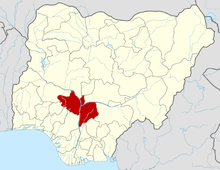 | |
| Countries |  | |
|---|---|---|
| Sections |
| |
| Tributaries (list) and distributaries | ||
| Cities | ||
| Lakes | ||
| Dams and bridges | ||
| Protected Areas | ||