Long Sault 12
| Long Sault 12 | |
|---|---|
| Indian reserve | |
| Long Sault Indian Reserve No. 12 | |
 Long Sault 12 | |
| Coordinates: 48°39′N 94°07′W / 48.650°N 94.117°WCoordinates: 48°39′N 94°07′W / 48.650°N 94.117°W | |
| Country |
|
| Province |
|
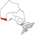
| District | Rainy River |
| First Nation | Rainy River |
| Area[1] | |
| • Land | 48.16 km2 (18.59 sq mi) |
| Population (2011)[1] | |
| • Total | 39 |
| • Density | 0.8/km2 (2/sq mi) |
| Website | www.rainyrverfirstnations.com |
Long Sault 12 is a First Nations reserve in northwestern Ontario. It is one of the reserves of the Rainy River First Nations.
References
- 1 2 "Long Sault 12 census profile". 2011 Census of Population. Statistics Canada. Retrieved 1 June 2015.
 |
Chapple | | ||
| Morley | |
Chapple | ||
| ||||
| | ||||
| Rainy River |
This article is issued from Wikipedia - version of the 1/26/2016. The text is available under the Creative Commons Attribution/Share Alike but additional terms may apply for the media files.