Loonse en Drunense Duinen
| Loonse en Drunense Duinen National Park | |
|---|---|
|
IUCN category II (national park) | |
|
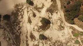
Aerial video of the Loonse en Drunese Duinen area. | |
| Location | Noord-Brabant, Netherlands |
| Coordinates | 51°38′52″N 5°06′53″E / 51.64778°N 5.11472°ECoordinates: 51°38′52″N 5°06′53″E / 51.64778°N 5.11472°E |
| Area | 35 km2 (14 sq mi) |
| Established | 2002[1] |
The Loonse en Drunense Duinen (Loonse and Drunense Dunes) is a national park situated in the south of the Netherlands, between the cities of Tilburg, Waalwijk & 's-Hertogenbosch. It has been designated as a national park since 2002. It is 35 km² (14 mile²) in area.

Detailmap
References
- ↑ (Dutch)http://www.nationaalpark.nl/ldd/ Nationaal park Loonse en Drunense Duinen
External links

| Wikimedia Commons has media related to Loonse en Drunense Duinen. |
This article is issued from Wikipedia - version of the 8/16/2016. The text is available under the Creative Commons Attribution/Share Alike but additional terms may apply for the media files.