Lord Howe Island Marine Park (Commonwealth waters)
| Lord Howe Island Marine Park (Commonwealth waters) Australia | |
|---|---|
|
IUCN category VI (protected area with sustainable use of natural resources) | |
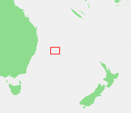 Location of Lord Howe Island in the Tasman Sea | |
| Coordinates | 31°38′22″S 159°10′10″E / 31.63944°S 159.16944°ECoordinates: 31°38′22″S 159°10′10″E / 31.63944°S 159.16944°E |
| Established | 2000 |
| Area | 3,000.63 km2 (1,158.5 sq mi) |
| Managing authorities | Commonwealth Department of the Environment |
| Website | Lord Howe Island Marine Park (Commonwealth waters) |
| Lord Howe Island Group | |
|---|---|
| Name as inscribed on the World Heritage List | |
| Type | Natural |
| Criteria | vii, x |
| Reference | 186 |
| UNESCO region | Asia-Pacific |
| Inscription history | |
| Inscription | 1982 (6th Session) |
Lord Howe Island Marine Park (Commonwealth waters) is a former marine park managed by the Commonwealth Department of the Environment, protecting the waters surrounding Lord Howe Island. It was adjacent to the 465.45 km² Lord Howe Island Marine Park managed by the Marine Parks Authority New South Wales. On 8 November 2012, it was replaced by a new protected area known as the Lord Howe Commonwealth Marine Reserve.[1][2]
References
- ↑ "Environment Protection and Biodiversity Conservation (Commonwealth Marine Reserves) Proclamation 2012 - F2012L02188". Commonwealth of Australia, Comlaw. Retrieved 17 March 2015.
- ↑ "New Lord Howe Commonwealth Marine Reserve". Commonwealth of Australia, Department of the Environment. Retrieved 17 March 2015.
This article is issued from Wikipedia - version of the 4/4/2016. The text is available under the Creative Commons Attribution/Share Alike but additional terms may apply for the media files.