Lorena, São Paulo
| Lorena | |
|---|---|
| Municipality | |
 | |
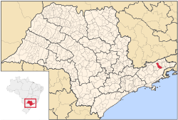 Location of Lorena within São Paulo state | |
 Lorena Location of Lorena within São Paulo state | |
| Coordinates: 22°43′51″S 45°07′29″W / 22.73083°S 45.12472°WCoordinates: 22°43′51″S 45°07′29″W / 22.73083°S 45.12472°W | |
| Country |
|
| Region | Southeast Brazil |
| State | São Paulo |
| Metropolitan Region | Vale do Paraíba e Litoral Norte |
| Founded | 1788 |
| Area | |
| • Total | 414.16 km2 (159.91 sq mi) |
| Elevation | 524 m (1,719 ft) |
| Population (2015) | |
| • Total | 87,178 |
| • Density | 210/km2 (550/sq mi) |
| • Literacy rate | 94.13% |
| Human Development Index | |
| • HDI | 0,807 |
| • Money Income | 0,740 |
| • Longevity | 0,761 |
| • Scholarship | 0,921 |
| Postal code | 12600-000 to 12614-999 |
| Area code | +55-12 |
| Website | www.lorena.sp.gov.br |
Lorena is a municipality in the state of São Paulo in Brazil.
General
Lorena is part of the Metropolitan Region of Vale do Paraíba e Litoral Norte.[1] The population is 87,178 (2015 est.) in an area of 414.16 km².[2] The elevation is 524 m.
The city was originated when a farm was constructed at the end of the 17th century. It became a parish in 1718, a municipality in 1788 and is a city since 1856. The city is now the seat of the Roman Catholic Diocese of Lorena. Its main business areas are industry, services and agro-business. It is also a highlight in region due to its three colleges, including areas from human to exact sciences.
The municipality contains the 281 hectares (690 acres) Lorena National Forest, created in 1934.[3]
Population history
| Year | Population |
|---|---|
| 2001 | 77,990 |
| 2004 | 77,843 |
| 2012 | 82,553 |
| 2015 | 87,178 |
Demographics
According to the 2010 IBGE Census, the population was 82,553, of which 80,182 are urban and 2,371 are rural. The average life expectancy for the municipality was 70.64 years. The literacy rate was at 94.13%.
References
- ↑ Assembleia Legislativa do Estado de São Paulo, Lei Complementar Nº 1.166
- ↑ Instituto Brasileiro de Geografia e Estatística
- ↑ FLONA de Lorena (in Portuguese), ISA: Instituto Socioambiental, retrieved 2016-10-02
External links
- (Portuguese) http://www.lorena.sp.gov.br
- (Portuguese) citybrazil.com.br
- (Portuguese) Lorena on Explorevale
- (Portuguese) The city of Lorena and several other places in the Vale do Paraíba
 |
Piquete | Piquete | Cachoeira Paulista | |
| Guaratinguetá | |
Canas and Silveiras | ||
| ||||
| | ||||
| Cunha |