Lough Nacung Upper
| Lough Nacung Upper Loch na Cuinge Uachtarach | |
|---|---|
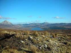 View towards Lough Nacung Upper, with Errigal to the left. | |
 Lough Nacung Upper | |
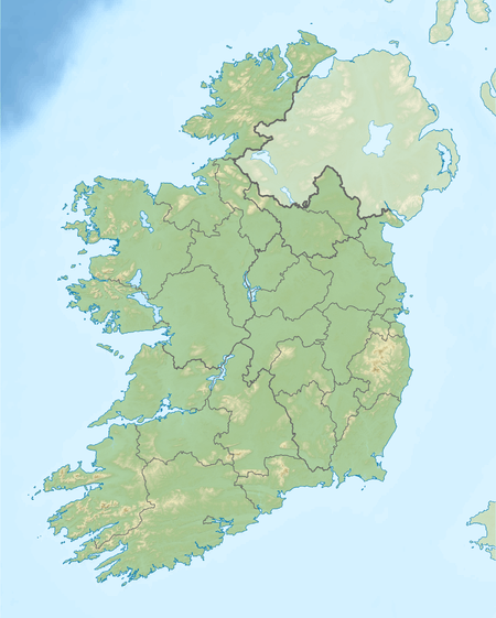
| Location | County Donegal, Ireland |
| Coordinates | 55°01′55″N 8°09′59″W / 55.031956°N 8.166305°WCoordinates: 55°01′55″N 8°09′59″W / 55.031956°N 8.166305°W |
| Primary inflows | Lough Dunlewey |
| Primary outflows | Lough Nacung Lower, to Clady River |
| Basin countries | Ireland |
| Surface area | 2.1 km2 (0.81 sq mi) |
| Surface elevation | 57 m (187 ft) |
Lough Nacung Upper (Irish: Loch na Cuinge Uachtarach meaning 'Upper Narrowness lake') is a lake in County Donegal, Ireland. It connects Lough Dunlewey to Lough Nacung Lower, which drains into the Clady River.[1] Lough Nacung is a Special Area of Conservation.[2]
The name is derived from the Irish cuing, meaning "narrow neck of land (as between two lakes)."[3][4]
Wildlife
The main fish species are sea trout and salmon.[5][6]
See also
References
- ↑ Administrator. "Lough Nacung Upper (IRL)".
- ↑ http://www.npws.ie/sites/default/files/protected-sites/conservation_objectives/CO000140.pdf
- ↑ http://www.logainm.ie/en/1396517
- ↑ http://www.teanglann.ie/en/fgb/cuing
- ↑ Website design and development Tibus. "Lough Nacung Lough Lacung Upper And Dunlewy Lake - Activities - Angling - Fisheries - All Ireland - Republic of Ireland - Donegal - Dunlewy - Discover Ireland".
- ↑ "Lough Nacung Upper, Donegal, Ireland Fishing Lake Maps - MyFishMaps.com".
This article is issued from Wikipedia - version of the 8/29/2016. The text is available under the Creative Commons Attribution/Share Alike but additional terms may apply for the media files.