Louth County Council
| Louth County Council Comhairle Contae Lú | |
|---|---|
| Type | |
| Type | |
| Leadership | |
|
Peter Savage, FF | |
| Structure | |
| Seats | 29 |
 | |
Political groups |
Sinn Féin (10) Fine Gael (7) Fianna Fáil (5) Green Party (2) Labour Party (2) Independent (3) |
| Elections | |
Last election | 23 May 2014 |
| Meeting place | |
| County Hall, Dundalk | |
| Website | |
|
www | |
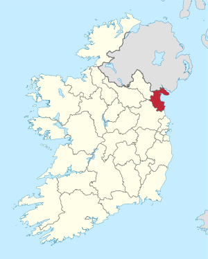
Louth County Council (Irish: Comhairle Contae Lú) is the authority responsible for local government in County Louth, Ireland. As a county council, it is governed by the Local Government Act 2001. The council is responsible for housing and community, roads and transportation, urban planning and development, amenity and culture, and environment.[1] The council has 29 elected members. Elections are held every five years and are by single transferable vote. The head of the council has the title of Cathaoirleach (Chairperson). The county administration is headed by a Chief Executive, Joan Martin. The county town is Dundalk.
Councillors
For the purpose of elections, the county is divided into four municipal districts: Ardee (6), Drogheda (10), Dundalk-Carlingford (6) and Dundalk South (7).[2]
2014 seats summary
| Party | Seats | |
|---|---|---|
| Sinn Féin | 10 | |
| Fine Gael | 7 | |
| Fianna Fáil | 5 | |
| Green Party | 2 | |
| Labour Party | 2 | |
| Independent | 3 | |
Councillors by municipal district
This list reflects the order in which councillors were elected on 23 May 2014.[3]
| Council members from 2014 election | |||
|---|---|---|---|
| Municipal District | Name | Party | |
| Ardee | Pearse McGeough | Sinn Féin | |
| Colm Markey | Fine Gael | ||
| Tom Cunningham | Sinn Féin | ||
| Liam Reilly | Fianna Fáil | ||
| Dolores Minogue | Fine Gael | ||
| Jim Tenanty | Independent | ||
| Drogheda | Imelda Munster | Sinn Féin | |
| Paul Bell | Labour Party | ||
| Alan Cassidy | Sinn Féin | ||
| Tommy Byrne | Fianna Fáil | ||
| Kevin Callan | Fine Gael | ||
| Oliver Tully | Fine Gael | ||
| Frank Godfrey | Independent | ||
| Richie Culhane | Fine Gael | ||
| Pio Smith | Labour Party | ||
| Kenneth Flood | Sinn Féin | ||
| Dundalk-Carlingford | Edel Corrigan | Sinn Féin | |
| Jim Loughran | Sinn Féin | ||
| Peter Savage | Fianna Fáil | ||
| John McGahon | Fine Gael | ||
| Conor Keelan | Fianna Fáil | ||
| Mark Dearey | Green Party | ||
| Dundalk South | Tomás Sharkey | Sinn Féin | |
| Declan Breathnach | Fianna Fáil | ||
| Maeve Anna Yore | Independent | ||
| Kevin Meenan | Sinn Féin | ||
| Jennifer Green | Sinn Féin | ||
| Marianne Butler | Green Party | ||
| Maria Doyle | Fine Gael | ||
Population by Municipal District
The table below sets out the population of the county broken down by municipal district.[4]
| Electoral Division | Population - 2006 | Population - 2011 | Population - 2016 |
|---|---|---|---|
| Louth | 111267 | 122897 | 128375 |
| Dundalk (Town + Rural), Co. Louth | 51758 | 56761 | 59557 |
| Dundalk Town, Co. Louth | 29037 | 31149 | 32288 |
| 004 Dundalk Urban No. 1, Co. Louth | 2190 | 2148 | 2169 |
| 005 Dundalk Urban No. 2, Co. Louth | 1211 | 1169 | 1140 |
| 006 Dundalk Urban No. 3, Co. Louth | 1400 | 1449 | 1710 |
| 007 Dundalk Urban No. 4, Co. Louth | 6183 | 6039 | 5970 |
| 023 Castletown (Part Urban), Co. Louth | 2518 | 2637 | 2685 |
| 027 Dundalk Rural (Part Urban), Co. Louth | 15440 | 17620 | 18514 |
| 030 Haggardstown (Part Urban), Co. Louth | 95 | 87 | 100 |
| Dundalk rural area, Co. Louth | 22721 | 25612 | 27269 |
| 019 Ballymascanlan, Co. Louth | 2016 | 2213 | 2206 |
| 020 Barronstown, Co. Louth | 647 | 744 | 746 |
| 021 Carlingford, Co. Louth | 1384 | 1801 | 2201 |
| 022 Castlering, Co. Louth | 935 | 1012 | 1034 |
| 023 Castletown (Part Rural), Co. Louth | 1421 | 1573 | 1622 |
| 024 Creggan Upper, Co. Louth | 684 | 787 | 852 |
| 025 Darver, Co. Louth | 562 | 568 | 678 |
| 026 Drummullagh, Co. Louth | 1120 | 1257 | 1350 |
| 027 Dundalk Rural (Part Rural), Co. Louth | 535 | 540 | 686 |
| 028 Faughart, Co. Louth | 905 | 991 | 958 |
| 029 Greenore, Co. Louth | 979 | 1169 | 1201 |
| 030 Haggardstown (Part Rural), Co. Louth | 5769 | 6303 | 6819 |
| 031 Jenkinstown, Co. Louth | 948 | 1173 | 1277 |
| 032 Killanny, Co. Louth | 683 | 799 | 825 |
| 033 Louth, Co. Louth | 1308 | 1505 | 1575 |
| 034 Mansfieldstown, Co. Louth | 640 | 807 | 855 |
| 035 Rathcor, Co. Louth | 1203 | 1352 | 1374 |
| 036 Ravensdale, Co. Louth | 982 | 1018 | 1010 |
| Drogheda Borough, Co. Louth | 28973 | 28576 | 29471 |
| 001 Fair Gate, Co. Louth | 9783 | 9806 | 10317 |
| 002 St. Laurence Gate, Co. Louth | 3801 | 4004 | 4075 |
| 003 West Gate, Co. Louth | 5899 | 6042 | 6284 |
| 041 St. Peter's (Part Urban), Co. Louth | 3460 | 2161 | 2099 |
| 047 St. Mary's (Part Urban), Co. Louth | 6030 | 6563 | 6696 |
| Ardee No. 1 rural area, Co. Louth | 17976 | 20262 | 20924 |
| 008 Ardee Rural, Co. Louth | 2626 | 2875 | 2952 |
| 009 Ardee Urban, Co. Louth | 4301 | 4554 | 4917 |
| 010 Castlebellingham, Co. Louth | 1371 | 1617 | 1688 |
| 011 Clonkeen, Co. Louth | 545 | 648 | 675 |
| 012 Collon, Co. Louth | 1380 | 1770 | 1859 |
| 013 Dromin, Co. Louth | 535 | 610 | 629 |
| 014 Dromiskin, Co. Louth | 1935 | 2187 | 2226 |
| 015 Drumcar, Co. Louth | 1385 | 1526 | 1451 |
| 016 Dunleer, Co. Louth | 2340 | 2796 | 2868 |
| 017 Stabannan, Co. Louth | 590 | 620 | 619 |
| 018 Tallanstown, Co. Louth | 968 | 1059 | 1040 |
| Louth rural area, Co. Louth | 12560 | 17298 | 18423 |
| 037 Clogher, Co. Louth | 2494 | 3031 | 3237 |
| 038 Dysart, Co. Louth | 777 | 918 | 925 |
| 039 Monasterboice, Co. Louth | 1164 | 1342 | 1365 |
| 040 Mullary, Co. Louth | 1528 | 1723 | 1754 |
| 041 St. Peter's (Part Rural), Co. Louth | 4022 | 6990 | 7605 |
| 042 Termonfeckin, Co. Louth | 2575 | 3294 | 3537 |
See also
References
- ↑ "Services". Louth County Council. Retrieved 31 March 2011.
- ↑ "2014 Local elections – Louth County Council". ElectionsIreland.org. Retrieved 5 June 2014.
- ↑ "2014 Local elections: Louth County Council". RTÉ News. Retrieved 5 June 2014.
- ↑ "Census of population by electoral division 2016". CENSUS OF POPULATION 2016 - PRELIMINARY RESULTS / GEOGRAPHIC CHANGES CENSUS OF POPULATION 2016 - PRELIMINARY RESULTS. CSO. Retrieved 17 July 2016.