Lower Upham

Coordinates: 50°58′23″N 1°15′20″W / 50.9730°N 1.2556°W
Lower Upham is a small village in Hampshire, England centred on the Post Office situated north-west of Bishop's Waltham on the B2177.
Governance
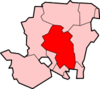
The village is part of the civil parish of Upham[1] and is part of the Owslebury and Curdridge ward of the City of Winchester non-metropolitan district of Hampshire County Council.[2]
Facilities
Lower Upham has a Post Office, the New Millennium Village Hall, two pubs - the Alma Inn and the Woodman Inn - and a small private airfield that is the home of Solent Flight,[3] a flying school. Other businesses in the village include a large motor home and caravan sales centre.
References
- ↑ legal record of public rights of way in Hampshire - sheet 1310 (PDF) (Map). 1 : 10,000. Cartography by Ordnance Survey. Hampshire County Council. 2008. Retrieved 5 November 2010.
- ↑ "Containing areas from mapit.mysociety.org". 2010. Retrieved 5 November 2010.
- ↑ "Solent Flight". Retrieved 2013-08-13.
- The geographic coordinates are from the Ordnance Survey.
This article is issued from Wikipedia - version of the 1/23/2016. The text is available under the Creative Commons Attribution/Share Alike but additional terms may apply for the media files.