Ludwigs Corner, Pennsylvania
| Ludwigs Corner, Pennsylvania | |
| Unincorporated community | |
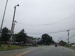 Ludwigs Corner at PA 100 and PA 401 | |
| Country | United States |
|---|---|
| State | Pennsylvania |
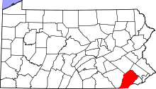
| County | Chester |
| Township | West Vincent |
| Elevation | 627 ft (191.1 m) |
| Coordinates | 40°06′56″N 75°41′38″W / 40.11556°N 75.69389°WCoordinates: 40°06′56″N 75°41′38″W / 40.11556°N 75.69389°W |
| Timezone | EST (UTC-5) |
| - summer (DST) | EDT (UTC-4) |
| Area code | 610 |
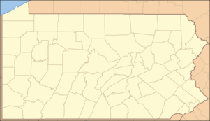 Location of Ludwigs Corner in Pennsylvania | |
 Location of Pennsylvania in the United States | |
Ludwigs Corner, Pennsylvania is a town located in West Vincent Township, four miles north of Eagle, PA. Upper Uwchlan Township, Chester County, Pennsylvania.
Geography
Ludwigs Corner is a community in Chester County, Pennsylvania located at latitude 40.116 and longitude -75.694 with an elevation of 627 feet.
Transportation
Ludwigs Corner is located at the junction of Pennsylvania Route 100 and Pennsylvania Route 401.
Located in West Vincent Township, Chester County, Pennsylvania, United State of America. Pennsylvania Route 401 is also known as Conestoga Road. In the colonial era this route was known as the Conestoga Turnpike and was a main path of travel between Philadelphia and western towns such as Lancaster. Many of the wagons were of a flat but arched design that would float when fording creeks and rivers with high water. They were known as Conestoga wagons.
History
Ludwigs Corner is the home of St. Andrews Episcopal Church, organized in 1832. Within the walled cemetery is the grave of Owen Josephus Roberts, United States Supreme Court Justice from 1930 - 1945.
Ludwigs Corner is known for being the host of the annual Ludwig's Corner Horse Show & Country Fair held over Labor Day Weekend. http://www.ludwigshorseshow.com/
References
- Ludwigs Corner, PA Profile
- Ludwigs Horse Show
- Ludwigs Grille
- Ludwigs Corner Fire Company
- Ludwigs Corner Veterinary Hospital
- Ludwig's Corner Riding & Driving Club
- Ludwig's Corner Horse Show and Country Fair
- Ludwig's Village Market