Luz (Santa Cruz da Graciosa)
| Luz | ||
| Civil Parish | ||
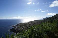 The most southern community in Luz, Carapacho, as seen from the Ponta da Restinga | ||
|
||
| Official name: Freguesia da Luz | ||
| Name origin: Portuguese for light; derived from the religious parish's name Nossa Senhora da Luz | ||
| Country | ||
|---|---|---|
| Autonomous Region | ||
| Island | Graciosa | |
| Municipality | Santa Cruz da Graciosa | |
| Localities | Alto do Sul, Fajã da Folga, Folga, Carapacho, Luz, Pedras Brancas | |
| Center | Luz | |
| - elevation | 88 m (289 ft) | |
| - coordinates | 39°1′18″N 27°59′23″W / 39.02167°N 27.98972°WCoordinates: 39°1′18″N 27°59′23″W / 39.02167°N 27.98972°W | |
| Highest point | Pico Timão | |
| - elevation | 398 m (1,306 ft) | |
| - coordinates | 39°2′15″N 28°0′30″W / 39.03750°N 28.00833°W | |
| Lowest point | Sea level | |
| - location | Atlantic Ocean | |
| - elevation | 0 m (0 ft) | |
| Area | 11.70 km2 (5 sq mi) | |
| - urban | 1.11 km2 (0 sq mi) | |
| Population | 683 (2011) | |
| Density | 58/km2 (150/sq mi) | |
| Settlement | fl.1600 | |
| - Parish | c.1601 | |
| - Civil Parish | c.1867 | |
| LAU | Junta Freguesia | |
| - location | Rua 6 Janeiro | |
| - coordinates | 39°1′19″N 27°59′26″W / 39.02194°N 27.99056°W | |
| President Junta | Manuel António Silva Ataíde Silveira (PPD-PSD) | |
| Timezone | Azores (UTC-1) | |
| - summer (DST) | Azores (UTC0) | |
| Postal Zone | 9880-154 | |
| Area Code & Prefix | (+351) 292 XXX-XXXX | |
| Patron Saint | Nossa Senhora de Luz | |
| Wikimedia Commons: Luz (Santa Cruz da Graciosa) | ||
| Website: cm-graciosa.azoresdigital.pt | ||

Luz is a civil parish in the municipality of Santa Cruz da Graciosa on the island of Graciosa in the Portuguese Azores. The population in 2011 was 683,[1] in an area of 11.70 km².[2]
References
This article is issued from Wikipedia - version of the 8/6/2016. The text is available under the Creative Commons Attribution/Share Alike but additional terms may apply for the media files.