Machias River
| Machias River | |
|---|---|
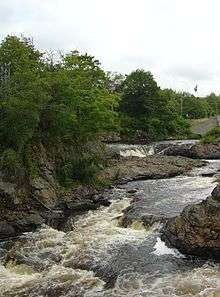 Bad Little Falls | |
| Country | United States[1] |
| Basin | |
| Main source |
Western Washington County, Maine[2] 1,371 feet (418 m)[1] |
| River mouth |
Machias Bay[2] 0 feet (0 m) |
| Basin size | 498.3 square miles (1,291 km2)[1] |
| Physical characteristics | |
| Length | 60 miles (97 km)[3] |
The Machias River is a 60.0-mile-long (96.6 km)[3] river in Maine, USA. It flows through Washington County in the eastern part of the state, from Third Machias Lake (45°05′21″N 67°51′49″W / 45.0892°N 67.8636°W), passing the town of Machias and emptying into Machias Bay.[4]
History
The name is believed to derive from a Passamaquoddy word meaning "bad run of water" or "bad little falls", either of which does describe the difficulty of canoeing some of the rapids in the river.[4][5] The river was used as a seasonal migration route by Indians.[4] The first European settlement is believed to have been an English trading post in 1633, almost immediately destroyed by the French. The first permanent settlement in the area in 1763 was intended to be a site for the production of lumber, with 1.6 million board feet produced in 1764. The river mouth and offshore waters were the scene of the Battle of Machias — the first naval battle of the American Revolution, occasioned by the British need for lumber for Boston.[6] Lumber remained a main industry along the river, with the river powering the sawmills. Production was as high as 40 million feet in a year, but declined in the late 19th century to between 10 and 20 million feet per year (with a similar amount of lath also produced). The woods cut were originally pine, and later also hemlock and spruce.[7] Natural water flow in the river varies seasonally, so dams were built to power the mills. The last dam was breached in 1973, and fully removed in 2000.[4][8][9]
See also
References
- 1 2 3 "Watershed Overview and Data Access". Senator George J. Mitchell Center for Environmental and Watershed Research, The University of Maine. Archived from the original on 2011-10-04. Retrieved 2008-08-26.
- 1 2 Saul B. Cohen, ed. (2000). The Columbia gazeteer of North America. New York: Columbia University Press. ISBN 0-231-11990-9. Retrieved 2008-08-26.
- 1 2 U.S. Geological Survey. National Hydrography Dataset high-resolution flowline data. The National Map, accessed 2011-06-22
- 1 2 3 4 Rooks, Douglas (Oct–Nov 2002). "Mesmerized by a River in Maine - Machias River". National Wildlife. National Wildlife Federation. Retrieved 2008-09-17.
- ↑ Federal Writers' Project (1937). Maine - A Guide 'Down East'. American Guide Series. Houghton Mifflin. pp. 234–236. ISBN 1-60354-018-0. Retrieved 2008-09-17.
- ↑ Maine League of Historical Societies and Museums (1970). Doris A. Isaacson, ed. Maine: A Guide 'Down East'. Rockland, Maine: Courier-Gazette, Inc. pp. 280–281.
- ↑ Defebaugh, James Elliott (1907). History of the Lumber Industry of America. 2. Chicago: The American Lumberman. pp. 82–83. Retrieved 2008-09-17.
- ↑ Wells, Walter, Secretary of the Hydrographic Survey (December 1867). Provisional Report upon the Water-Power of Maine. Augusta, Maine: Stevens & Sayward. pp. 194–196. Retrieved 2008-09-17.
- ↑ Hawkins, Yvonne L. "East Machias River, Maine". National Fish Passage Program. U.S. Fish & Wildlife Program. Archived from the original on July 6, 2008. Retrieved 2008-09-17.
External links
- "Machias River". Geographic Names Information System. United States Geological Survey. 30 September 1980. Retrieved 2009-09-27.
Coordinates: 44°41.8′N 67°23.5′W / 44.6967°N 67.3917°W