Mahinerangi Wind Farm
| Mahinerangi Wind Farm | |
|---|---|
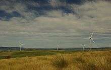 Four of the twelve turbines at Mahinerangi Wind Farm, 2 April 2011 | |
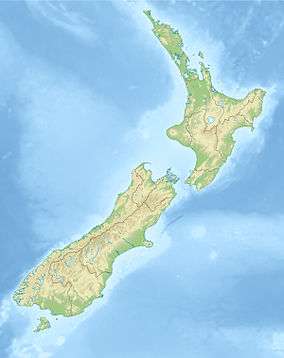 Location of Mahinerangi Wind Farm in New Zealand | |
| Country | New Zealand |
| Location | north of Lake Mahinerangi, Otago |
| Coordinates | 45°45′38″S 169°54′18″E / 45.76056°S 169.90500°ECoordinates: 45°45′38″S 169°54′18″E / 45.76056°S 169.90500°E |
| Status | Operational |
| Construction began | September 2010 |
| Commission date | March 2011 |
| Construction cost | NZ$75 million[1] |
| Owner(s) | TrustPower |
| Wind farm | |
| Type | Onshore |
| Avg. site elevation | 600–730 m (1,970–2,400 ft) |
| Site usage | Farming |
| Site area | 17.23 km2 (6.65 sq mi) |
| Rotor diameter | 90 m (295 ft) |
| Rated wind speed | 15 m/s (54 km/h; 34 mph) |
| Power generation | |
| Units operational | 12 |
| Make and model | Vestas: V90-3MW |
| Nameplate capacity |
36 MW Planned: 200 MW |
| Average generation | 105 GWh (stage 1)[2] |
|
Website Mahinerangi - Trustpower | |
The Mahinerangi Wind Farm is a wind farm on the north side of Lake Mahinerangi, around 50 km west of Dunedin, in Otago, New Zealand. Stage one of the wind farm, generating 36 MW, was commissioned in March 2011, and an additional 164 MW is consented to be commissioned in further stages.
The wind farm is owned and operated by generator-retailer TrustPower. It is the company's third wind farm, and the second major wind farm to be built in the South Island.
History
Resource consent was granted in 2007[3] and later confirmed after an appeal to the Environment Court.[4]
Construction of stage 1 of the wind farm, consisting of twelve turbines, began in September 2010.[5] Vestas V90-3MW turbines were chosen for the wind farm, having previously used by TrustPower for stage 3 of its Tararua Wind Farm in 2007. Turbines were shipped to Port Chalmers, and trucked through Dunedin to their final site.
The wind farm generated its first electricity on 21 February 2011, with the first two turbines being commissioned.[6] All twelve stage one turbines were completed and generating electricity by the end of March 2011.[1]
Location
The wind farm will be contained within 17.23 km2 (6.65 sq mi) of land at an elevation of 600 to 730 meters above sea level and about 50 kilometres west of Dunedin.[7] Most of the land in the proposed site is pasture grazed by sheep and cattle.[8]
Transmission
Electricity generated from Stage 1 turbines will be injected into TrustPower's nearby Deep Stream and Waipori hydro schemes. This allows the wind turbines to operate in synergy with the hydro schemes, allowing water to be preserved during off-peak times while the wind farm is generating. Electricity from Stage 1 and the hydro schemes is then injected into either Dunedin's local distribution network, or into Transpower's Halfway Bush-Balclutha-Gore 110 kV line at Berwick.
Stage 2 and beyond is too large to inject into the Waipori/Deep Stream system. Instead, it will inject into Transpower's Halfway Bush-Roxburgh 110 kV line, which passes a short distance south of the wind farm.[2]
See also
References
- 1 2 "DUNEDIN'S NEWEST WIND FARM OPEN TO THE PUBLIC". TrustPower. Retrieved 5 April 2011.
- 1 2 "About the Mahinerangi Wind Farm". TrustPower. Retrieved 22 February 2011.
- ↑ TrustPower Welcomes Mahinerangi Wind Farm Decision (2007-10-01) Scoop
- ↑ "Mahinerangi wind farm passes court hurdle". Otago Daily Times. NZPA. 22 December 2008. Retrieved 19 October 2011.
- ↑ "Mahinerangi Wind Farm Project Community Meeting Progress Booklet". 15 December 2010. Retrieved 2011-01-23.
- ↑ "Mahinerangi Windfarm up and in action". Channel 9 Dunedin. 21 February 2011. Retrieved 21 February 2011.
- ↑ TrustPower Mahinerangi Wind Farm
- ↑ TrustPower - AEE Volume I
External links
- TrustPower - Mahinerangi Wind Farm information page
- Upland Landscape Protection Society