Mallee Highway
| Mallee Highway South Australia–Victoria | |
|---|---|
 | |
| General information | |
| Type | Highway |
| Length | 377 km (234 mi) |
| Route number(s) |
|
| Former route number |
|
| Major junctions | |
| West end | |
|
for full list see major intersections | |
| East end | |
| Location(s) | |
| Major settlements | Lameroo, Pinnaroo, Ouyen, Manangatang |
| Highway system | |
|
Highways in Australia National Highway • Freeways in Australia Highways in South Australia Highways in Victoria | |
| |
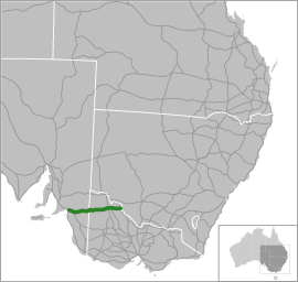
The Mallee Highway[1][2][3] (formerly the Ouyen Highway in Victoria) is part of the shortest route between Adelaide and Sydney. It runs east from Tailem Bend in South Australia through cereal-growing farmland at the southern end of the Murray Mallee to Pinnaroo near the border with Victoria, where it crosses Pinaroo-Loxton and Pinaroo-Bordertown Road in Pinaroo. It continues in Victoria through Ouyen, where it crosses the Calder Highway (the old Ouyen Highway terminated at the Calder Highway and never proceeded east), and Piangil, where it crosses the Murray Valley Highway.
Route B12, however continues past the Mallee Highway terminus along the Murray Valley Highway for two kilometres north of Piangil, linking to Tooleybuc Road where it continues until it crosses the New South Wales border and the Murray River at Tooleybuc. The road then continues to Balranald, at the Murrumbidgee River (without the B12 designation). Tooleybuc Road terminates at the Sturt Highway which continues en route to Sydney via the Hume Highway or Mid-Western Highway.
Major intersections and towns
See also
- Highways in Australia
- Highways in Victoria
- List of highways in New South Wales
- List of highways in South Australia
References
- ↑ Mallee Highway Touring Route, Design Train. Retrieved on 15 September 2013.
- ↑ National Routes - Interstate Links, Main Roads Victoria. Retrieved on 15 September 2013.
- ↑ B12 Mallee Highway, Ozroads. Retrieved on 15 September 2013.
External links
![]() Media related to Mallee Highway at Wikimedia Commons
Media related to Mallee Highway at Wikimedia Commons
Road infrastructure in South Australia | ||
|---|---|---|
| Freeways | ||
| Interstate highways | ||
| State highways | ||
| Arterial roads |
| |
| Outback tracks | ||