Mariscala
| Mariscala | |
|---|---|
| Town | |
 Mariscala Location in Uruguay | |
| Coordinates: 34°2′0″S 54°47′0″W / 34.03333°S 54.78333°WCoordinates: 34°2′0″S 54°47′0″W / 34.03333°S 54.78333°W | |
| Country |
|
| Department | Lavalleja Department |
| Population (2011) | |
| • Total | 1,626 |
| Time zone | UTC -3 |
| Postal code | 30001 |
| Dial plan | +598 4449 (+4 digits) |
Mariscala is a small town in the Lavalleja Department of southeastern Uruguay.
Location
The town is located on Route 8, 60 kilometres (37 mi) northeast of Minas.
History
Its status was elevated to "Pueblo" (village) category on 1 February 1918 by decree Ley Nº 5.639[1] and on 27 June 1988 to "Villa" (town) by decree Ley Nº 15.960.[2]
Population
In 2011 Mariscala had a population of 1,626.[3]
| Year | Population |
|---|---|
| 1908 | 2,464 |
| 1963 | 1,440 |
| 1975 | 1,395 |
| 1985 | 1,415 |
| 1996 | 1,507 |
| 2004 | 1,624 |
| 2011 | 1,626 |
Source: Instituto Nacional de Estadística de Uruguay[1]
Places of worship
- Our Lady of Pompei Parish Church (Roman Catholic)
References
- 1 2 "Statistics of urban localities (1908–2004)" (PDF). INE. 2012. Retrieved 4 September 2012.
- ↑ "Ley Nº 15.960". República Oriental del Uruguay, Poder Legislativo. 1988. Retrieved 4 September 2012.
- ↑ "Censos 2011 Cuadros Lavalleja". INE. 2012. Retrieved 25 August 2012.
External links
Capital: Minas | ||
| Towns and villages | 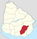 | |
| Sights | ||
This article is issued from Wikipedia - version of the 5/13/2013. The text is available under the Creative Commons Attribution/Share Alike but additional terms may apply for the media files.