Mata Qaqa
| Mata Qaqa | |
|---|---|
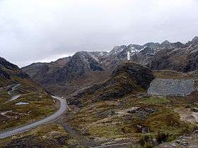 Mata Qaqa in the background (center-right) as seen from the road above Qiruqucha | |
| Highest point | |
| Elevation | 4,400 m (14,400 ft) [1] |
| Coordinates | 9°41′20″S 77°09′55″W / 9.68889°S 77.16528°WCoordinates: 9°41′20″S 77°09′55″W / 9.68889°S 77.16528°W |
| Geography | |
 Mata Qaqa Location in Peru | |
| Location | Peru, Ancash Region |
| Parent range | Andes |
Mata Qaqa (Quechua mata united, qaqa rock,[2][3] "united rock", hispanicized spelling Matagaga) is a mountain on the eastern extensions of the Cordillera Blanca in the Andes of Peru, about 4,400 metres (14,436 ft) high. It is situated in the Ancash Region, Huari Province, Chavin de Huantar District. Mata Qaqa lies east of the Ranra Kancha valley (Quechua for "stoney corral", also spelled Rangracancha) and northeast of the Challwa valley (Quechua challwa fish, also spelled Challhua). The Musna River (Mosna) flows along its northern slopes.
References
- ↑ escale.minedu.gob.pe - UGEL map of the Huari Province (Ancash Region)
- ↑ Diccionario Quechua - Español - Quechua, Academía Mayor de la Lengua Quechua, Gobierno Regional Cusco, Cusco 2005 (Quechua-Spanish dictionary)
- ↑ Teofilo Laime Ajacopa, Diccionario Bilingüe Iskay simipi yuyayk'ancha, La Paz, 2007 (Quechua-Spanish dictionary)
This article is issued from Wikipedia - version of the 12/6/2015. The text is available under the Creative Commons Attribution/Share Alike but additional terms may apply for the media files.