Mathon, Herefordshire
For the Swiss place with the same name, see Mathon, Switzerland.
| Mathon | |
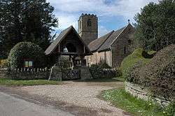 Lych gate to Mathon Church |
|
 Mathon |
|
| Population | 280 |
|---|---|
| OS grid reference | SO734458 |
| Civil parish | Mathon |
| Unitary authority | Herefordshire |
| Ceremonial county | Herefordshire |
| Region | West Midlands |
| Country | England |
| Sovereign state | United Kingdom |
| Postcode district | WR13 |
| Police | West Mercia |
| Fire | Hereford and Worcester |
| Ambulance | West Midlands |
| EU Parliament | West Midlands |
|
|
Coordinates: 52°06′36″N 2°23′06″W / 52.11°N 2.385°W
Mathon is a small village and civil parish in eastern Herefordshire, England, lying just to the west of the Malvern Hills between Malvern and Ledbury. Nearby villages include Cradley and Colwall. Immediately to the east is the country boundary with Worcestershire.
The population was recorded by the 2011 census at 280.[1]
Politics
Mathon has a parish council.
The parishes of Bosbury, Coddington, Colwall, and Mathon together form the ward of Hope End, which returns one elected councillor to Herefordshire Council.[2] The most recent election was in May 2015, in which the Conservative candidate, Tony Johnson, was elected.[3] Councillor Johnson is the Leader of the Council.[4]
References
- ↑ Neighbourhood Statistics
- ↑ LGBCE Final recommendations 2014 review - PDF map
- ↑ Herefordshire Council Hope End declaration 2015
- ↑ Herefordshire Council Cllr A W Johnson
External links
| Wikimedia Commons has media related to Mathon, Herefordshire. |
This article is issued from Wikipedia - version of the 2/8/2016. The text is available under the Creative Commons Attribution/Share Alike but additional terms may apply for the media files.