Mazar Dam
| Mazar Dam | |
|---|---|
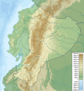 Location of Mazar Dam in Ecuador | |
| Country | Ecuador |
| Location | Cañar Province |
| Coordinates | 2°35′31.71″S 78°37′03.58″W / 2.5921417°S 78.6176611°WCoordinates: 2°35′31.71″S 78°37′03.58″W / 2.5921417°S 78.6176611°W |
| Purpose | Power |
| Status | Operational |
| Construction began | 2004 |
| Opening date | 2010 |
| Owner(s) | Corporación Eléctrica del Ecuador (CELEC) |
| Dam and spillways | |
| Type of dam | Embankment, concrete-face rock-fill |
| Impounds | Paute River |
| Height | 166 m (545 ft) |
| Length | 340 m (1,120 ft) |
| Elevation at crest | 2,166 m (7,106 ft) |
| Width (base) | 500 m (1,600 ft) |
| Dam volume | 5,483,000 m3 (193,600,000 cu ft) |
| Reservoir | |
| Active capacity | 309×106 m3 (251,000 acre·ft) |
| Inactive capacity | 410×106 m3 (330,000 acre·ft) |
| Catchment area | 4,388 km2 (1,694 sq mi) |
| Max. length | 31 km (19 mi) |
| Normal elevation | 2,153 m (7,064 ft) |
| Power station | |
| Commission date | 2010 |
| Hydraulic head | 68 m (223 ft) |
| Turbines | 2 x 85 MW (114,000 hp) Francis-type |
| Installed capacity | 170 MW (230,000 hp) |
| Annual generation | 800 gigawatt-hours (2,900 TJ) (est.) |
The Mazar Dam is a concrete-face rock-fill dam on the Paute River Cañar Province, Ecuador. The purpose of the dam is hydroelectric power generation and it is located directly upstream of the Paute Dam as part of the Amaluza-Molino project. The dam's power station has an installed capacity of 170 megawatts (230,000 hp). Construction on the dam began in 2004; the generators were commissioned in 2010 and the remaining works were completed in 2011.[1][2][3]
References
- ↑ "Introduction". CELEC. Retrieved 7 May 2013.
See all pages for the Mazar Dam
- ↑ "Mazar Dam and Hydropower Project". Tractebel. Retrieved 7 May 2013.
- ↑ "Mazar Hydroelectric Plant". Impreglio. Retrieved 7 May 2013.
This article is issued from Wikipedia - version of the 9/19/2015. The text is available under the Creative Commons Attribution/Share Alike but additional terms may apply for the media files.