Mbogwe District
| Mbogwe District | |
|---|---|
| District | |
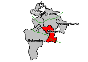 Mbogwe District's location within Geita Region. | |
| Coordinates: 03°22′S 032°9′E / 3.367°S 32.150°ECoordinates: 03°22′S 032°9′E / 3.367°S 32.150°E | |
| Country | Tanzania |
| Region | Geita Region |
| Population (2012) | |
| • Total | 193,922 |
Mbogwe District is one of the five districts of Geita Region of Tanzania. It is bordered to the north by Chato District and Geita District, to the east by Kahama Rural District and Kahama Urban District, to the south by Kahama Rural District, and to the west by Bukombe District.
As of 2012, the population of Mbogwe was 193,922.[1] Mbogwe was established in 2012 and became part of the newly established Geita Region.[2]
Transport
Mbogwe district is connected by paved trunk road T3 (from Morogoro to the Rwanda border), that passes through the district from east to west.[3]
Wards
As of 2012, Mbogwe District was administratively divided into 16 wards.[4]
The 12 wards in 2012:
|
|
|
|
References
- ↑ "2012 Census". National Bureau of Statistics. Archived from the original on March 5, 2016. Retrieved 1 December 2015.
- ↑ "Tanzania: New Regions, Districts Will Facilitate Service Provision". All Africa. Retrieved 1 December 2015.
- ↑ "Trunk and Regional Roads in Tanzania". Tanroads. Archived from the original on December 8, 2015. Retrieved 1 December 2015.
- ↑ "2012 Census". National Bureau of Statistics. Archived from the original on March 5, 2016. Retrieved 1 December 2015.
This article is issued from Wikipedia - version of the 9/21/2016. The text is available under the Creative Commons Attribution/Share Alike but additional terms may apply for the media files.