Mechraa Safa
| Mechraa Safa مشرع الصفاء | |
|---|---|
| Commune and town | |
 | |
 Mechraa Safa | |
| Coordinates: DZ 35°23′2″N 1°3′12″E / 35.38389°N 1.05333°E | |
| Country |
|
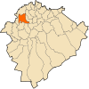
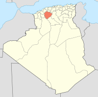
| Province | Tiaret Province |
| District | Mechraâ Sfa District |
| Area | |
| • Total | 116.91 sq mi (302.79 km2) |
| Population (2008) | |
| • Total | 16,077 |
| Time zone | CET (UTC+1) |
| CP | 14145 |
Mechraa Safa is a town and commune in Tiaret Province in northwestern Algeria.[1]
References
- ↑ "Communes of Algeria". Statoids. Retrieved December 12, 2010.
Coordinates: 35°23′02″N 1°03′12″E / 35.38389°N 1.05333°E
This article is issued from Wikipedia - version of the 5/18/2013. The text is available under the Creative Commons Attribution/Share Alike but additional terms may apply for the media files.