Meghraj
| Meghraj (Arvalli) મેઘરજ | |
|---|---|
| city | |
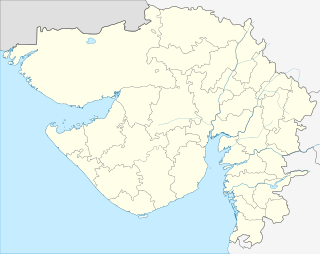 Meghraj (Arvalli)  Meghraj (Arvalli) Location in Gujarat, India | |
| Coordinates: 23°30′N 73°30′E / 23.5°N 73.5°ECoordinates: 23°30′N 73°30′E / 23.5°N 73.5°E | |
| Country |
|
| State | Gujarat |
| District | Aravalli district |
| Elevation | 178 m (584 ft) |
| Population (2011) | |
| • Total | 11,363 |
| Languages | |
| • Official language | Gujarati |
| • Spoken languages (Organised alphabetically) | |
| Time zone | IST (UTC+5:30) |
| PIN | 383350 |
| Vehicle registration | GJ-31 |
| Literacy | 86.05% |
| Website |
gujaratindia |
Meghraj is a census town in Aravalli district in the Indian state of Gujarat.
Geography
Meghraj is a Taluka in Arvalli District of Gujarat State, India. It is located 22 km towards west from District headquarters Modasa. 108 km from State capital Gandhinagar towards west .
Meghraj Taluka is bounded by Malpur Taluka towards South, Modasa Taluka towards west, Khanpur Taluka towards South, Simalwara Taluka towards East. Modasa City, Lunawada City, Sagwara City are the nearby Cities to Meghraj.
Meghraj consist of 279 Villages and 43 Panchayats. It is in the 149 m elevation(altitude).
Dungarpur, Sabarkantha, Gandhinagar, Banswara, Dahod, Shamlaji, Majum Dam, Kaleshwari, Kadana Dam are the nearby Important tourist destinations to see Meghraj is located at 23°30′N 73°30′E / 23.5°N 73.5°E.[2] It has an average elevation of 178 metres (583 feet).
Demographics
As of 2011 India census,[3] The Meghraj Census Town has population of 11,363 of which 5,834 are males while 5,529 are females as per report released by Census India 2011. Population of Children with age of 0-6 is 1343 which is 11.82% of total population of Meghraj (CT). In Meghraj Census Town, Female Sex Ratio is of 948 against state average of 919. Moreover Child Sex Ratio in Meghraj is around 784 compared to Gujarat state average of 890. Literacy rate of Meghraj city is 86.05% higher than state average of 78.03%. In Meghraj, Male literacy is around 92.68% while female literacy rate is 79.23%. Meghraj Census Town has total administration over 2,401 houses to which it supplies basic amenities like water and sewerage. It is also authorized to build roads within Census Town limits and impose taxes on properties coming under its jurisdiction.Town had various National bank for his banking facility.
History
In 1526 Sultan Bahadur first time came in Meghraj (Mahmud nagar), Sultan's journey Jonpur to Ahmedabad one stopped Mahmud nagar after death of his brother Sultan Sikandar Shah.
In 1528 Sultan Bahadur Shah again came to Mahmud nagar (Meghraj), That time King of Dungarpur came in Meghraj for Welcoming of Sultan Bahadur Shah.
Etymology
Name of city comes from the name of Thakur Sahab Shri Meghrajsinhji s/o Hamrajsinhji in the Samvant 1410. They establish state of 42 village under Meghraj and then after shifted to Moti Mori in Samvant 1601 and establish state of 62 villages
Places
Meghraj has beautiful places which you can visit like, Gayatri Temple, Hanuman Temple, Gheli Mata Temple, Ambe Mata Temple & Mahadev Temple, Shree Nathji Temple, Roleshwar Mahadev Temple, Nana-Nani Garden and Newly made Jala-Sai Temple, Jumma Masjid, Masjide Raza, Ashrafi Masjid, Madina Masjid, Ashrafiya Darool Qir'aat, Chishtiya Darbar and Babe Noorul Ain Gate.
Sufi Saints
(1) Hazrat Syed Jahangir baba r.a, Khalifa of Dariyai Dulha (virpur)
(2) Hazrat Ali ji Wali ji r.a, (Modasa road)
(3) Hazrat Saat Syed baba r.a, (at hills)
(4) Hazrat Geban Shah baba also known as a Moriwale pir baba r.a, (behind bus station)
(5) Hazrat Bakshu Shahid r.a ( opp.library)
(6) Hazrat Ogan Syed r.a (Kasba)
References
- ↑ Ajay Mitra Shastri; R. K. Sharma; Devendra Handa (2005). Revealing India's past: recent trends in art and archaeology. Aryan Books International. p. 227. ISBN 8173052875, ISBN 978-81-7305-287-3.
It is an established fact that during 10th-11th century.....Interestingly the language was known as the Gujjar Bhakha.
- ↑ "redirect to /world/IN/09/Meghraj.html".
- ↑ "Meghraj City Population Census 2011 - Gujarat".