Melbourne tram route 112
| Route 112 | ||||
|---|---|---|---|---|
| West Preston – St Kilda/Fitzroy Street | ||||
 | ||||
| Overview | ||||
| System | Melbourne tramway network | |||
| Operator | Yarra Trams | |||
| Depot | East Preston | |||
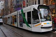
| Vehicle | A class, B class, D2 class | |||
| Began service | 1 April 2000 [1] | |||
| Ended service | 27 July 2014 [2] | |||
| Route | ||||
| Locale | Melbourne, Australia | |||
| Start | West Preston | |||
| Via |
Thornbury Northcote Fitzroy North Fitzroy East Melbourne Collins Street South Melbourne Albert Park Middle Park | |||
| End | St Kilda | |||
| Zone(s) | Zone 1 – entire route | |||
| Timetable | Route 112 timetable | |||
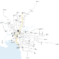
| Map | Route 112 map | |||
| ||||
Tram route 112 was a public transport service in Melbourne, Victoria, Australia. It ran from West Preston, in the northern suburbs to St Kilda. The route number was introduced in 2002, and was discontinued on Sunday 27 July 2014 as part of a wider timetable change to the Yarra Trams network.[3]
Like most tram routes in Melbourne, it fell within Metlink ticketing Zone 1.
The route 11 was a variation of the 112, running between West Preston and Victoria Harbour Docklands (via Collins Street) during AM and PM peak periods on weekdays. This was until the 27th of July when Yarra Trams decided to axe the 112 in favour of two separate sections, the now Full-time 11 and the new route 12.
History
The origins of route 112 lie in separate tram lines, a cable tram from Spencer Street to Fitzroy North, an electric line from Fitzroy North to West Preston and an electric line from the CBD to Fitzroy Street, St Kilda (partially built utilising a former cable line).
A cable line was opened from Spencer Street to Barkly Street, Fitzroy North along Collins Street, MacArthur Street, Gisborne Street, Victoria Parade, Brunswick Street and St Georges Road on the 2 October 1886, by the Melbourne Tramway and Omnibus Company.[4]
The Fitzroy, Northcote and Preston Tramways Trust had started constructing a system but it wasn't until after its takeover by the Melbourne and Metropolitan Tramways Board that services first ran, on 1 April 1920, part of this system included a line from Barkly Street, Fitzroy North to Regent Street, Preston.[5] This network was orphaned from the rest of the electric network until 24 March 1925 when a line along Holden Street, Pilkington Street and Barkly Street was built by the Melbourne and Metropolitan Tramways Board to allow access to the CBD via Lygon Street.[6]
On 31 October 1925 a new route to St Kilda was opened by the Melbourne and Metropolitan Tramways Board, travelling from St Kilda Road along Sturt Street, Eastern Road, Heather Street, Park Street, Clarendon Street, Albert Road, Canterbury Road, Mills Street, Danks Street, Patterson Street, Park Street, Mary Street and Beaconsfield Parade.[6]
In 1929 the Melbourne and Metropolitan Tramways Board started converting the Collins Street cable lines to electric traction, with the last cable tram running down Collins Street on 14 September 1929, and the first electric tram on 8 December 1929.[6] At the same time the Melbourne and Metropolitan Tramways Board built a new electric line down the centre of Victoria Parade to replace the cable line, which opened on 15 September 1929.[6] The remaining section of cable tram track along Brunswick Street and St Georges Road was converted to electric traction by the Melbourne and Metropolitan Tramways Board on 26 October 1930,[6] connecting the West Preston electric line to Collins Street.
The South Melbourne cable line was converted to electric traction by the Melbourne and Metropolitan Tramways Board on 25 July 1937,[7] with the section of track between Clarendon Street and Hanna Street (now Kings Way) along City Road abandoned in favour of a new section of track along Clarendon Street, between City Road and Flinders Street. This allowed trams to travel from St Kilda to Collins Street, along Clarendon Street and Spencer Street.
On 8 November 1959 the track along Mary St and Beaconsfield Parade, St Kilda West were abandoned in favour of a short extension along Park Street to Fitzroy Street, St Kilda, route 112's current terminus.[8]
From the 1950s until 1992 this line ran mainly as two separate routes which overlapped along Collins Street. Route 12, ran from the Fitzroy Street, St Kilda terminus to St Vincent's plaza, with the destinations being 'South Melbourne - St Kilda Beach' and 'City - Brunswick Street' respectively. Route 11 was similar to the current route, running from West Preston to the City, terminating at Spencer Street, where trams would reverse. The destinations were simply 'West Preston' and 'City'. A route 10 also operated out of peak hours, which traversed the whole line from West Preston to St Kilda Beach.[9]
Route 10 was discontinued in 1992, with only routes 11 and 12 operating, which were then replaced by route 112 in 2002, a new number for the old route 10.
In 2005 route 112 was part of the Think>Tram project, with measures aimed at improving tram services introduced to Clarendon Street, South Melbourne.[10]
With the extension of the Collins Street tram tracks into the Docklands in 2009, route 11 was resurrected for peak hour services running from West Preston (or actually most frequently as the 11d from Miller Street in Thornbury) down Collins and terminating in the Docklands.[11]
In July 2014, route 112 was removed from the network and replaced by routes 11 and 12. This was part of the program by Yarra Trams to simplify the network and increase passenger capacity.
Route
Description
.jpg)
Route 112 and Route 11 run from West Preston south on Gilbert Road, turning east at Miller Street and south onto St Georges Road. They then traverse the suburbs of Thornbury, Northcote and Fitzroy North. At Edinburgh Gardens they turn slightly into Brunswick Street and continue south into Fitzroy. They both turn west into Victoria Parade, passing through St Vincent's Plaza, East Melbourne, St Vincent's Hospital, the Eye and Ear Hospital and then turn south onto Gisborne Street. They then continue south west along MacArthur Street and turns west into Collins Street, entering the CBD, passing Melbourne Town Hall and City Square. It is at this point where Route 11 and Route 112 traverse on separate lines.

Route 11 continues west along Collins Street, passing through Batman's Hill and Harbour Esplanade, where it intersects with tram route 70 to Waterfront City Docklands, as well as the City Circle Tram. It then continues west along Collins Street and approaches the terminus at Victoria Harbour.
Route 112 turns south from Collins Street into Spencer Street, passing Southern Cross Station. It then crosses the Yarra River and enters Southbank on Clarendon Street where it traverses through South Melbourne. It turns south wast at Albert Road, passing the Melbourne Sports and Aquatic Centre, it turns south east briefly onto Canterbury Road, Albert Park and turns south west into Mills Street, and finally south east into Danks Street, Middle Park, Patterson Street and Park Street, where it continues and arrives at its terminus at Fitzroy Street, St Kilda.
Schematic map
| Route 112 | ||||||||||||||||||||||||||||||||||||||||||||||||||||||||||||||||||||||||||||||||||||||||||||||||||||||||||||||||||||||||||||||||||||||||||||||||||||||||||||||||||||||||||||||||||||||||||||||||||||
|---|---|---|---|---|---|---|---|---|---|---|---|---|---|---|---|---|---|---|---|---|---|---|---|---|---|---|---|---|---|---|---|---|---|---|---|---|---|---|---|---|---|---|---|---|---|---|---|---|---|---|---|---|---|---|---|---|---|---|---|---|---|---|---|---|---|---|---|---|---|---|---|---|---|---|---|---|---|---|---|---|---|---|---|---|---|---|---|---|---|---|---|---|---|---|---|---|---|---|---|---|---|---|---|---|---|---|---|---|---|---|---|---|---|---|---|---|---|---|---|---|---|---|---|---|---|---|---|---|---|---|---|---|---|---|---|---|---|---|---|---|---|---|---|---|---|---|---|---|---|---|---|---|---|---|---|---|---|---|---|---|---|---|---|---|---|---|---|---|---|---|---|---|---|---|---|---|---|---|---|---|---|---|---|---|---|---|---|---|---|---|---|---|---|---|---|---|
| ||||||||||||||||||||||||||||||||||||||||||||||||||||||||||||||||||||||||||||||||||||||||||||||||||||||||||||||||||||||||||||||||||||||||||||||||||||||||||||||||||||||||||||||||||||||||||||||||||||
|
Not all stops are shown, refer to timetable for full list of stops. | ||||||||||||||||||||||||||||||||||||||||||||||||||||||||||||||||||||||||||||||||||||||||||||||||||||||||||||||||||||||||||||||||||||||||||||||||||||||||||||||||||||||||||||||||||||||||||||||||||||
Operation
Route 112 and Route 11 are run from East Preston depot[12] and Southbank depot[13] and are predominantly run with A1 class, B1 class, B2 class and D2 class trams.
See also
References
- ↑ "Tram route numbers" (PDF). Yarra Trams. Retrieved 2014-07-23.
- ↑ "Timetables - Public Transport Victoria". PTV. 2014-04-06. Retrieved 2014-07-23.
- ↑ "Capacity boost for tram passengers". Yarra Trams. 9 July 2014. Retrieved 25 July 2014.
- ↑ "Melbourne Tramway and Omnibus Company Limited" (PDF), TMSV Running Journal Vol 9 No 3, page 16, retrieved 2011-10-17
- ↑ "Milestones, 1911 - 1920", Yarra Trams, retrieved 2011-10-17
- 1 2 3 4 5 "Milestones, 1921 - 1930", Yarra Trams, retrieved 2011-10-17
- ↑ "Milestones, 1931 - 1940", Yarra Trams, retrieved 2011-10-17
- ↑ "Re: Barkly Street", jebounds, retrieved 2011-10-17
- ↑ As shown on period maps and destination rolls in chat groups and sale sites
- ↑ "BATCHELOR PROMPTS MOTORISTS TO THINK TRAM", Yarra Trams, retrieved 2011-10-17
- ↑ "11 West Preston - Victoria Harbour Docklands". Public Transport Victoria. Retrieved 2014-06-27.
- ↑ "East Preston Depot", VICSIG, retrieved 2011-10-17
- ↑ "Southbank Depot", VICSIG, retrieved 2011-10-17
External links
| Wikimedia Commons has media related to |