Mettet
| Mettet | ||
|---|---|---|
| Municipality | ||
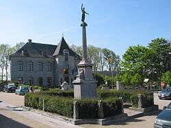
|
Mettet town hall | ||
| ||
 Mettet Location in Belgium | ||
|
Location of Mettet in the province of Namur 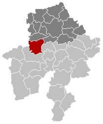 | ||
| Coordinates: 50°19′N 04°40′E / 50.317°N 4.667°ECoordinates: 50°19′N 04°40′E / 50.317°N 4.667°E | ||
| Country | Belgium | |
| Community | French Community | |
| Region | Wallonia | |
| Province | Namur | |
| Arrondissement | Namur | |
| Government | ||
| • Mayor | Michel Remy (ICAP) | |
| • Governing party/ies | ICAP, RC-MR | |
| Area | ||
| • Total | 116.78 km2 (45.09 sq mi) | |
| Population (1 January 2016)[1] | ||
| • Total | 12,898 | |
| • Density | 110/km2 (290/sq mi) | |
| Postal codes | 5640, 5641, 5644, 5646 | |
| Area codes | 071 | |
| Website | www.mettet.be | |

Mettet (French pronunciation: [mɛ.tɛ]) is a Walloon municipality located in the Belgian province of Namur, 20 km southeast of Charleroi. On 1 January 2006 Mettet had 11,977 inhabitants. The total area is 116.78 km², giving a population density of 103 inhabitants per km².
The municipality consists of the following sub-municipalities: Mettet proper, Biesme, Biesmerée, Ermeton-sur-Biert, Furnaux, Graux, Oret, Saint-Gérard, and Stave.
Circuit Jules Tacheny
In Mettet there is a race track, Circuit Jules Tacheny Mettet, for motorbikes and cars.
Notable people
- Alain Crépin (1954–), conductor and musician
See also
 St. John the Baptist church
 Baptismal font of Furnaux
References
- ↑ Population per municipality as of 1 January 2016 (XLS; 397 KB)
External links
-
 Media related to Mettet at Wikimedia Commons
 - Official website (in French)
- Official website of race track "Jules Tacheny" (in French and Dutch)
- Motorbike Race Circuit "Jules Tacheny" (in French)
- Mettet d'autrefois, Site of old postcards and old photographs of Mettet. Collection of PIERRE HUBOT
 |
Fosses-la-Ville | | ||
| Gerpinnes (WHT) Florennes |
|
Profondeville Anhée | ||
| ||||
| | ||||
| Florennes | Onhaye |
Municipalities in the Province of Namur | ||
|---|---|---|
| Dinant | 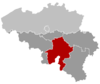 | |
| Namur | ||
| Philippeville | ||
This article is issued from Wikipedia - version of the 12/1/2016. The text is available under the Creative Commons Attribution/Share Alike but additional terms may apply for the media files.