Middlebush Brook (New Jersey)
| Middlebush Brook | |
|---|---|
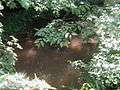
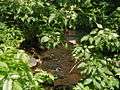 Middlebush Brook crossing Blackwells Mills Road, near its mouth | |
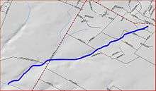 Middlebush Brook map | |
| Country | United States |
| Basin | |
| Main source | 40°29′21″N 74°30′41″W / 40.48917°N 74.51139°W |
| River mouth |
59 ft (18 m) 40°28′21″N 74°33′02″W / 40.47250°N 74.55056°WCoordinates: 40°28′21″N 74°33′02″W / 40.47250°N 74.55056°W |
| Progression | Six Mile Run, Millstone River, Raritan River, Atlantic Ocean |
Middlebush Brook is a tributary of Six Mile Run in Somerset County, New Jersey in the United States.
As its name suggests, Middlebush Brook begins in the town of Middlebush. Its source is at 40°29′21″N 74°30′41″W / 40.48917°N 74.51139°W,[1] just south of Hamilton Street in north-western Franklin Park.
Tributaries
This stream has several unnamed tributaries. One closely parallels South Middlebush Road before splitting into two more tributaries. One of them ends in a development near Amwell Road (the same road as Hamilton Street), while the other is a drain for a residential development.
Course
Middlebush Brook starts at 40°29′21″N 74°30′41″W / 40.48917°N 74.51139°W[1] in a commercial development. It exits the commerce area and flows through a marsh, then crossing Bennetts Lane. It runs behind a cow farm then crosses South Middlebush Road right above Blackwells Mills Road. It crosses Blackwells Mills Road a little later on, then drains into Six Mile Run at 40°28′21″N 74°33′02″W / 40.47250°N 74.55056°W.[1]
It has several branches, including one that runs for a distance along South Middlebush Road and one that flows to a residential development near CR-514 (Amwell Road).
Accessibility
This stream flows through wooded areas downstream, where it is not accessible easily. It is accessible upstream though, where it flows through a residential development.
It may be accessed, though with difficulty, at the Blackwells Mills Road crossing.
Terrain
This stream has a streambed composed of small boulders, making it difficult to walk on. Some locations have pebbles. It is not muddy and therefore is not suitable for frogs.
Sister tributaries
Gallery
- Middlebush Brook at Blackwells Mills Road, just before its mouth
 Middlebush Brook at Blackwells Mills Road, just before its mouth
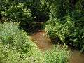 Middlebush Brook crossing South Middlebush Road
 Branch of Middlebush Brook running alongside South Middlebush Road
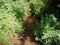 Branch of Middlebush Brook crossing South Middlebush Road
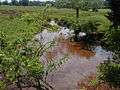 Branch of Middlebush Brook mentioned above running through a dairy farm
 Middlebush Brook crossing Bennets Lane
 Middlebush Brook crossing Bennets Lane, lost in a marsh
See also
References
- 1 2 3 "USGS GNIS - Middlebush Brook". USGS. Retrieved 9 June 2010.