Milevska Planina
| Milevska planina | |
|---|---|
 View towards Milevska Planina's highest peak from the Bulgarian side | |
| Highest point | |
| Elevation | 1,738 m (5,702 ft) [1] |
| Coordinates | 42°33′54″N 22°26′22″E / 42.56500°N 22.43944°ECoordinates: 42°33′54″N 22°26′22″E / 42.56500°N 22.43944°E |
| Geography | |
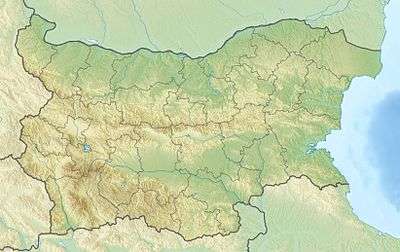 Milevska planina Location within Bulgaria | |
| Location | Pčinja District, Serbia |
Milevska planina[1] (Cyrillic: Милевска планина) is a mountain in western Bulgaria and southeastern Serbia, near the town of Bosilegrad. Its highest peak Milevets (Bulgarian: Милевец) or Krvavi kamik (Serbian Cyrillic: Крвави камик) has an elevation of 1,738 meters above sea level. It is located at the border of Bulgaria and Serbia.
References
- 1 2 Jovan Đokić. "Katalog planina Srbije". PSD Kopaonik Beograd.
This article is issued from Wikipedia - version of the 5/25/2015. The text is available under the Creative Commons Attribution/Share Alike but additional terms may apply for the media files.