Mill Neck, New York
| Mill Neck, New York | |
|---|---|
| Village | |
| Incorporated Village of Mill Neck | |
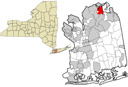 Location in Nassau County and the state of New York. | |
 Location within the state of New York | |
| Coordinates: 40°53′20″N 73°33′22″W / 40.88889°N 73.55611°WCoordinates: 40°53′20″N 73°33′22″W / 40.88889°N 73.55611°W | |
| Country | United States |
| State | New York |
| County | Nassau |
| Area | |
| • Total | 2.9 sq mi (7.6 km2) |
| • Land | 2.6 sq mi (6.7 km2) |
| • Water | 0.3 sq mi (0.9 km2) |
| Elevation | 141 ft (43 m) |
| Population (2010) | |
| • Total | 997 |
| Time zone | Eastern (EST) (UTC-5) |
| • Summer (DST) | EDT (UTC-4) |
| ZIP code | 11765 |
| Area code(s) | 516 |
| FIPS code | 36-47405 |
| GNIS feature ID | 0957256 |
| Website |
millneckvillage |
Mill Neck is a village in Nassau County, New York in the United States. The population was 997 at the 2010 census.
Geography
Mill Neck is located at 40°53′20″N 73°33′22″W / 40.88889°N 73.55611°W (40.888890, -73.556080).[1] The highest point of Mill Neck is Mill Hill.
According to the United States Census Bureau, the village has a total area of 2.9 square miles (7.5 km2), of which, 2.6 square miles (6.7 km2) of it is land and 0.3 square miles (0.78 km2) of it (11.95%) is water.
Demographics
| Historical population | |||
|---|---|---|---|
| Census | Pop. | %± | |
| 1930 | 516 | — | |
| 1940 | 101 | −80.4% | |
| 1950 | 505 | 400.0% | |
| 1960 | 701 | 38.8% | |
| 1970 | 982 | 40.1% | |
| 1980 | 959 | −2.3% | |
| 1990 | 977 | 1.9% | |
| 2000 | 825 | −15.6% | |
| 2010 | 997 | 20.8% | |
| Est. 2015 | 1,015 | [2] | 1.8% |
As of the census[4] of 2000, there were 825 people, 295 households, and 241 families residing in the village. The population density was 319.8 people per square mile (123.5/km²). There were 326 housing units at an average density of 126.4 per square mile (48.8/km²). The racial makeup of the village was 92.00% White, 0.24% African American, 4.73% Asian, 2.42% from other races, and 0.61% from two or more races. Hispanic or Latino of any race were 5.58% of the population.
There were 295 households out of which 34.6% had children under the age of 18 living with them, 74.9% were married couples living together, 5.8% had a female householder with no husband present, and 18.0% were non-families. 13.6% of all households were made up of individuals and 6.4% had someone living alone who was 65 years of age or older. The average household size was 2.80 and the average family size was 3.07.
In the village the population was spread out with 23.3% under the age of 18, 4.4% from 18 to 24, 24.7% from 25 to 44, 31.0% from 45 to 64, and 16.6% who were 65 years of age or older. The median age was 44 years. For every 100 females there were 97.4 males. For every 100 females age 18 and over, there were 97.2 males.
The median income for a household in the village was $125,477, and the median income for a family was $145,643. Males had a median income of $95,429 versus $51,528 for females. The per capita income for the village was $77,899. About 2.3% of families and 2.9% of the population were below the poverty line, including none of those under age 18 and 3.6% of those age 65 or over.
References
- ↑ "US Gazetteer files: 2010, 2000, and 1990". United States Census Bureau. 2011-02-12. Retrieved 2011-04-23.
- ↑ "Annual Estimates of the Resident Population for Incorporated Places: April 1, 2010 to July 1, 2015". Retrieved July 2, 2016.
- ↑ "Census of Population and Housing". Census.gov. Retrieved June 4, 2015.
- ↑ "American FactFinder". United States Census Bureau. Retrieved 2008-01-31.
 |
Lattingtown | Bayville | | |
| Locust Valley | |
Oyster Bay Harbor | ||
| ||||
| | ||||
| Matinecock | Upper Brookville | Oyster Bay |