Millerand Island
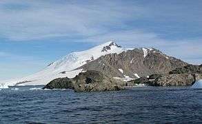 Millerand Island from San Martín Base, 2011 | |
 Millerand Island Location in Antarctica | |
| Geography | |
|---|---|
| Location | Antarctica |
| Coordinates | 68°09′S 67°13′W / 68.150°S 67.217°WCoordinates: 68°09′S 67°13′W / 68.150°S 67.217°W |
| Length | 6 km (3.7 mi) |
| Width | 6 km (3.7 mi) |
| Administration | |
|
None | |
| Demographics | |
| Population | Uninhabited |
| Additional information | |
| Administered under the Antarctic Treaty System | |
Millerand Island or Cap Millerand is a high rugged island 6 km (3 nmi) in diameter, lying 7 km (4 nmi) south of Cape Calmette, off the west coast of Graham Land. Millerand Island was discovered by the French Antarctic Expedition (1908-1910) under Jean-Baptiste Charcot. Millerand Island was named by Jean-Baptiste Charcot, presumably for Alexandre Millerand, French statesman.
See also
- Composite Antarctic Gazetteer
- List of Antarctic and sub-Antarctic islands
- List of Antarctic islands south of 60° S
- SCAR
- Territorial claims in Antarctica
References
External links
![]() This article incorporates public domain material from the United States Geological Survey document "Millerand Island" (content from the Geographic Names Information System).
This article incorporates public domain material from the United States Geological Survey document "Millerand Island" (content from the Geographic Names Information System).
This article is issued from Wikipedia - version of the 11/12/2016. The text is available under the Creative Commons Attribution/Share Alike but additional terms may apply for the media files.