Minami-Urawa Station
Minami-Urawa Station 南浦和駅 | |
|---|---|
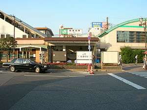 Station west entrance, June 2005 | |
| Location |
2-37-2 Minami-Urawa, Minami-ku, Saitama-shi, Saitama-ken (埼玉県さいたま市南区南浦和2丁目37-2) Japan |
| Operated by |
|
| Line(s) | |
| Platforms | 2 island platforms + 2 side platforms |
| History | |
| Opened | 1961 |
| Traffic | |
| Passengers (FY2014) | 58,408 daily |
Minami-Urawa Station (南浦和駅 Minami-urawa-eki) is a railway station on the Musashino Line in Minami-ku, Saitama, Saitama Prefecture, Japan, operated by East Japan Railway Company (JR East).[1]
Lines
Minami-Urawa Station is served by the Keihin-Tōhoku Line linking Saitama Prefecture with central Tokyo and Kanagawa Prefecture, and the orbital Musashino Line. Many Keihin-Tōhoku services originate and terminate at this station. The station is located 31.7 kilometers from Fuchū-Hommachi Station on the Musashino Line.
Station layout
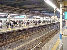
The station consists of two island platforms for the Keihin-Tōhoku Line, serving four tracks, with two opposed elevated side platforms for the Musashino Line located above and at a right angle to the island platforms. The station building is elevated and is located on a mezzanine level in between the two sets of platforms. The station has a Midori no Madoguchi staffed ticket office.
Platforms
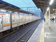
| 1, 2 | ■ Keihin-Tōhoku Line | for Ueno, Tokyo, Shinagawa, Yokohama, and Negishi Line for Ōfuna |
| 3, 4 | ■ Keihin-Tōhoku Line | for Kita-Urawa, Yono, and Ōmiya |
| 5 | ■ Musashino Line | for Minami-Koshigaya, Nishi-Kokubunji, and Fuchū-Hommachi |
| 6 | ■ Musashino Line | for Shin-Matsudo, Nishi-Funabashi, Tokyo, and Kaihin-Makuhari |
| Minami-Urawa Track Layout | |||||||||||||||||||||||||||||||||||||||||||||||||||||||||||||||||||||||||||||||||||||||||||||||||||||||||||||||||||||||||||||||||||||||||||||||||||
|---|---|---|---|---|---|---|---|---|---|---|---|---|---|---|---|---|---|---|---|---|---|---|---|---|---|---|---|---|---|---|---|---|---|---|---|---|---|---|---|---|---|---|---|---|---|---|---|---|---|---|---|---|---|---|---|---|---|---|---|---|---|---|---|---|---|---|---|---|---|---|---|---|---|---|---|---|---|---|---|---|---|---|---|---|---|---|---|---|---|---|---|---|---|---|---|---|---|---|---|---|---|---|---|---|---|---|---|---|---|---|---|---|---|---|---|---|---|---|---|---|---|---|---|---|---|---|---|---|---|---|---|---|---|---|---|---|---|---|---|---|---|---|---|---|---|---|---|
Legend
| |||||||||||||||||||||||||||||||||||||||||||||||||||||||||||||||||||||||||||||||||||||||||||||||||||||||||||||||||||||||||||||||||||||||||||||||||||
Adjacent stations
| « | Service | » | ||
|---|---|---|---|---|
| Keihin-Tōhoku Line | ||||
| Warabi | Rapid | Urawa | ||
| Warabi | Local | Urawa | ||
| Musashino Line | ||||
| Musashi-Urawa | - | Higashi-Urawa | ||
History
The station opened on July 1, 1961 on the Keihin-Tōhoku Line.[1] The Musashino Line platforms opened on April 1, 1973 when passenger services on the line started. A widely reported incident occurred at the station about 9:15 a.m. on July 22, 2013, when a woman fell into the gap between a train and the edge of the platform. About 40 bystanders helped station staff push against the side of the train so that the woman could be safely extricated. A member of the station staff began pushing the train after the woman fell into the gap and bystanders quickly joined in to help with the rescue effort. The woman was not seriously injured.[3]
Passenger statistics
In fiscal 2014, the station was used by an average of 58,048 passengers daily (boarding passengers only).[4] The passenger figures for previous years are as shown below.
| Fiscal year | Daily average |
|---|---|
| 2000 | 51,863[5] |
| 2005 | 55,624[6] |
| 2010 | 56,804[7] |
| 2011 | 56,408[8] |
| 2012 | 57,499[9] |
See also
References
- 1 2 各駅情報(南浦和駅) [Minami-Urawa Station information] (in Japanese). East Japan Railway Company. Retrieved 2 November 2011.
- ↑ 祖田圭介 (October 2006). "立体交差駅66クロス". Tetsudo Fan (Magazine). 交友. 546: p. 26. (Japanese)
- ↑ http://the-japan-news.com/news/article/0000423339
- ↑ 各駅の乗車人員 (2014年度) [Station passenger figures (Fiscal 2014)] (in Japanese). Japan: East Japan Railway Company. Retrieved 3 February 2016.
- ↑ 各駅の乗車人員 (2000年度) [Station passenger figures (Fiscal 2000)] (in Japanese). Japan: East Japan Railway Company. Retrieved 3 August 2013.
- ↑ 各駅の乗車人員 (2005年度) [Station passenger figures (Fiscal 2005)] (in Japanese). Japan: East Japan Railway Company. Retrieved 3 August 2013.
- ↑ 各駅の乗車人員 (2010年度) [Station passenger figures (Fiscal 2010)] (in Japanese). Japan: East Japan Railway Company. Retrieved 3 August 2013.
- ↑ 各駅の乗車人員 (2011年度) [Station passenger figures (Fiscal 2011)] (in Japanese). Japan: East Japan Railway Company. Retrieved 3 August 2013.
- ↑ 各駅の乗車人員 (2012年度) [Station passenger figures (Fiscal 2012)] (in Japanese). Japan: East Japan Railway Company. Retrieved 3 August 2013.
External links
| Wikimedia Commons has media related to Minami-Urawa Station. |
- JR East station information (Japanese)
Coordinates: 35°50′52″N 139°40′09″E / 35.84778°N 139.66917°E