Minnesota State Highway 109
| ||||
|---|---|---|---|---|
| Route information | ||||
| Maintained by Mn/DOT | ||||
| Length: | 32.833 mi[1] (52.840 km) | |||
| Existed: | April 22, 1933[2] – present | |||
| Major junctions | ||||
| West end: |
| |||
|
| ||||
| East end: |
| |||
| Location | ||||
| Counties: | Faribault, Freeborn | |||
| Highway system | ||||
| ||||

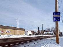
Minnesota State Highway 109 (MN 109) is a highway in south-central Minnesota, which runs from its intersection with U.S. Highway 169 in Winnebago and continues east to its eastern terminus at its interchange with Interstate 90 in Alden.
Highway 109 is 33 miles (53 km) in length and passes through the cities of Winnebago, Wells, and Alden.
Route description
Highway 109 serves as an east–west route in south-central Minnesota between Winnebago, Delavan, Easton, Wells, and Alden.
Highway 109 runs concurrent with State Highway 22 on 2nd Avenue NW in the city of Wells for two blocks.
The route is also known as South Broadway in Alden.
Highway 109, together with State Highway 22 and I-90, are used by motorists as a direct route between Albert Lea and Mankato.
Highway 109 mostly parallels I-90 and State Highway 30 throughout its route. 109 intersects I-90 at its eastern terminus in Alden.
History
Highway 109 was authorized in 1933 between Alden and Wells.[2] The route was expanded west of Wells to Winnebago in 1949.[3]
The entire route was paved by 1953, including the expanded section between Wells and Winnebago.[4]
Major intersections
| County | Location | mi[1] | km | Destinations | Notes |
|---|---|---|---|---|---|
| Faribault | Winnebago | 0.000 | 0.000 | ||
| Delavan | 7.927 | 12.757 | |||
| Lura Township | 10.926 | 17.584 | |||
| Barber Township | 11.932 | 19.203 | |||
| Walnut Lake Township | 16.034 | 25.804 | |||
| 17.611 | 28.342 | ||||
| Wells | 22.590 | 36.355 | South end of MN 22 overlap | ||
| 22.764 | 36.635 | North end of MN 22 overlap | |||
| 23.279 | 37.464 | ||||
| Freeborn | Carlston Township | 31.670 | 50.968 | ||
| Alden | 32.808 | 52.799 | Interchange | ||
1.000 mi = 1.609 km; 1.000 km = 0.621 mi
| |||||
References
- 1 2 "Trunk Highway Log Point Listing - Construction District 7" (PDF). Minnesota Department of Transportation. August 23, 2010. Retrieved November 19, 2010.
- 1 2 "Chapter 440-H.F. No. 2000", Session Laws of Minnesota for 1933, Mike Holm, Secretary of State, pp. 881–897
- ↑ "Chapter 663-H.F. No. 1792", Session Laws of Minnesota for 1949, Earl L. Berg, Commissioner of Administration, pp. 1177–1185
- ↑ Riner, Steve. "Details of routes 101–149". The Unofficial Minnesota Highways Page. Self-published. Retrieved November 19, 2010.