Minnesota State Highway 270
| ||||
|---|---|---|---|---|
| Route information | ||||
| Defined by MS § 161.115(201) | ||||
| Maintained by Mn/DOT | ||||
| Length: | 7.659 mi[1] (12.326 km) | |||
| Existed: | July 1, 1949[2] – present | |||
| Major junctions | ||||
| West end: | CR 13 at Hills | |||
| East end: |
| |||
| Location | ||||
| Counties: | Rock | |||
| Highway system | ||||
| ||||

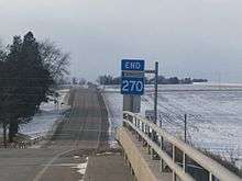
Minnesota State Highway 270 (MN 270) is a state highway in the southwest corner of Minnesota, which runs from its intersection with County Road 13 (CR 13) in the city of Hills, and continues east to its eastern terminus at its intersection with U.S. Highway 75 (US 75) in Clinton Township, eight miles (13 km) south of Luverne. The highway is 7.7 miles (12.4 km) in length.
Route description
MN 270 serves as a short east–west route in southwest Minnesota between Hills and US 75. Its route follows 1st Street in Hills. The western terminus of Highway 270 at Hills is located approximately four miles (6.4 km) from the South Dakota state line and two miles (3.2 km) from the Iowa state line.[3] The highway is legally defined as Route 270 in the Minnesota Statutes.[4]
History
MN 270 was authorized in 1949.[2] Originally, the highway turned southward along present-day CR 11 and back east on a local road to pass through Steen. It was moved to its present direct routing in 1953.[5][6]
The route was paved in 1954 or 1955.[7]
Major intersections
The entire route is in Rock County.
| Location | mi[1] | km | Destinations | Notes | |
|---|---|---|---|---|---|
| Hills | 0.000 | 0.000 | Western terminus at western city limits | ||
| Clinton Township | 7.659 | 12.326 | Eastern terminus | ||
| 1.000 mi = 1.609 km; 1.000 km = 0.621 mi | |||||
References
- 1 2 Construction District 7 (September 4, 2009). "Trunk Highway Logpoint Listing" (PDF). Minnesota Department of Transportation. Retrieved May 29, 2010.
- 1 2 Berg, Earl L. (ed.). "Chapter 663-H.F. No. 1792". Session Laws of Minnesota for 1949. State of Minnesota. pp. 1177–1185.
- ↑ General Highway Map of Rock County (PDF) (Map). Minnesota Department of Transportation. 2010. Retrieved May 4, 2010.
- ↑ Minnesota Legislature (2010). "161.115, Additional Trunk Highways". Minnesota Statutes. Office of the Revisor of Statutes, State of Minnesota. Retrieved January 23, 2011.
- ↑ 1953 Official Road Map of Minnesota (Map). Cartography by The H.M. Gousha Company. Minnesota Department of Highways. January 1, 1953. § C20. Retrieved January 23, 2011.
- ↑ 1954 Official Road Map of Minnesota (Map). Cartography by The H.M. Gousha Company. Minnesota Department of Highways. January 1, 1954. § C20. Retrieved January 23, 2011.
- ↑ 1956 Official Road Map of Minnesota (Map). Cartography by The H.M. Gousha Company. Minnesota Department of Highways. 1956. § B20-C20. Retrieved January 23, 2011.