Mont Pelat
| Mont Pelat | |
|---|---|
.JPG) Mont Pelat | |
| Highest point | |
| Elevation | 3,052 m (10,013 ft) [1] |
| Prominence | 770 m (2,530 ft) [1] |
| Coordinates | 44°15′54″N 6°42′21″E / 44.26500°N 6.70583°ECoordinates: 44°15′54″N 6°42′21″E / 44.26500°N 6.70583°E [1] |
| Geography | |
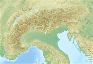 Mont Pelat Location in the alps | |
| Location | Provence-Alpes-Côte-d'Azur, France |
| Parent range | Maritime Alps |
Mont Pelat (3,050m), is a mountain of the Maritime Alps located in the chain of mountains between the high valley of Verdon to the west, the high valley of Var to the east and the Bachelard valley in the North. Located in the department of Alpes-de-Haute-Provence, it gives it name to the Pelat Massif. The summit is located in the central area of the Mercantour National Park. It is known as being one of the easiest of the 3,000m Alpine peaks to climb. It overlooks the magnificent glacial Allos Lake, the largest mountain lake in Europe which is 2,227 m (7,306 ft) above sea level.
The normal access route is through the valley of Pelat, located southeast of the summit and accessible both from Lake Allos and from the Col de la Cayolle. The path presents no particular difficulty. On the summit, the view stretches from the Montagne Sainte-Victoire in the south to Mont Blanc in the north.
References
- 1 2 3 "Mont Pelat". Peakbagger.com. Retrieved 5 January 2015.
1. ↑ Bénédicte Fénié, Jean-Jacques Fénié Provençal Toponymy, Southwest Publishing, 2002 (reprint), ISBN 978-2-87901-442-5, p. 80 2. ↑ Pages 4 and 5 in "Explanatory Note" of the geological map 1:50 000 ALLOS XXXV-40 published by the Bureau of Geological and Mining Research, Berger-Levrault, Nancy, 728720-9-1968 3. ↑ Definitions SOIUSA Mountain Gate Mountain Gate