Mount Emmons (Alaska)
For other uses, see Mount Emmons (disambiguation).
| Mount Emmons | |
|---|---|
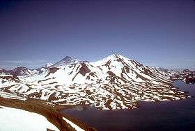 View, looking northeast, of Mount Emmons in 1987 | |
| Highest point | |
| Elevation | 4,711 ft (1,436 m) [1] |
| Listing | List of volcanoes in the United States |
| Coordinates | 55°20′27″N 162°04′21″W / 55.3409°N 162.0726°WCoordinates: 55°20′27″N 162°04′21″W / 55.3409°N 162.0726°W [2] |
| Geography | |
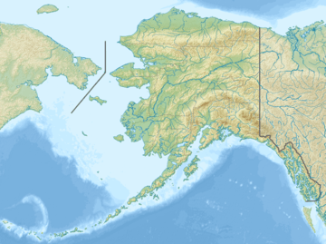 Mount Emmons Alaska | |
| Location | Alaska Peninsula. Alaska, U.S. |
| Parent range | Aleutian Range |
| Topo map | USGS Cold Bay B-1 |
| Geology | |
| Mountain type | Caldera |
| Volcanic arc/belt | Aleutian Arc |
| Last eruption | Unknown |
Mount Emmons is a post-caldera stratovolcano within the Emmons Lake caldera on the Alaska Peninsula. It is one of three cones constructed within the 7-by-11-mile (11 km × 18 km) caldera, which also contains an elongated crater lake on its southwest side.[1]
The most recent of several caldera-forming eruptions at Emmons Lake occurred more than 10,000 years ago. No historical eruptions have occurred at Emmons Lake.[3]
Mount Emmons is a local name published on a USGS map in 1943.[4]
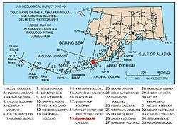
Map showing volcanoes of Alaska. The mark is set at the location of Emmons Lake.
References
- 1 2 "Emmons Lake". Global Volcanism Program. Smithsonian Institution. Retrieved 2005-01-26.
- ↑ "Emmons Lake Volcanic Center". Alaska Volcano Observatory. Retrieved 2009-06-01.
- ↑ "Volcanoes of the Alaska Peninsula and Aleutian Islands". Digital Data Series DDS-40. U.S. Geological Survey. 2002. Retrieved 2009-06-01.
- ↑ "Mount Emmons". Geographic Names Information System. United States Geological Survey. Retrieved 2009-06-01.
This article is issued from Wikipedia - version of the 1/3/2016. The text is available under the Creative Commons Attribution/Share Alike but additional terms may apply for the media files.