Mount Fernie
| Mount Fernie | |
|---|---|
 Mount Fernie | |
| Highest point | |
| Elevation | 2,210 m (7,250 ft) |
| Coordinates | 49°31′26″N 115°07′23″W / 49.524°N 115.123°WCoordinates: 49°31′26″N 115°07′23″W / 49.524°N 115.123°W |
| Geography | |
| Location | Fernie, British Columbia, Canada |
| Parent range | Canadian Rockies |
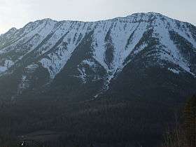
Mount Fernie is a 2,210-metre-high (7,251 ft) mountain, and is directly northwest of the town of Fernie, British Columbia. It offers an excellent hiking trail for those that can handle steep and challenging ridges. Mount Fernie Provincial Park is adjacent to the Mountain.
References
This article is issued from Wikipedia - version of the 11/28/2016. The text is available under the Creative Commons Attribution/Share Alike but additional terms may apply for the media files.