Mount Landolt
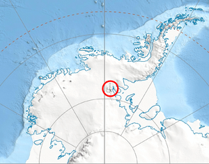
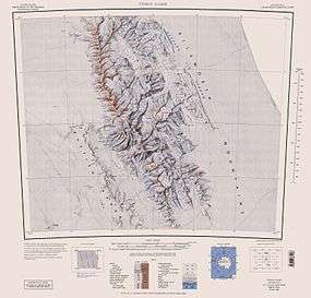
Mount Landolt (78°46′S 84°30′W / 78.767°S 84.500°WCoordinates: 78°46′S 84°30′W / 78.767°S 84.500°W) is a mountain, 2,280 metres (7,480 ft) high, standing at the head of Hudman Glacier in the Petvar Heights at the southeastern extremity of the Sentinel Range in the Ellsworth Mountains of Antarctica. It was first mapped by the United States Geological Survey from surveys and U.S. Navy air photos from 1957–59, and was named by the Advisory Committee on Antarctic Names for Arlo U. Landolt, an aurora scientist at the International Geophysical Year South Pole Station in 1957.[1]
Maps
- Vinson Massif. Scale 1:250 000 topographic map. Reston, Virginia: US Geological Survey, 1988.
References
- ↑ "Mount Landolt". Geographic Names Information System. United States Geological Survey. Retrieved 2013-05-29.
![]() This article incorporates public domain material from the United States Geological Survey document "Mount Landolt" (content from the Geographic Names Information System).
This article incorporates public domain material from the United States Geological Survey document "Mount Landolt" (content from the Geographic Names Information System).