Mount Rainier Historic District
|
Mount Rainier Historic District | |
|
Intersection of U.S. Route 1 and 34th St. | |
 | |
| Location | Roughly bounded by Arundel St., 37th St., Bladensburg Rd. and Eastern Ave., Mount Rainier, Maryland |
|---|---|
| Coordinates | 38°56′21″N 76°57′42″W / 38.93917°N 76.96167°WCoordinates: 38°56′21″N 76°57′42″W / 38.93917°N 76.96167°W |
| Area | 260 acres (110 ha) |
| Built | 1900 |
| Architect | Multiple |
| Architectural style | Queen Anne, Late 19th And Early 20th Century American Movements |
| NRHP Reference # | 90001319[1] |
| Added to NRHP | September 7, 1990 |
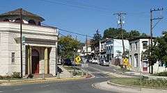
The Mount Rainier Historic District is a national historic district located at Mount Rainier, Prince George's County, Maryland, which began as a streetcar suburb located northeast of Washington, D.C. The district was built on a gently rolling rural landscape from about 1900 to 1940. The district contains more than 1,000 buildings, which are modestly scaled, detached, single-family, frame houses sited closely together with common setbacks. It consists primarily of single-family homes, with some small apartment buildings, a few duplexes, and single family homes that include a small storefront, usually located at the corner of an intersection. With the exception of five churches and a bank building known to have been designed by local architects, the remainder of the district's buildings are vernacular in character. Some homes contain Queen Anne detailing.[2]
It was listed on the National Register of Historic Places in 1990.[1]
References
- 1 2 National Park Service (2010-07-09). "National Register Information System". National Register of Historic Places. National Park Service.
- ↑ Howard S. Berger (June 1990). "National Register of Historic Places Registration: Mount Rainier Historic District" (PDF). Maryland Historical Trust. Retrieved 2015-08-01.
External links
- Mount Rainier Historic District, Prince George's County, Inventory No.: PG:68-74, including photo in 1989, at Maryland Historical Trust website
- Boundary Map of the Mount Rainier Historic District, Prince George's County, at Maryland Historical Trust
| Topics |  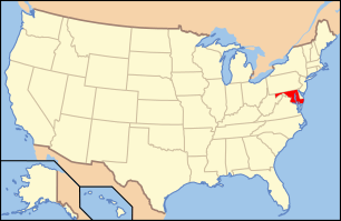 | |
|---|---|---|
| Lists by county | ||
| Lists by city | ||
| Other lists | ||
| ||