Mount Russell (California)
- For the peak in Alaska, see Mount Russell (Alaska).
| Mount Russell | |
|---|---|
 Mount Russell, south slope. | |
| Highest point | |
| Elevation | 14,094 ft (4,296 m) NAVD 88[1] |
| Prominence | 1,096 ft (334 m) [1] |
| Parent peak | Mount Whitney[2] |
| Listing |
|
| Coordinates | 36°35′24″N 118°17′26″W / 36.589935°N 118.2906469°WCoordinates: 36°35′24″N 118°17′26″W / 36.589935°N 118.2906469°W [6] |
| Geography | |
 Mount Russell
| |
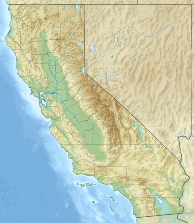
| Location | Inyo and Tulare counties, California, U.S. |
| Parent range | Sierra Nevada |
| Topo map | USGS Mount Whitney |
| Climbing | |
| First ascent | June 24, 1926 by Norman Clyde[7] |
| Easiest route | Exposed Scramble, class 3[7] |
Mount Russell is a peak in the Sierra Nevada mountain range in the U.S. state of California, about 0.8 miles (1.3 km) north of Mount Whitney. It rises to an elevation of 14,094 feet (4,296 m) and is the seventh-highest peak in the state.
Geography
Russell is located on the Sierra Crest, which in this area marks the boundary between the John Muir Wilderness, the Inyo National Forest and Sequoia National Park; and the boundary between Inyo County and Tulare County. It rises just southwest of Tulainyo Lake, one of the highest and largest of the high alpine lakes of the southern Sierra.
History
The Peak was named for Israel Cook Russell, an American geologist who was a member of the Wheeler Survey and who was best known for his explorations in Alaska.[8]
Climbing
The first ascent of Mount Russell was on June 24, 1926 by famed Sierra mountaineer Norman Clyde. It offers climbers at least a dozen routes, from multiple scrambling routes (class 3) to a serious technical route (Grade IV, 5.10).[7]
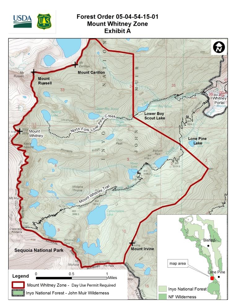
Mount Russell sees far less traffic than its much more famous neighbor Mount Whitney. However, since its southern and eastern slopes fall in the Mount Whitney Zone of the Inyo National Forest, these approaches are governed by stricter access limits. From May to October, only ten people per day are permitted to enter the North Fork of Lone Pine Creek for overnight use. Day-use climbers are grouped with the Whitney Main Trail day-use quota. This puts climbers on Russell's most common approaches in competition with climbers on Whitney's popular Mountaineer's Route, and also with the Main Trail users.[9]
See also
References
- 1 2 "Mount Russell, California". Peakbagger.com. Retrieved 2009-01-13.
- ↑ "Key Col for Mount Russell". Peakbagger.com. Retrieved 2016-03-23.
- ↑ "California 14,000-foot Peaks". Peakbagger.com. Retrieved 2016-03-23.
- ↑ "Sierra Peaks Section List" (PDF). Angeles Chapter, Sierra Club. Retrieved 2009-02-10.
- ↑ "Western States Climbers List". Climber.org. Retrieved 2016-03-24.
- ↑ "Mount Russell". Geographic Names Information System. United States Geological Survey. Retrieved 2009-01-13.
- 1 2 3 Roper, Steve (1976). The Climber's Guide to the High Sierra. San Francisco: Sierra Club Books. p. 305, 367. ISBN 9780871561473.
- ↑ Farquhar, Francis P. (1926). Place Names of the High Sierra. San Francisco: Sierra Club. Retrieved 2009-01-13.
- ↑ "Recreational Activities - Mount Whitney Zone Map". Inyo National Forest website. Retrieved 2014-01-19.
External links
- "Mount Russell". SummitPost.org.