Multyfarnham or Fearbranagh
| Multyfarnham or Fearbranagh | |
|---|---|
| Townland | |
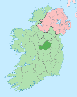
 Multyfarnham or Fearbranagh Location of Multyfarnham or Fearbranagh within County Westmeath in the Republic of Ireland | |
| Coordinates: 53°37′14″N 7°22′28″W / 53.62056°N 7.37444°WCoordinates: 53°37′14″N 7°22′28″W / 53.62056°N 7.37444°W | |
| Country |
|
| Province | Leinster |
| County | County Westmeath |
| Irish grid reference | N414635 |
Multyfarnham or Fearbranagh is a townland in County Westmeath, Ireland. It is located about 10.82 kilometres (7 mi) north of Mullingar.
Multyfarnham or Fearbranagh spans two civil parishes; it is one of 11 townlands of the civil parish of Stonehall and one of 12 townlands of the civil parish of Tyfarnham, both in the barony of Corkaree in the Province of Leinster. The townland covers 260.67 acres (1.0549 km2).
The neighbouring townlands are: Lismalady and Multyfarnham to the north, Killintown to the east, Culleenabohoge and Tyfarnham to the south and Ballindurrow and Rathganny to the west.[1][2][3]
In the 1911 census of Ireland there were 5 houses[4] and 9 inhabitants[5] in the townland.
References
- ↑ Multyfarnham or Fearbranagh Townland, Co. Westmeath Townlands.ie Retrieved on 14 August 2015.
- ↑ Multyfarnham or Fearbranagh Townland, Stonehall civil parish IreAtlas Townland Data Base. Retrieved on 14 August 2015.
- ↑ Multyfarnham or Fearbranagh Townland, Tyfarnham civil parish IreAtlas Townland Data Base. Retrieved on 14 August 2015.
- ↑ Houses in Multyfarnham or Fearbranagh. Census of Ireland 1911. Retrieved on 14 August 2015.
- ↑ Inhabitants in Multyfarnham or Fearbranagh. Census of Ireland 1911. Retrieved on 14 August 2015.
External links
- Map of Multyfarnham or Fearbranagh at openstreetmap.org
- Multyfarnham or Fearbranagh Townland, Stonehall civil parish at the IreAtlas Townland Data Base
- Multyfarnham or Fearbranagh Townland, Tyfarnham civil parish at the IreAtlas Townland Data Base
- Multyfarnham or Fearbranagh at Townlands.ie
- Multyfarnham or Fearbranagh at The Placenames Database of Ireland