Munnar
| Munnar മൂന്നാർ The Kashmir of south India | |
|---|---|
| Hill station | |
|
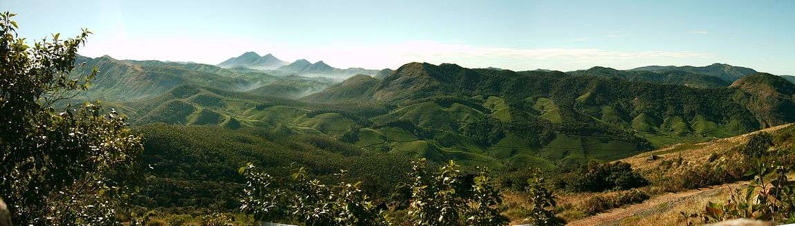
Munnar town | |
 Munnar  Munnar | |
| Coordinates: 10°05′21″N 77°03′35″E / 10.08917°N 77.05972°ECoordinates: 10°05′21″N 77°03′35″E / 10.08917°N 77.05972°E | |
| Country | India |
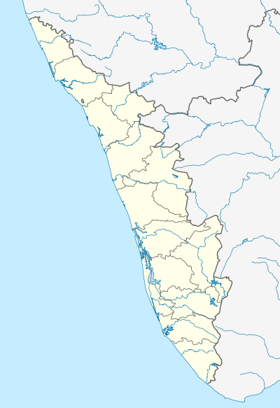
| State | Kerala |
| District | Idukki |
| Named for | Tea plantations, cool climate |
| Government | |
| • Type | Panchayath |
| • Body | Munnar grama panchayath |
| Area | |
| • Total | 187 km2 (72 sq mi) |
| Elevation[1] | 1,700 m (5,600 ft) |
| Population (2001) | |
| • Total | 38,471 |
| • Density | 210/km2 (530/sq mi) |
| Languages | |
| • Official | Malayalam, English |
| Time zone | IST (UTC+5:30) |
| PIN | 685612 |
| Telephone code | 04865 |
| Vehicle registration | KL-68, KL-06 |
| Literacy | 76% |
| Website |
keralatourism |

Munnar (Malayalam: മൂന്നാർ) is a town and hill station located in the Idukki district of the southwestern Indian state of Kerala. Munnar is situated at around 1,600 metres (5,200 ft) above mean sea level,[2] in the Western Ghats range of mountains.
Etymology
The name Munnar is believed to mean "three rivers",[3] referring to its location at the confluence of the Mudhirapuzha, Nallathanni and Kundaly rivers.[4]
Location
Geographic coordinates of Munnar is 10°05′21″N 77°03′35″E. Munnar town is situated on the Kannan Devan Hills village in Devikulam taluk and is the largest panchayat in the Idukki district covering an area of nearly 557 square kilometres (215 sq mi).
Road
Munnar is well connected by both National highways, state highways and rural roads. The town lies in the Kochi - Dhanushkodi National highway (N.H 49), about 130 km (81 mi) from Cochin, 31 km (19 mi) from Adimali, 85 km (53 mi) from Udumalpettu in Tamil Nadu and 60 km (37 mi) from Neriyamangalam.
Railway
The nearest major railway stations are at Ernakulam and Aluva (approximately 140 kilometres (87 mi) by road). The Nearest Functioning Railway station is at Udumalaipettai.
Airport
The nearest airport is Cochin International Airport, which is 105 kilometres (65 mi) away.
Administration
The panchayath of Munnar formed in 1961 January 24 is divided into 21 wards for administrative convenience. Coimbatore district lies in the north, Pallivasal in south, Devikulam and Marayoor in east and Mankulam, Kuttampuzha panchayaths in the west.
|
|
|
Flora and fauna
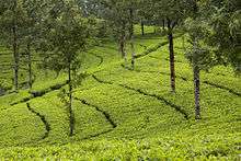
Most of the native flora and fauna of Munnar have disappeared due to severe habitat fragmentation resultant from the creation of the plantations. However, some species continue to survive and thrive in several protected areas nearby, including the new Kurinjimala Sanctuary to the east, the Chinnar Wildlife Sanctuary, Manjampatti Valley and the Amaravati reserve forest of Indira Gandhi Wildlife Sanctuary to the north east, the Eravikulam National Park and Anamudi Shola National Park to the north, the Pampadum Shola National Park to the south and the proposed Palani Hills National Park to the east.
Endemic species
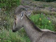
These protected areas are especially known for several threatened and endemic species including Nilgiri Thar, the grizzled giant squirrel, the Nilgiri wood-pigeon, elephant, the gaur, the Nilgiri langur, the sambar, and the neelakurinji (that blossoms only once in twelve years). [5][6]
Land ownership
There has been action to address the problems of property takeovers by the land mafia that have, according to successive governments, plagued the area. In 2011, the government estimated that 20,000 hectares of land had been illegally appropriated and it launched a campaign of evictions that had first been mooted in 2007.[7]
Places of interest
_(13694719014).jpg)
- Eravikulam National Park
- Anamudi Peak
- Mattupetty Dam
- Pallivasal
- Chinnakanal and Anayirangal
- Top Station
- Munnar Tea Museum
Geography and climate

The region in and around Munnar varies in height from 1,450 meters (4,760 ft) to 2,695 meters (8,842 ft) above mean sea level. The temperature ranges between 5 °C (41 °F) and 25 °C (77 °F) in winter and 15 °C (59 °F) and 25 °C (77 °F) in summer.[8] Temperatures as low as −4 °C (25 °F) have been recorded in the Sevenmallay region of Munnar.[9]
Köppen-Geiger climate classification system classifies it as subtropical highland (Cwb).[10]
| Climate data for Munnar | |||||||||||||
|---|---|---|---|---|---|---|---|---|---|---|---|---|---|
| Month | Jan | Feb | Mar | Apr | May | Jun | Jul | Aug | Sep | Oct | Nov | Dec | Year |
| Average high °C (°F) | 22.4 (72.3) |
23.7 (74.7) |
25.3 (77.5) |
25.6 (78.1) |
25.6 (78.1) |
23.7 (74.7) |
22.4 (72.3) |
22.8 (73) |
23.2 (73.8) |
22.7 (72.9) |
21.8 (71.2) |
21.9 (71.4) |
23.42 (74.17) |
| Daily mean °C (°F) | 17.6 (63.7) |
18.7 (65.7) |
20.2 (68.4) |
21 (70) |
21.4 (70.5) |
20.3 (68.5) |
19.3 (66.7) |
19.5 (67.1) |
19.6 (67.3) |
19.2 (66.6) |
18.3 (64.9) |
17.7 (63.9) |
19.4 (66.94) |
| Average low °C (°F) | 12.9 (55.2) |
13.7 (56.7) |
15.1 (59.2) |
16.5 (61.7) |
17.3 (63.1) |
16.9 (62.4) |
16.3 (61.3) |
16.3 (61.3) |
16 (61) |
15.7 (60.3) |
14.8 (58.6) |
13.5 (56.3) |
15.42 (59.76) |
| Average precipitation mm (inches) | 18 (0.71) |
29 (1.14) |
47 (1.85) |
129 (5.08) |
189 (7.44) |
420 (16.54) |
583 (22.95) |
364 (14.33) |
210 (8.27) |
253 (9.96) |
164 (6.46) |
64 (2.52) |
2,470 (97.25) |
| Average rainy days | 2 | 2 | 3 | 6 | 8 | 9 | 10 | 9 | 10 | 12 | 8 | 5 | 84 |
| Mean monthly sunshine hours | 248 | 232 | 248 | 240 | 217 | 120 | 124 | 124 | 150 | 155 | 180 | 217 | 2,255 |
| Source #1: Climate-Data.org, altitude: 1461m[10] | |||||||||||||
| Source #2: Weather2Travel for sunshine and rainy days[11] | |||||||||||||
See also
References
- ↑ Munnar
- ↑ Munnar - the Hill Station of Kerala in Idukki | Kerala Tourism
- ↑ Munnar History
- ↑ "Munnar".
- ↑ "Government of Kerala, Forest and Wildlife Department, Notification No. 36/2006 F&WLD". Kerala Gazette. 6 October 2006. Retrieved 2007-12-05.
- ↑ Roy, Mathew (25 September 2006). "Proposal for Kurinjimala sanctuary awaits Cabinet nod". The Hindu. Retrieved 2007-12-05.
- ↑ Jacob, Jeemon (12 July 2011). "Kerala government launches eviction drive in Munnar". Retrieved 2014-07-10.
- ↑ Eravikulam "Eravikulam National Park, Munnar, Kerala, India, the home of Nilgiri Tahr" Check
|url=value (help). Eravikulam National Park. Retrieved 2013-08-28. - ↑ Frost hits plantations in Munnar
- 1 2 "Climate: Munnar — Climate graph, Temperature graph, Climate table". Climate-Data.org. Retrieved 2013-08-28.
- ↑ "Munnar Climate and Weather Averages, Kerala". Weather2Travel. Retrieved 2013-08-28.
External links
| Wikimedia Commons has media related to Munnar. |
![]() Munnar travel guide from Wikivoyage
Munnar travel guide from Wikivoyage