Murcanyo
| Murcanyo Murcanyo مورايو | |
|---|---|
| Town | |
|
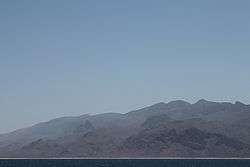
View of Murcanyo town at the foot of the Jebel Murcanyo mountains | |
| Nickname(s): Bander Murcaayo | |
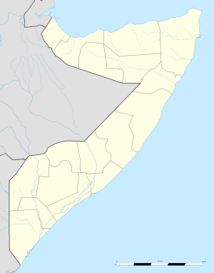 Murcanyo Location in Somalia. | |
| Coordinates: 11°41′00″N 50°27′00″E / 11.68333°N 50.45000°ECoordinates: 11°41′00″N 50°27′00″E / 11.68333°N 50.45000°E | |
| Country | |
| Region | Bari |
| Time zone | EAT (UTC+3) |
Murcanyo (Somali: Muranyo, Arabic: مورايو), also known as Bander Murcaayo (alternatively Bandar Murcaayo or Bunder Marayah), is a coastal town in the northeastern Bari province of Somalia. It is situated in the autonomous Puntland region.
Location
Murcanyo is located at 11°41′34.98″N 50°27′25.34″E / 11.6930500°N 50.4570389°E, in the Gulf of Aden. It lies 7 nautical miles (8 miles) southwest of Habo, 18 nautical miles (21 miles) southwest of Ras Filuk, and 38 nautical miles (44 miles) east of Qandala.
Geography
The town is situated along the beach of a long bay that borders the Gulf of Aden. The bay stretches from a rocky outcrop to the immediate west of Murcanyo and eastwards past the town, towards the headland of Ras Filuk. On the low plain that hugs this bay also lie the towns of Geesaley and Habo.
Murcanyo lies at the foot of the Jebel Murcanyo mountains (Jebel meaning mountain in Arabic), also known as Jebel Marayah. This mountain range stretches across the Bari region to the Indian Ocean coastline at Bargal. The range consists of cream-coloured limestone, as well as sandstone, shale and quartz.[1]
History
Murcanyo was historically an important port town along the northeastern Somalia littoral. It served as a stronghold of Bedouins from the Majeerteen clan. Through trading dhows, the town was connected to a merchant network that included regional ports like Al Mukalla, Jeddah and Mumbai. Local inhabitants produced and exported frankincense, indigo and mats, and imported items such as dates, a special cloth, rice and metals.[1]
In 1872, Murcanyo's resident population was estimated at 600-700 inhabitants. The town was at the time ruled by the Majeerteen Sultanate, which maintained a fort in the area. It also had three mosques.[1]
Administration
On April 8, 2013, the Puntland government announced the creation of a new region coextensive with Murcanyo and Cape Guardafui, named Gardafuul. Carved out of the Bari region, it consists of three districts and has its capital at Alula.
Education
According to the Puntland Ministry of Education, there is 1 primary school in Murcanyo.[2]
See also
Notes
- 1 2 3 Miles, S.B. (1872). On the Neighbourhood of Bunder Marayah - The Journal of the Royal Geographical Society, Volume 42. Royal Geographical Society (Great Britain). pp. 61–68. Retrieved 18 November 2014.
- ↑ "Puntland - Primary schools". Ministry of Education Puntland. Retrieved 8 September 2014.
References
Template:Somalia